


Pistyll Cain, also written as Pistill Cain and Pistill Y Caen, is a renowned waterfall in Meirionnydd (Sir Feirionnydd) in north Wales. [1] It lies north-east of Ganllwyd off the A470 trunk road between Dolgellau and Trawsfynydd.
Pistyll Cain, also written as Pistill Cain and Pistill Y Caen, is a renowned waterfall in Meirionnydd (Sir Feirionnydd) in north Wales. [1] It lies north-east of Ganllwyd off the A470 trunk road between Dolgellau and Trawsfynydd.
Prints made from engravings based on various artists' drawings were made of the falls in the first half of the 19th century during the Romantic period.


Merionethshire or Merioneth is one of thirteen historic counties of Wales, a vice county and a former administrative county.

The Afon Mawddach is a river in Gwynedd, Wales, which has its source in a wide area SH820300 north of Dduallt in Snowdonia. It is 28 miles (45 km) in length, and is much branched; many of the significant tributaries are of a similar size to the main river. The catchment area is bounded to the east by the Aran Fawddwy massif and to the west and north by the Harlech dome which forms a watershed just south of Llyn Trawsfynydd.

The Bala Lake Railway is a narrow-gauge railway along the southern shore of Bala Lake in Gwynedd, North Wales. The line, which is 4+1⁄2 miles (7.2 km) long, is built on a section of the former standard-gauge Ruabon–Barmouth GWR route that closed in 1965. Another section of the former permanent way is used by the Llangollen Railway. The Bala Lake Railway, which runs on 600 mm -gauge preserved rolling stock, is a member of the Great Little Trains of Wales.
The Gwynedd Football League was a football league at the fifth level of the Welsh football league system in north-west Wales.

Drws-y-Nant railway station in Gwynedd, Wales, was formerly a station on the Ruabon to Barmouth line.
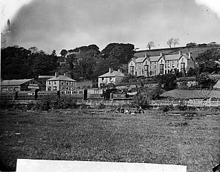
Dolgellau railway station in Gwynedd, North Wales, was a station on the Ruabon to Barmouth line, originally the terminus of a Cambrian Railways branch from Barmouth Junction, then linked by the Great Western Railway to Bala and Ruabon. The station spent most of its life with the spelling "Dolgelley" ; this was altered to "Dolgellau" on 12 September 1960. It was opened on 4 August 1868, and closed to passengers on Monday 18 January 1965 as a result of the Beeching Axe.

Bont Newydd railway station in Gwynedd, Wales, was a station on the now-closed Ruabon to Barmouth line.

Llandrillo railway station (ɬandriːɬɔ) in Denbighshire, Wales, was a station on the Ruabon to Barmouth line. It was to have closed to passengers on Monday 18 January 1965 but closed prematurely on 14 December 1964 due to flood damage. The station had a signal box and was a passing place on the single line.

Cynwyd was a railway station in Cynwyd, Denbighshire, Wales on the Ruabon Barmouth Line. It was to have closed to passengers on Monday 18 January 1965 but closed prematurely on 14 December 1964 due to flood damage.

Garneddwen Halt in Merioneth, Wales, was formerly a station at the summit of the Great Western Railway Ruabon to Barmouth line. It closed to passengers on Monday 18 January 1965.
Dinckley Brook is a minor river of Lancashire, England. The stream rises at the confluence of several minor watercourses at Wheatley Farm close to Copster Green and flows northwards, through Cunliffe House Wood and under Dinckley Bridge. The brook continues past Brockhall, Great Wood and Bradyll, continuing past the Brockhall training base of Blackburn Rovers and through Mill Wood. Soon afterwards, Dinckley Brook falls into the River Ribble.
The Mawddach Trail is a cycle path route, part of Lôn Las Cymru, which runs for some 8 miles (13 km) from Dolgellau (52.7446°N 3.8866°W) to Morfa Mawddach railway station (52.7076°N 4.0315°W), by Barmouth bridge on the Cambrian coast. It is maintained by the Snowdonia National Park and is popular with walkers and cyclists alike. It passes some estuarine areas that are important for water birds, and the RSPB Information Centre at Penmaenpool makes use of the old signal box as an observation centre overlooking the estuary.
Sun Bank Halt in Wrexham County Borough, Wales, was a minor station on the Ruabon to Barmouth line. It opened as Garth & Sun Bank Halt but was renamed on 1 July 1906. The line was double track and there was never a signal box nor freight facilities here.

Llys Halt in Gwynedd, Wales, was on the Ruabon to Barmouth line. There was no passing place or freight activity here.
Wnion Halt in Gwynedd, Wales, was on the Ruabon to Barmouth line. The station was situated in a narrow part of the Wnion Valley next to Pont Llanrhaiadr and squeezed against a road retaining wall on the north side of the line. There was a short timber-edged platform with a timber shelter and nameboard. There was no passing place or freight activity here. Today rusted platform supports remain and the entrance gate is part of a driveway to a private residence to the east of the halt.

Dolserau Halt in Gwynedd, Wales, was on the Ruabon to Barmouth line. The platform edge was made of timber and was situated on the north side of the line. It had a timber shelter and a name-board with the suffix "FOR THE TORRENT WALK". There was no passing place or freight activity here.
The A496 is a major coastal and mountainous road in southern Snowdonia.
The Harlech Dome is a geological dome in southern Snowdonia in north Wales. It extends approximately from Blaenau Ffestiniog in the north to Tywyn in the south, and includes Harlech, The Rhinogydd, Barmouth and Cadair Idris.

Fishing Lake 89A is an Indian reserve of the Fishing Lake First Nation in Saskatchewan. It is Section 13 and the southeast portion of Section 14, Township 33, Range 12, west of the Second Meridian. In the 2016 Canadian Census, it recorded a population of 0 living in 0 of its 0 total private dwellings.