
Plaue is a district of the city of Brandenburg an der Havel.
Contents
On December 31, 2015, the district was recorded as having 2,593 inhabitants. [1]
Plaue is a district of the city of Brandenburg an der Havel.
On December 31, 2015, the district was recorded as having 2,593 inhabitants. [1]
Plaue lies in the far west of the city administrative area, at the outflow of the Havel from the Plauer See, northeast of the confluence of the Elbe-Havel Canal and the Plauer Canal into the Wendsee. Plaue is on the right bank of the Havel, opposite a flatland that hosts the Brandenburg-Briest Solarpark.
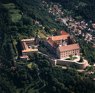
A language school was housed in the Plaue Castle , which was owned by the Count of Königsmarck until 1945. [2]
In addition to the old town center, the Plaue district also includes the residential areas of expansion, Charlottenhof, Gartenstadt, Margaretenhof, Neu Plaue, Plauerhof, Plauer Schleuse and Roberdam. [3]
The area of Plaue is known to have been inhabited since the Middle Ages.
A Slavic burial ground dated to the period between the 10th to 12th centuries was discovered in the course of construction work on the Plauerhof street in the summer of 2001. This discovery was a surprise, because the preliminary investigations had only revealed prehistoric findings. The evaluation of the excavations showed that with around 170 documented burials it was the largest discovered burial ground from the period in Havelland up to that time. Most of the dead were buried in a stretched supine position with side arms and an approximate west–east orientation. Three young women were found in a crouched position (de). The graves were arranged individually in rows, mostly without overlaps, which suggested an above-ground marking. The grave pits were in many cases provided with wooden fittings with clear protrusions from the side and cross boards. Some graves showed traces of charring on the wooden fittings, which indicated a rite of fire. Vascular accessories were found in about 30 percent of the graves. Other items such as jewelry and coins were only occasionally proven. The skeletons were examined by Bettina Jungklaus. However, the skeletons were mostly poorly preserved due to the sandy, acidic soil. 40 percent of the buried were in adulthood and 35 percent in childhood. This indicates rather poor living conditions for the rural population of Plaue. There were also signs of malnutrition. [4] [5] [6] [7] [8]
In 1197, a witness is named Henrycus de Plawe.[ where? ] In 1216 the "Fixed House", the castle, in Plaue was mentioned for the first time in a document.[ which? ] Next to this castle, which protected an important Havel crossing, was the Kiez. To the west and a little further from the castle was a street village without a market.
The town of Plaue later emerged from these two civil settlements, which was first designated as such in 1411. The castle and the town were fiercely contested in the 13th and 14th centuries between the Margraviate of Brandenburg and the Archbishopric of Magdeburg. In 1421 it finally came to the Margraviate of Brandenburg. The town and castle were owned by various noble families, vassals of the Archbishop of Magdeburg or the Margrave of Brandenburg.
Plaue was originally a city in the district of West Havelland in the Prussian government district of Potsdam. It was incorporated on July 25, 1952, together with Kirchmöser in the city of Brandenburg an der Havel. [9]

Brandenburg an der Havel is a town in Brandenburg, Germany, which served as the capital of the Margraviate of Brandenburg until it was replaced by Berlin in 1417.

The Havel is a river in northeastern Germany, flowing through the states of Mecklenburg-Vorpommern, Brandenburg, Berlin and Saxony-Anhalt. It is a right tributary of the Elbe and 325 kilometres (202 mi) long. However, the direct distance from its source to its mouth is only 94 kilometres (58 mi). For much of its length, the Havel is navigable; it provides an important link in the waterway connections between the east and west of Germany, as well as beyond.

The Province of Saxony, also known as Prussian Saxony was a province of the Kingdom of Prussia and later the Free State of Prussia from 1816 until 1944. Its capital was Magdeburg.

Köpenick is a historic town and locality (Ortsteil) in Berlin, situated at the confluence of the rivers Dahme and Spree in the south-east of the German capital. It was formerly known as Copanic and then Cöpenick, only officially adopting the current spelling in 1931. It is also known for the famous imposter Hauptmann von Köpenick.

Schwedt is a town in Brandenburg, in northeastern Germany. With the official status of a Große kreisangehörige Stadt, it is the largest town of the Uckermark district, located near the river Oder, which forms the border with Poland.
The Hevelli or Hevellians/ Navellasîni were a tribe of the Polabian Slavs, who settled around the middle Havel river in the present-day Havelland region of Brandenburg in eastern Germany from the 8th century onwards.
Plassenburg is a castle in the city of Kulmbach in Bavaria. It is one of the most impressive castles in Germany and a symbol of the city. It was first mentioned in 1135. The Plassenberg family were ministerial of the counts of Andechs and used as their seat the Plassenburg. The House of Guttenberg, a prominent Franconian noble family, traces its origins back to 1149 with a Gundeloh v. Blassenberg (Plassenberg). The name Guttenberg is derived from Guttenberg and was adopted by a Heinrich von Blassenberg around 1310. From 1340, the Hohenzollerns governed from Plassenburg castle their territories in Franconia till 1604. The Plassenburg was fortress and residence for the Hohenzollerns.

Genthin is a town in Jerichower Land district, in Saxony-Anhalt, Germany.

Jerichow is a town on the east side of the river Elbe, in the District of Jerichower Land, of the state of Saxony-Anhalt in Germany. With about 270 square kilometres (100 sq mi), the municipality of Jerichow is one of the largest municipalities in area size in Germany.

The Province of Brandenburg was a province of Prussia from 1815 to 1945. Brandenburg was established in 1815 from the Kingdom of Prussia's core territory, comprised the bulk of the historic Margraviate of Brandenburg and the Lower Lusatia region, and became part of the German Empire in 1871. From 1918, Brandenburg was a province of the Free State of Prussia until it was dissolved in 1945 after World War II, and replaced with reduced territory as the State of Brandenburg in East Germany, which was later dissolved in 1952. Following the reunification of Germany in 1990, Brandenburg was re-established as a federal state of Germany, becoming one of the new states.

Ketzin is a town in the Havelland district, in Brandenburg, Germany. It is situated on the river Havel, 17 km northwest of Potsdam, and 40 km west of Berlin.

Plau am See is a town in the Ludwigslust-Parchim district, in Mecklenburg-Western Pomerania, Germany. It is situated 28 km east of Parchim, and 29 km west of Waren.

The Margraviate of Brandenburg was a major principality of the Holy Roman Empire from 1157 to 1806 that played a pivotal role in the history of Germany and Central Europe.
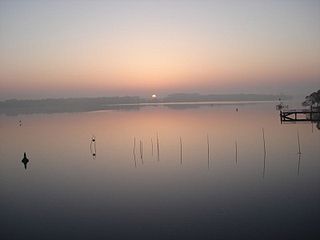
Plauer See is a lake in the state of Brandenburg, Germany. It is situated to the west of the city of Brandenburg an der Havel, and is one of a number of directly linked lakes, along with the Breitlingsee, Möserscher See, Quenzsee and Wendsee.

John I, Margrave of Brandenburg was from 1220 until his death Margrave of Brandenburg, jointly with his brother Otto III "the Pious".
Otto III, nicknamed the pious was Margrave of Brandenburg jointly with his elder brother John I until John died in 1266. Otto III then ruled alone, until his death, the following year.
The Swedish invasion of Brandenburg (1674–75) involved the occupation of the undefended Margraviate of Brandenburg by a Swedish army launched from Swedish Pomerania during the period 26 December 1674 to the end of June 1675. The Swedish invasion sparked the Swedish-Brandenburg War that, following further declarations of war by European powers allied with Brandenburg, expanded into a North European conflict that did not end until 1679.

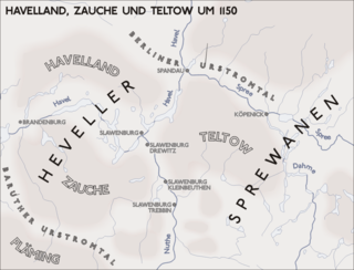
Geographically, the Havelland is the region around which the River Havel flows in a U-shape between Oranienburg to the northeast and Rhinow to the northwest. The northern boundary of the Havelland is formed by the River Rhin and the Rhin Canal. In the history of Brandenburg, the Havelland represents a historic region.

The Nauen Plateau is a low plateau in the German states of Brandenburg and Berlin. It rises above the surrounding countryside by an average of 15 metres (49 ft) and is a largely contiguous upland area that was formed during the Saale and Weichselian glaciations. It consists predominantly of ground moraine deposits, partly overlain by gently rolling end moraine formations. Whilst the neighbouring regions of Zauche to the south, the Teltow to the southeast and the Barnim to the northeast have the same name as their geological formation, the cultural landscape on the Nauen Plateau bears the historical and regional name of Havelland. That said, the river country of the Havelland extends beyond the plateau to include the Havel valley and other lowland areas.

Joachim Wagner was an important Brandenburg organ builder.