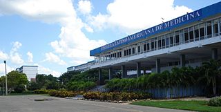
La Habana Province[la aˈβana](listen), formerly known as Ciudad de La Habana Province, is a province of Cuba that includes the territory of the city of Havana, the Republic's capital. Between 1878 and 2010, the name referred to another province that covered a much larger area, which in 2010 was subdivided into the present-day provinces of Artemisa and Mayabeque.

Baracoa, whose full original name is: Nuestra Señora de la Asunción de Baracoa, is a municipality and city in Guantánamo Province near the eastern tip of Cuba. It was visited by Admiral Christopher Columbus on November 27, 1492, and then founded by the first governor of Cuba, the Spanish conquistador Diego Velázquez de Cuéllar on August 15, 1511. It is the oldest Spanish settlement in Cuba and was its first capital.

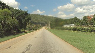
The Carretera Central (CC), meaning "Central Road", is a west-east highway spanning the length of the island of Cuba.
Bauta is a municipality and town located 40 km (25 mi) southwest of Havana City, in the Artemisa Province of Cuba since 2010 as a result of the division of what was the Province of Havana.

Nuevitas is a municipality and port town in the Camagüey Province of Cuba. The large bay was sighted by Christopher Columbus in 1492.

Moa is a municipality and an industrial city in the Holguín Province of Cuba. Its name is believed to mean "water here".

Florida is a municipality and city in the Camagüey Province of Cuba. It is located 40 km (25 mi) north-west of Camagüey, along the Carretera Central highway. The city was established in 1907, and the municipality was established in 1924. Of all the municipalities of the Cuban province of Camagüey, Florida is third in area size. The name is Spanish for Land of flowers.

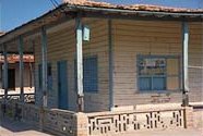
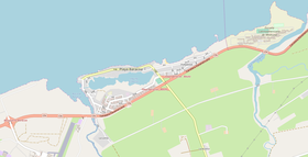
Playa Baracoa Airport is an airport west of Havana, Cuba. It is located in the municipality of Caimito, Artemisa Province, in front of the village of Playa Baracoa, belonging to the neighboring municipality of Bauta.
Batabanó is a municipality and town in the Mayabeque Province of Cuba. It was founded in 1688.

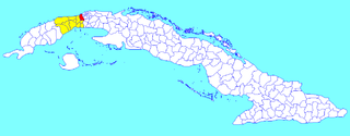
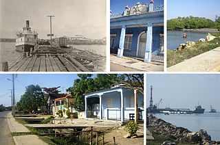
Caimito is a municipality and town in Artemisa Province of Cuba. The town was founded in 1820. The municipality of Caimito del Guayabal was created in 1910, based on the previously existing (1879–1902) municipality of Guayabal in the Pinar del Río Province. Since 1976, the official name is Caimito.

Wajay is a ward of the city of Havana, the capital of Cuba, belonging to the municipal borough of Boyeros. In 2011, it had a population of 47,954.

Artemisa Province is one of the two new provinces created from the former La Habana Province, whose creation was approved by the Cuban National Assembly on August 1, 2010, the other being Mayabeque Province. The new provinces came into existence on January 1, 2011.
Santa Fe is a ward in the municipality of Playa in Havana, Cuba.

La Fe is a Cuban village of the municipality of Sandino, in Pinar del Río Province. It is part of the consejo popular of Cayuco.

The road network of Cuba consists of 60,858 km (37,815 mi) of roads, of which over 29,850 km (18,550 mi) are paved and 31,038 km (19,286 mi) are unpaved. The Caribbean country counts also 654 km (406 mi) of motorways (autopistas).
The Circuito Norte (CN), meaning "Northern Circuit", is a west-east highway spanning the length of the island of Cuba, through the Atlantic Coast. With a length of 1,222 km, it is the second-longest Cuban highway, after the "Carretera Central"; and two sections of it, named "Vía Blanca" and "Panamericana", are classified as Expressways.

Mir is a Cuban village and consejo popular of the municipality of Calixto García, in Holguín Province. In 2011 it had a population of 6,647.

The Autopista del Mediodía is a Cuban motorway linking Havana to San Antonio de los Baños. It is a toll-free road and has a length of 18 km (11 mi).

The Autopista Havana–Mariel, also known as Carretera Panamericana, is a Cuban motorway linking Havana to Mariel. It is a toll-free road and has a length of 26 km (16 mi). Even though it is a motorway (autopista), it is part of the national highway Circuito Norte (CN).