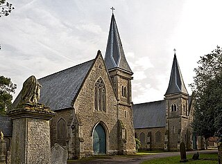
Dunton is a village and civil parish in the Aylesbury Vale district of Buckinghamshire, England. The village is situated approximately 8 miles (13 km) north from Aylesbury and 4 miles (6.4 km) south-east from Winslow.

East Farndon is a small linear village and civil parish about one mile south of Market Harborough in West Northamptonshire, England. The village is close to the border with Leicestershire, and has a Leicestershire post code and telephone dialling code. At the time of the 2001 census, the parish's population was 258 people, increasing to 307 at the 2011 census.

Farthingstone is a village in West Northamptonshire in England. It is close to the major trunk routes of the M1 junction 16, M40 motorway, and A5 road, at the head of a valley and is 7 miles (11 km) south of Daventry and 3.5 miles (5.6 km) south west of Weedon Bec.
Longthorpe is an area of the city of Peterborough, in the unparished area of Peterborough, in the Peterborough district, in the ceremonial county of Cambridgeshire, England. Located two miles (3.2 km) west from the city centre, the area covers 1,390 acres. For electoral purposes it forms part of Peterborough West ward.

Weedon Bec, usually just Weedon, is a village and parish in West Northamptonshire, England. It is close to the source of the River Nene. The population of the civil parish at the 2011 census was 2,706.

Sulgrave is a village and civil parish in West Northamptonshire, England, about 5 miles (8 km) north of Brackley. The village is just south of a stream that rises in the parish and flows east to join the River Tove, a tributary of the Great Ouse.
Weston is a village in West Northamptonshire, England. Together with neighbouring Weedon Lois it forms the civil parish of Weston and Weedon, which had a population of 960 at the 2011 Census.

Weedon Lois is a village and former civil parish, now in the parish of Weston and Weedon, in the West Northamptonshire district, in the ceremonial county of Northamptonshire, England. It is about 5.5 miles (9 km) west of Towcester. In 1931 the parish had a population of 296.

Old Weston – in Huntingdonshire, England – is a village near Molesworth west of Huntingdon.

Ampton is a village and civil parish in the West Suffolk District of Suffolk, England, about five miles north of Bury St Edmunds.

Belleau is a hamlet and civil parish in the East Lindsey district of Lincolnshire, England. It is situated approximately 7 miles (11 km) south-east of Louth, and 4 miles (6 km) north-west of Alford. The parish of Belleau includes the hamlet of Claythorpe.

Chelveston is a small village in North Northamptonshire. It is about 2 miles (3.2 km) east of Higham Ferrers and 7 miles (11.3 km) east of Wellingborough on the B645 from Higham Ferrers to St Neots. To the south is the hamlet of Caldecott and the settlement of Chelston Rise which together comprise the civil parish of Chelveston cum Caldecott. The population is now included in the civil parish of Chelveston cum Caldecott.

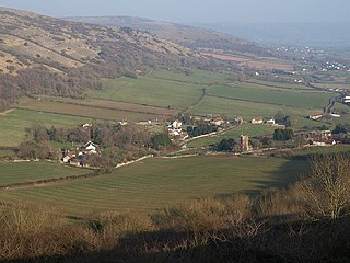
Compton Bishop is a small village and civil parish, at the western end of the Mendip Hills in the English county of Somerset. It is located close to the historic town of Axbridge. Along with the village of Cross and the hamlets of Rackley and Webbington it forms the parish of Compton Bishop and Cross.

Newton, sometimes called Newton in the Willows, is a small village and former civil parish, now in the parish of Newton and Little Oakley, in the North Northamptonshire district, in the ceremonial county of Northamptonshire, England. The village is in the Ise valley. Newton and Little Oakley had a population at the 2001 census of 147, decreasing to 126 at the 2011 Census. It has a combined parish council with Geddington.

Duddington is a village and former civil parish, now in the parish of Duddington-with-Fineshade, in the North Northamptonshire district, in the ceremonial county of Northamptonshire, England. It is by the junction of the A47 and A43 roads, and is 9 kilometres (6 mi) southwest of the town of Stamford. The village is on the east bank of the River Welland which is the county boundary of Rutland. In 1961 the parish had a population of 184.

Furtho is a deserted medieval village and former civil parish, now in the parish of Potterspury, in the West Northamptonshire district, in the ceremonial county of Northamptonshire, England. In 1931 the parish had a population of 25.

Culworth is a village and civil parish about 7 miles (11 km) north of Brackley in West Northamptonshire, England. Culworth is also about 7 miles (11 km) northeast of the north Oxfordshire town of Banbury.

Evenley is a village and civil parish just over 1 mile (1.6 km) south of Brackley in West Northamptonshire, England. The 2011 Census recorded the parish's population as 571.

Edmund Francis Law, usually referred to as 'E. F. Law', FRIBA was an English architect during the 19th century, notable for a large number of projects, particularly restorations, in the counties of Northamptonshire, Leicestershire and Rutland.


