
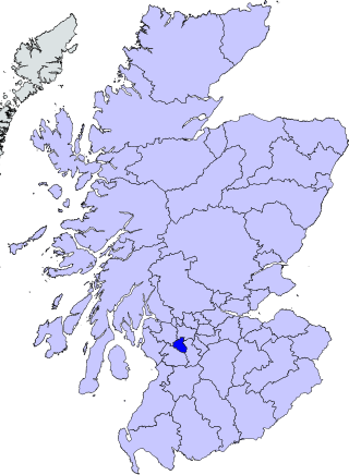
East Renfrewshire is one of 32 council areas of Scotland. It was formed in 1996, as a successor to the Eastwood district of the Strathclyde region. The northeastern part of the council area is close to Glasgow and many of the council area's northern settlements fall into the Greater Glasgow urban area.

Glasgow City Council is the local government authority for Glasgow City council area, Scotland. In its modern form it was created in 1996. Glasgow was formerly governed by a corporation, also known as the town council, from the granting of its first burgh charter in the 1170s until 1975. From 1975 until 1996 the city was governed by City of Glasgow District Council, a lower-tier authority within the Strathclyde region.
Govan is a district, parish, and former burgh now part of southwest Glasgow, Scotland. It is situated 2+1⁄2 miles west of Glasgow city centre, on the south bank of the River Clyde, opposite the mouth of the River Kelvin and the district of Partick. Historically it was part of the County of Lanark.

Dunbartonshire or the County of Dumbarton is a historic county, lieutenancy area and registration county in the west central Lowlands of Scotland lying to the north of the River Clyde. Dunbartonshire borders Perthshire to the north, Stirlingshire to the east, Lanarkshire and Renfrewshire to the south, and Argyllshire to the west.

Port Glasgow is the second-largest town in the Inverclyde council area of Scotland. The population according to the 1991 census for Port Glasgow was 19,426 persons and in the 2001 census was 16,617 persons. The most recent census in 2011 states that the population has declined to 15,414. It is located immediately to the east of Greenock and was previously a burgh in the county of Renfrewshire.
Strathclyde was one of nine former local government regions of Scotland created in 1975 by the Local Government (Scotland) Act 1973 and abolished in 1996 by the Local Government etc. (Scotland) Act 1994. The Strathclyde region had 19 districts. The region was named after the early medieval Kingdom of Strathclyde centred on Govan, but covered a broader geographic area than its namesake.
Eastwood was a local government district in the Strathclyde region. It was derived from the civil parish of Eastwood which had been within the county of Renfrewshire, though latterly included areas which had become annexed Lanarkshire and the expanding city of Glasgow. Established in 1975, it covered the parts of the parish outside Glasgow, plus adjoining areas to the south; it was abolished in 1996 to become part of East Renfrewshire.

Pollokshields is an area in the Southside of Glasgow, Scotland. Its modern boundaries are largely man-made, being formed by the M77 motorway to the west and northwest with the open land of Pollok Country Park and the Dumbreck neighbourhood beyond, by the Inverclyde Line railway and other branches which separate its territory from the largely industrial areas of Kinning Park, Kingston and Port Eglinton, and by the Glasgow South Western Line running from the east to south, bordering Govanhill, Strathbungo, Crossmyloof and Shawlands residential areas. There is also a suburban railway running through the area.
Glasgow South is a burgh constituency of the House of Commons of the Parliament of the United Kingdom (Westminster). It elects one Member of Parliament (MP) by the first past the post system of election.

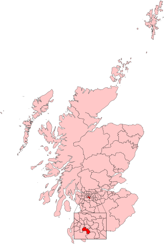
East Renfrewshire is a constituency of the UK House of Commons, to the south of Glasgow, Scotland. It elects one Member of Parliament (MP) using the first-past-the-post system of voting.

Renfrew District was, between 1975 and 1996, one of nineteen local government districts in the Strathclyde region of Scotland.

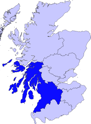
Renfrewshire or the County of Renfrew is a historic county, registration county and lieutenancy area in the west central Lowlands of Scotland. The lieutenancy area covers the three modern council areas of Inverclyde, Renfrewshire and East Renfrewshire, and this area is occasionally termed Greater Renfrewshire to distinguish it from the modern council area called Renfrewshire. The historic county additionally included territory on the south-western edge of Glasgow which was gradually transferred to the administrative area of the city as it grew.

The Levern Water, is a small river in East Renfrewshire and Glasgow, Scotland. It rises in the Long Loch, and flows generally north and east, past the towns of Neilston and Barrhead, for a total distance of 9 miles (14 km). It empties into the White Cart River.

Renfrew is a town 6 miles (10 km) west of Glasgow in the west central Lowlands of Scotland. It is the historic county town of Renfrewshire. Called the "Cradle of the Royal Stewarts" for its early link with Scotland's former royal house, Renfrew gained royal burgh status in 1397.

Kingston is an area of Glasgow, Scotland, from which the Kingston Bridge takes its name. Together with Ibrox, it forms one of the 56 neighbourhoods of Glasgow defined by Glasgow City Council for operational purposes. The area was assigned to Ward 54 until 2007 when it was reclassified as part of the Govan ward.
Kinning Park was a 19th-century sports ground in Kinning Park, Renfrewshire, Scotland, primarily used for cricket and football. It was the home of Clydesdale Cricket Club from 1849, staging a number of important matches against visiting English teams. It was also the original home of the club's football team, Clydesdale F.C. When both teams relocated to Titwood in 1876, Kinning Park was taken over by Rangers F.C., who played there until moving to the first Ibrox Park in 1887. The ground was the venue for the 1881 Scottish Cup Final between Queen's Park and Dumbarton.

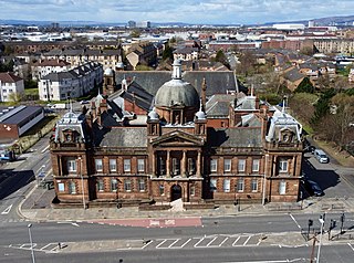
Dixon Halls, formerly Crosshill and Govanhill Burgh Hall, is a daycare centre for elderly people and Category B listed building on Cathcart Road, Glasgow, Scotland.
Eastwood is a civil parish which straddles Glasgow and East Renfrewshire in Scotland. The parish has had no administrative functions since 1930, but is still used for some statistical purposes.

Below is a list of Municipalities of Scotland. Scottish municipalities have existed in the form of burgh, royal burgh, cities and, currently most common, local councils. Between 1855 and 1975, valuation rolls in Scotland were divided into counties and burghs. A burgh was a Scottish town which had certain privileges conferred by a charter and had a town council to run its affairs. Each burgh had its own separate legal and administrative status. A royal charter was issued to localities which were granted the title of royal burgh.
