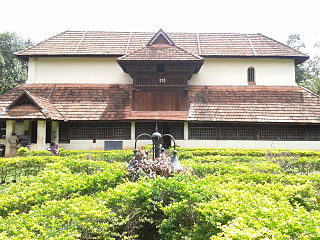
Ponnampet is a taluk headquarters in the southern part of the district of Kodagu in the state of Karnataka.Ponnampet taluk came into existence on 29 November 2020.[1][2][3]
It was originally named after Diwan Cheppudira Ponnappa as Ponnapett.[4] It was established in the year 1821 in the name of the Late Diwan under the regime of Kodagu Rajas.
The town was called notified area in the period of British and later on it was converted into a Municipality and now it is known as 1st Grade Village Panchayath. Ponnampet was a Taluk Headquarters during Pre-Independence Period and continues up to the re-organisation of states after independence.
Ponnampet belongs to Halligattu grama panchayath and has a population of 6,473 according to 2011 census.[5] A college of forestry formerly a part of the University of Agricultural Sciences, Bangalore, now with the University of Agricultural and Horticultural Sciences, Shimoga is located here. A hill known as Kundah overlooks the town.
Various Banks like DCC Bank, SBI, Canara Bank, Igguthappa Souhardha Bank, Town Cop Bank, APCMS, Corporation Bank, Primary Agriculture and Credit Co-op bank, APCMS.
Sports Facilities like Astro Turf Ground, Sports School
Inspection Bungalow
Kodava Samaj
Veterinary Hospital
Ramakrishna Sharada Seva Ashram Hospital
Agriculture Research Centre
BSNL Office - Telephone Exchange
Mahila Co-op Society
Police Station
Swami Vivekananda Ashram Hospital
In addition to this within 5 kilometres the Gonikoppal town in which Krishi Vigyan Kendra (KVK), Cauvery degree college, Coffee Board Research Centre, many schools and college, a circle inspector office, KEB - AEE office are also located here.
Wayanad is a district in the north-east of the Indian state of Kerala, with administrative headquarters at the municipality of Kalpetta. It is the only plateau in Kerala. The Wayanad Plateau forms a continuation of the Mysore Plateau, the southern portion of Deccan Plateau which links the Western Ghats with the Eastern Ghats. It is set high in the Western Ghats with altitudes ranging from 700 to 2100 meters. Vellari Mala, a 2,240 m (7,349 ft) high peak situated on the trijunction of Wayanad, Malappuram, and Kozhikode districts, is the highest point in Wayanad district. The district was formed on 1 November 1980 as the 12th district in Kerala, by carving out areas from Kozhikode and Kannur districts. An area of 885.92 km2 of the district is forested. Wayanad has three municipal towns—Kalpetta, Mananthavady and Sulthan Bathery. There are many indigenous tribes in this area. The Kabini River, a tributary of Kaveri River, originates at Wayanad. Wayanad district, along with the Chaliyar valley in neighbouring Nilambur in Malappuram district, is known for natural gold fields, which are also seen in other parts of the Nilgiri Biosphere Reserve. Chaliyar river, which is the fourth longest river of Kerala, originates on the Wayanad plateau. The historically important Edakkal Caves are located in Wayanad district.
Nedumangad is a town and municipality in Thiruvananthapuram metropolitan area of Thiruvananthapuram district in the Indian state of Kerala, and is the headquarters of Nedumangad tehsil and Nedumangad Revenue Division (RDO). It is a suburb of the extended metropolitan region of Thiruvananthapuram city. It is located around 16 km to the north-east of Thiruvananthapuram city on the Thiruvananthapuram – Shenkottah (State Highway 2). It is an important commercial center in the district. It is a growing commercial and educational hub and all important government institutions are situated in the town. Nedumangadu Market is important in South Kerala.
Irinjalakuda is a municipal town in Thrissur district, Kerala, India. It is the headquarters of Irinjalakuda Revenue Division, Thrissur Rural Police and Mukundapuram Taluk. After Thrissur, this town has most number of administrative, law-enforcement, and judicial offices in the district. The place is well known for Koodalmanikyam Temple and the Thachudaya Kaimals, who had princely status until 1971. The earliest recorded history of this temples date back to the ninth century of Common Era (CE).
Kalpetta is a major City,Town and municipality in the Wayanad district, state of Kerala, India. Kalpetta is the headquarters of Wayanad district, as well as the headquarters of Vythiri taluk. It is a bustling town surrounded by dense coffee and tea plantations and mountains. It lies on the Kozhikode-Mysore National Highway NH 766 at an altitude of about 780 m above sea level. Kalpetta is 72 km from Kozhikode and 140 km from Mysore.
Mysore district, officially Mysuru district, is an administrative district located in the southern part of the state of Karnataka, India. It is the administrative headquarters of Mysore division.Chamarajanagar District was carved out of the original larger Mysore District in the year 1998. The district is bounded by Chamrajanagar district to the southeast, Mandya district to the east and northeast, Kerala state to the south, Kodagu district to the west, and Hassan district to the north.
Iritty is a Municipality and a Taluk of Kannur district in Kerala State, India. The town is the main market place for the farmer communities in the surrounding regions. Iritty is known as The Coorg Valley in God's Own Country. Iritty is at a distance of 20 km (12 mi) from Kannur International Airport and one among five taluks in Kannur district. Iritty is one of the major towns lies between Coorg and Kannur international airport -Mattanur.
Manjeri is a major town and municipality in Malappuram district, Kerala, India. It is the fourth-most populous municipality in state. It is situated 23 kilometres (14 mi) southeast to Karipur International Airport and 13 kilometres (8.1 mi) northeast to Malappuram, the district headquarters, and forms a part of Malappuram metropolitan area. It is one of the major commercial towns under the Malappuram urban agglomeration and serves as the headquarters of Eranad Taluk. Manjeri Municipality is a Local Self Government Institution with a jurisdiction of three villages namely Manjeri, Payyanad, and Narukara.
Kushalanagar or Kushalanagara is a city located in the Kodagu district of the Indian state of Karnataka. Surrounded by Kaveri river, it is the gateway to Kodagu district. It also serves as the headquarters of Kushalanagar Taluk. By population, Kushalanagar is the second largest town in Kodagu district after Madikeri and the fastest developing town in the district. Kushalnagar is an important commercial centre in Kodagu.
Ulikkal is a growing town in Kannur District in Kerala. It is the HQ of Ulikkal Grama Panchayat in Iritty Taluk. Kerala State Hill highway SH 59 passes through Ulikkal Town.
Gonikoppal is a census town in the Kodagu district of the Indian state of Karnataka.
Peralasseri is a census town and Panchayat headquarters in Kannur district in the Indian state of Kerala, situated on the Kannur-Kuthuparamba State Highway 38 (Kerala), 12 km from Kannur city, on the bank of Anjarakandy river.
Thavanur is a village located on the southern bank of Bharathapuzha, the longest river of Kerala in the Malappuram District of Kerala state in India. This village is located at the border of Tirur and Ponnani Taluks. The Bharathappuzha River separates Thavanur from Tirunavaya and Kuttippuram towns in Tirur Taluk.
Chathamangalam is a village in Kozhikode district of Kerala state, India.
Mazhuvannoor is a panchayat village in the Ernakulam district of Kerala, India. It is located in the Kunnathunad taluk. It is located near the town of Kolenchery. The panchayat headquarters are located at Airapuram.
Kutta is a small village in Ponnampet taluk of Kodagu, in Karnataka state of India.
Thamarassery, formerly known as Thazhmalachery, is one of the taluks and a major hill town in the Kozhikode district of Kerala, India, 30 km north-east of Kozhikode (Calicut) city and 29 km east of Koyilandy. It lies on the Calicut - Wayanad - Mysore route.
Saligrama is a new sub-district of Mysore district, situated on the northern bank of the river Cauvery [Kaveri]. This place is esteemed as sacred by the Shri Vaishnavas on account of its having been the residence of Sri Ramanujacharya. It is the headquarters of Saligrama Taluk. It was established as a new taluk carving out of K.R.Nagar taluk with effect from 31.12.2020 and become ninth taluk of Mysore district of Karnataka, India.
Kattikkulam (Kartikulam) is a small town near Mananthavady in Wayanad district, Kerala, India.The office of the Thirunelly Gramapanchayath is located at Kartikulam.
Shantheyanda Veena Achayya is an Indian politician and member of the Karnataka Legislative Council from the Indian National Congress. She was a former president of the Kodagu District Congress Committee, while also having served as the president of the Kodagu Zilla Panchayat.
This page is based on this Wikipedia article Text is available under the CC BY-SA 4.0 license; additional terms may apply. Images, videos and audio are available under their respective licenses.