
The South West Coast Path is England's longest waymarked long-distance footpath and a National Trail. It stretches for 630 miles (1,014 km), running from Minehead in Somerset, along the coasts of Devon and Cornwall, to Poole Harbour in Dorset. Because it rises and falls with every river mouth, it is also one of the more challenging trails. The total height climbed has been calculated to be 114,931 ft (35,031 m), almost four times the height of Mount Everest. It has been voted 'Britain's Best Walking route' twice in a row by readers of The Ramblers' Walk magazine, and regularly features in lists of the world's best walks.

Exmoor is loosely defined as an area of hilly open moorland in west Somerset and north Devon in South West England. It is named after the River Exe, the source of which is situated in the centre of the area, two miles north-west of Simonsbath. Exmoor is more precisely defined as the area of the former ancient royal hunting forest, also called Exmoor, which was officially surveyed 1815–1818 as 18,810 acres (7,610 ha) in extent. The moor has given its name to a National Park, which includes the Brendon Hills, the East Lyn Valley, the Vale of Porlock and 55 km (34 mi) of the Bristol Channel coast. The total area of the Exmoor National Park is 692.8 km2 (267.5 sq mi), of which 71% is in Somerset and 29% in Devon.

North Devon is a local government district in Devon, England. Its council is based just outside Barnstaple, the district's largest town. The district also includes the towns of Ilfracombe, Lynton and Lynmouth and South Molton along with numerous villages, seaside resorts and surrounding rural areas.
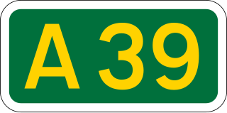
The A39 is an A road in south west England. It runs south-west from Bath in Somerset through Wells, Glastonbury, Street and Bridgwater. It then follows the north coast of Somerset, Devon and Cornwall through Williton, Minehead, Porlock, Lynmouth, Barnstaple, Bideford, Stratton, Camelford, Wadebridge and St Columb Major. It then joins the route of the A30 road for around 5 miles (8.0 km), re-emerging near Zelah to head for the south Cornish coast via Truro and Falmouth.

Lynmouth is a village in Devon, England, on the northern edge of Exmoor. The village straddles the confluence of the West Lyn and East Lyn rivers, in a gorge 700 feet (210 m) directly below the neighbouring town of Lynton, which was the only place to expand to once Lynmouth became as built-up as possible. The villages are connected by the Lynton and Lynmouth Cliff Railway, which works two cable-connected cars by gravity, using water tanks.
Porlock is a coastal village in Somerset, England, 5 miles (8 km) west of Minehead. At the 2011 census, the village had a population of 1,440.

Hardknott Pass is a hill pass between Eskdale and the Duddon Valley in the Lake District National Park, Cumbria, England. The tarmac-surfaced road, which is the most direct route from the central Lake District to West Cumbria, shares the title of steepest road in England with Rosedale Chimney Bank in North Yorkshire. It has a maximum gradient of 1 in 3.

Bwlch y Groes is the second highest public road mountain pass in Wales, with a summit altitude of 545 metres (1,788 ft). Gospel Pass in south Wales is slightly higher. It lies on minor roads linking Dinas Mawddwy, Llanuwchllyn and Lake Vyrnwy. The view from the pass encompasses the plain of the Dyfi valley, Cadair Idris and a close view of Aran Fawddwy. The cross, just below the summit at the junction of the roads from Vyrnwy and from Dinas Mawddwy, commemorates the place of the pass on a pilgrim route from north Wales.

The Lynton and Lynmouth Cliff Railway is a water-powered funicular joining the twin towns of Lynton and Lynmouth on the rugged coast of North Devon in southwest England.

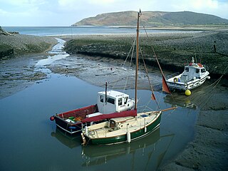
Porlock Weir is a harbour settlement approximately 1.5 miles (2.4 km) west of the inland village of Porlock, Somerset, England. "Porlock" comes from the Old English portloca, meaning an enclosure near a harbour. Porlock Weir refers to the salmon stakes and traps that were situated along the shore.

The Coleridge Way is a 51-mile (82 km) long-distance trail in Somerset and Devon, England.
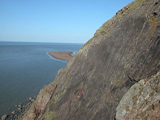
Hurlstone point is a promontory of land between Porlock Weir and Minehead in the Exmoor National Park on the coast of Somerset, England.

Quantock Motor Services is a privately owned bus operator in Bishops Lydeard, Somerset, England. The company operates a substantial heritage fleet for private hire and on route 300.
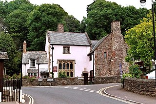
Dovery Manor Museum, also known as Porlock Museum, is a local museum in Porlock, Somerset, England.
The Lynmouth Flood occurred on the night of 15–16 August 1952, principally affecting the village of Lynmouth, in North Devon. A storm with heavy rainfall, combined with already saturated soil and flood debris, led to the flooding of the village and a total loss of 34 lives.
Lynmouth Lifeboat Station was the base for Royal National Lifeboat Institution (RNLI) search and rescue operations at Lynmouth, Devon in England from 1869 until 1944. Its best known action was in 1899 when the lifeboat was taken 15 miles (24 km) across Exmoor before being launched to assist a ship in trouble.

Countisbury is a village and former civil parish, now in the parish of Brendon and Countisbury, in the North Devon district, in the county of Devon, England. It is on Exmoor, roughly two miles east of Lynmouth along the A39. It has a church and pub. The National Trust owns the other buildings. In 2001 the parish had a population of 66.

Samaritans Way South West is a 103 miles (166 km) Long-distance footpath in South West England. It was officially opened on 21 April 2004 by the Ramblers Vice Chairman, the Samaritans (charity) Chief Executive and a farmer from Gloucestershire who headed the Farmers Helpline. In the same year it appeared on the Ordnance Survey maps supported and encouraged by Local Authorities, National Parks and Area of Outstanding Natural Beauty by giving their consent; however Somerset County Council later asked the Ordnance Survey to remove the route from their maps. A way marked walk linking the Cotswolds, the Mendips, the Polden Hills, the Quantocks, the Brendons, Exmoor National Park and the North Devon Coast.

Lynton and Lynmouth is a civil parish in the North Devon district of Devon, England. The parish is named after its two main settlements of Lynton, which stands on a plateau above the Glen Lyn Gorge, and Lynmouth which lies at the foot of the gorge where the West Lyn River and East Lyn River converge and then meet the sea. The two are connected by the Lynton and Lynmouth Cliff Railway, a water-powered funicular railway.
The geology of Exmoor National Park in south-west England contributes significantly to the character of Exmoor, a landscape which was designated as a national park in 1954. The bedrock of the area consists almost wholly of a suite of sedimentary rocks deposited during the Devonian, a period named for the English county of Devon in which the western half of the park sits. The eastern part lies within Somerset and it is within this part of the park that limited outcrops of Triassic and Jurassic age rocks are to be found.


