Related Research Articles

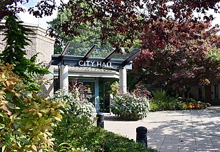
Maple Ridge is a city in British Columbia, Canada. It is located in the northeastern section of Greater Vancouver between the Fraser River and the Golden Ears, which is a group of mountain summits which are the southernmost of the Garibaldi Ranges of the Coast Mountains. Maple Ridge's population in 2021 was 90,990. Its downtown core area was once known as Haney.

Mission is a city in the Lower Mainland of the province of British Columbia, Canada. It was originally incorporated as a district municipality in 1892, growing to include additional villages and rural areas over the years, adding the original Town of Mission City, long an independent core of the region, in 1969. It is bordered by the city of Abbotsford to the south and the city of Maple Ridge to the west. To the east are the unincorporated areas of Hatzic and Dewdney.
Pitt Meadows is a municipality within Metro Vancouver in southwestern British Columbia, Canada. Incorporated in 1914, it currently has a land area of 86.34 square kilometres (33.34 sq mi) with a population of 19,146 as of 2021. The municipality received its name from the Pitt River and Pitt Lake. Pitt Meadows is one of 21 municipalities including Electoral Area A that comprises the Metro Vancouver Regional District.

Pitt Meadows—Maple Ridge—Mission was a federal electoral district in British Columbia, Canada, that was represented in the House of Commons of Canada from 1997 to 2015.

The Burrard Peninsula is a peninsula in the Lower Mainland region of British Columbia, Canada, bounded by the Burrard Inlet to the north, the Georgia Strait to the west, the North Arm of Fraser River to the south, and the Pitt River and Douglas Island to the east. The City of Vancouver occupies almost all of the western half of the peninsula, and the Cities of Burnaby and New Westminster occupy more than half of the eastern half. At its northeastern end, the peninsula is connected to the Eagle Mountain and Mount Burke of the Coast Mountains via a small isthmus at the center of the Tri-Cities.
Ruskin is a rural, naturally-treed community, about 35 mi (56 km) east of Vancouver on the north shore of the Fraser River. It was named around 1900 after of the English art critic, essayist, and prominent social thinker John Ruskin.

The history of Vancouver, British Columbia, is one that extends back thousands of years, with its first inhabitants arriving in the area following the Last Glacial Period. With its location on the western coast of Canada near the mouth of the Fraser River and on the waterways of the Strait of Georgia, Howe Sound, Burrard Inlet, and their tributaries, Vancouver has – for thousands of years – been a place of meeting, trade, and settlement.

Marc H.J. Dalton is a Canadian politician. He is the current Conservative Member of Parliament for Pitt Meadows—Maple Ridge after the 2019 Canadian federal election. He was a BC Liberal Member of the Legislative Assembly of British Columbia following the 2009 and 2013 provincial elections for the riding of Maple Ridge-Mission.
Albion, British Columbia is a neighbourhood in Maple Ridge, British Columbia and is one of several small towns incorporated within the municipality at its creation. It is the oldest non-indigenous community of the district's settlements, and is only slightly younger than Fort Langley, adjacent across the Fraser River, and Kanaka Creek, which is just to the west and lies along the creek of the same name. Its official definition is the area bounded by the Fraser River, Kanaka Way, and 240th Street, but in its historic sense it means the community centred on and flanking 240th Street and adjoining areas along the Fraser River waterfront and around the Maple Ridge Fairgrounds, while along Kanaka Way and also on the near bank of Kanaka Creek, the creek, is historically the community of Kanaka Creek. Burgeoning newer home construction east of 240th Street near the Lougheed Highway is also often referred to as part of Albion.
Whonnock is a rural, naturally treed, and hilly community on the north side of the Fraser River in the eastern part of the City of Maple Ridge, British Columbia, Canada. It is approximately 56 kilometres east of Downtown Vancouver on the Lougheed Highway Whonnock shares borders with three other Maple Ridge communities. To the west the borders are 256th Street with Albion and upper Kanaka Creek with Webster's Corners. To the east Whonnock Creek forms the border with Ruskin. To the north is the municipal border and to the south the Fraser River.
Haney, British Columbia is the name of the downtown core of the city of Maple Ridge, British Columbia. The name derived originally from Thomas Haney, the namesake of Port Haney, the neighbourhood adjoining today's downtown along the Fraser River immediately south, which is today includes a station on the West Coast Express and was formerly a steamboat port. Port Haney is a designated heritage district in Maple Ridge and includes buildings moved to the neighbourhood from other parts of the municipality that otherwise might have been demolished.
Maple Meadows station is a stop on the West Coast Express commuter rail line connecting Vancouver to Mission, British Columbia, Canada. The station is located on the north side of the Canadian Pacific Railway (CPR) tracks in Maple Ridge, just off Maple Meadows Way and Hammond Road. The station opened in 1995, when the West Coast Express began operating. 467 park and ride spaces are available. All services are operated by TransLink.
The Dewdney Trunk Road was one of the earliest major roads in the Fraser Valley of British Columbia, Canada. Originally running from Port Moody to Dewdney, just east of Mission, it exists in three sections today:
The Dewdney-Alouette Regional District was a regional district in the Lower Mainland of British Columbia, Canada, comprising the district municipalities of Pitt Meadows, Maple Ridge and Mission and unincorporated areas east to the Harrison River and north to the southern end of Lillooet Lake. The regional district was partitioned when the Greater Vancouver Regional District was expanded in 1995 to take in Pitt Meadows and Maple Ridge; the regional district's eastern half was combined with the former Central Fraser Valley Regional District and the Regional District of Fraser-Cheam to form the Fraser Valley Regional District.
Bradner is a community within the City of Abbotsford, British Columbia, Canada, located in a rural northwest region of that city which also includes Mount Lehman. Bradner occupies a height of land above the Fraser River, immediately across which is the community of Silverdale, a part of the District of Mission, and Ruskin, on the border between Mission and Maple Ridge. On the floodplain below to the west is the Langley rural neighbourhood of Glen Valley, while on the floodplain to the east, which is called Matsqui Prairie, the nearest Abbotsford neighbourhood is Matsqui Village. Bradner was formerly part of the District of Matsqui, which in 1995 was amalgamated into the City of Abbotsford.

The Katzie First Nation or Katzie Nation is a First Nation whose traditional territory lies in the Lower Fraser Valley of British Columbia, Canada. According to their oral tradition, the Katzie people are the descendants of the Oe'lecten and Swaneset communities, two of five established by the Creator in present-day Greater Vancouver.
Matsqui is a former district municipality in British Columbia, Canada. It was incorporated in 1892 and merged with the district municipality of Abbotsford in 1995 to create the new City of Abbotsford. Matsqui used to be the western part of what is now Abbotsford. It had commercial growth in the Clearbrook area which then spilled over to Abbotsford.

Port Mann townsite was created in 1911 in the municipality of Surrey, British Columbia. The new town was to adjoin the new railway yard and roundhouse forming the terminus of the new trans-national rail-line operated by Canadian Northern Railway. It was named for Donald Mann, a partner in the building of the Canadian Northern Railway. Newspaper quoted that the town was intended to be a model town. Purchase of sections had been completed by 1911 and clearing of the forest had begun. The sale of lots began in March 1912 and by June 1912 all land in the townsite had been sold. Four million dollars worth of land was sold in Port Mann. Borrowing from mid-nineteenth century notions of Baron Haussmann’s Paris, Port Mann was laid out by landscape architect Frederick S. Todd with streets radiating from a central circus in the residential section. The business sector was to cluster around a large open square. In June 1912 the Toronto World also published that Port Mann would be the site of a large scale steel mill by Carnegie Steel Company of Pittsburgh as well as the site of flour mill, and grain elevators by International Milling, and the site of a large dry dock and shipbuilding yards.
The Leq'á:mel First Nation, formerly known as Lakahahmen First Nation, is a First Nations band government whose community and offices are located in the area near Deroche, British Columbia in the Fraser Valley region in Canada, about 12 kilometres east of the District of Mission. They are a member government of the Sto:lo Nation Chiefs Council, which is one of two tribal councils of the Sto:lo.
Fraser Mills was a municipality in British Columbia on the north bank of the Fraser River that was incorporated in 1913, but has since amalgamated with the City of Coquitlam.
References
- ↑ The Heritage Resources of Maple Ridge (PDF) Archived 2010-12-18 at the Wayback Machine
- ↑ "Port Hammond (community)". BC Geographical Names .
- ↑ The Heritage Resources of Maple Ridge (PDF) Archived 2010-12-18 at the Wayback Machine
- ↑ The Heritage Resources of Maple Ridge (PDF) Archived 2010-12-18 at the Wayback Machine
- ↑ "Neighbourhoods in Maple Ridge, BC". Archived from the original on 2021-10-23. Retrieved 2021-10-24.
- ↑ "Port Hammond/The Ridge". Archived from the original on 2021-10-25. Retrieved 2021-10-25.