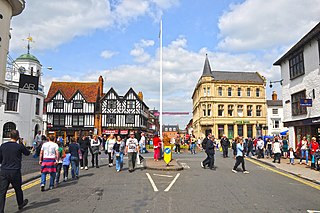
Stratford-upon-Avon, commonly known as just Stratford, is a market town and civil parish in the Stratford-on-Avon district, in the county of Warwickshire, in the West Midlands region of England. It is situated on the River Avon, 91 miles (146 km) north-west of London, 22 miles (35 km) south-east of Birmingham and 8 miles (13 km) south-west of Warwick. The town is the southernmost point of the Arden area at the northern extremity of the Cotswolds. In the 2021 census Stratford had a population of 30,495.
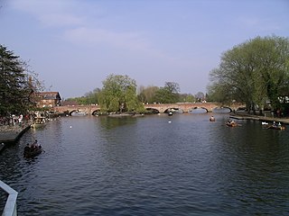
The River Avon, also in central England flows generally southwestwards and is a major left-bank and easternmost tributary of the River Severn. It is also known as the Warwickshire Avon or Shakespeare's Avon, to distinguish it from several other rivers of the same name in the United Kingdom.

Royal Leamington Spa, commonly known as Leamington Spa or simply Leamington, is a spa town and civil parish in Warwickshire, England. Originally a small village called Leamington Priors, it grew into a spa town in the 18th century following the popularisation of its water which was reputed to have medicinal qualities. In the 19th century, the town experienced one of the most rapid expansions in England. It is named after the River Leam, which flows through the town.

Southam is a market town and civil parish in the Stratford-on-Avon district of Warwickshire, England. Southam is situated on the River Stowe, which flows from Napton-on-the-Hill and joins Warwickshire's River Itchen at Stoneythorpe, just outside the town. In the 2021 census, the population of Southam was 8,114.

Warwick is a market town, civil parish and the county town of Warwickshire in the Warwick District in England, adjacent to the River Avon. It is 9 miles (14 km) south of Coventry, and 19 miles (31 km) south-east of Birmingham. It is adjoined with Leamington Spa and Whitnash.

Warwickshire is a ceremonial county in the West Midlands of England. It is bordered by Staffordshire and Leicestershire to the north, Northamptonshire to the east, Oxfordshire and Gloucestershire to the south, and Worcestershire and the West Midlands county to the west. The largest settlement is Nuneaton and the county town is Warwick.

Warwick is a local government district in Warwickshire, England. It is named after the historic county town of Warwick, which is the district's second largest town; the largest town is Royal Leamington Spa, where the council is based. The district also includes the towns of Kenilworth and Whitnash and surrounding villages and rural areas. Leamington Spa, Warwick and Whitnash form a conurbation which has about two thirds of the district's population.
Whitnash is a town and civil parish located southeast of, and contiguous with Leamington Spa and Warwick in Warwickshire, England. In 2001, it had a population of 7,760 which increased to 9,129 in the 2011 census, increasing again to 10,489 in the 2021 census.

Warwick and Leamington is a constituency represented in the House of Commons of the UK Parliament since the 2017 general election by Matt Western of the Labour Party.

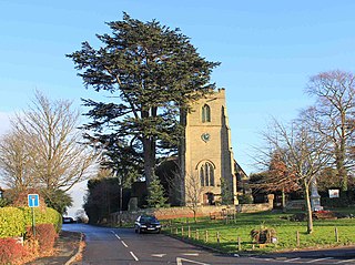
Leek Wootton is a village and former civil parish, now in the parish of Leek Wootton and Guy's Cliffe, in the Warwick district, in the county of Warwickshire, England, approximately 2 miles south of Kenilworth and 2.5 miles north of Warwick. It lies in the triangle created by Kenilworth, Warwick and Leamington Spa. In 1961 the parish had a population of 671.
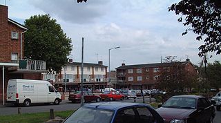
Lillington is a suburb of Leamington Spa, in the civil parish of Royal Leamington Spa, in the Warwick District in the county of Warwickshire, England. Historically a village which existed before the time of the Domesday Book (1086), it was incorporated into the borough of Leamington in 1890. Lillington is a ward of Warwick District Council and Royal Leamington Spa Town Council.

Barford is a village and civil parish in the Warwick district of Warwickshire, England, about three miles south of Warwick. As at the 2001 census the parish had a population of 1,171, that increased to 1,336 at the 2011 census. The Joint parish council also runs the villages of Sherbourne and Wasperton. In March 2014 "The Sunday Times" listed the village as one of the Top 10 places to live in The Midlands. In the village there are two pubs, a hotel with swimming pool, and a village shop owned and run by the community.

Warwickshire Police is the territorial police force responsible for policing Warwickshire in England. It is the second smallest territorial police force in England and Wales after the City of London Police, with only 823 regular officers as of September 2017. The resident population of the force area is 554,002.

Old Milverton is a hamlet east of Warwick and north west of Leamington Spa in Warwickshire, England, and situated in a bend of the River Avon. The population as taken at the 2011 census was 319.

The A445 road is a road in Warwickshire, England. It runs between the town of Warwick and the A45, also passing through the north of Leamington Spa. The road provides the major link between Leamington/Warwick and north-east Warwickshire, including Rugby and the M45/M1 motorways. The M45/M1 provided the major route to London until the early 1990s but have now been superseded by the M40, which passes to the south of the Leamington/Warwick conurbation.

Stratford-upon-Avon Parkway is a railway station located on the northern outskirts of Stratford-upon-Avon in Warwickshire, England. It is on the North Warwickshire Line, adjacent to the A46.

The Leamington & Warwick Tramways & Omnibus Company operated a tramway service between Warwick and Leamington Spa between 1881 and 1930.

