Postal codes in Slovakia

Last updated
2-digit postcode areas Slovakia (defined through the first two postcode digits) 2 digit postcode slovakia.png
2-digit postcode areas Slovakia (defined through the first two postcode digits)

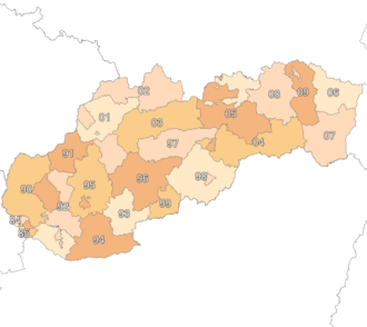
Postal codes in Slovakia use the old system of Czechoslovakia.

The system of PSČ numbers (PSČ, stands for Slovak : Poštové smerovacie číslo - postal routing number) was introduced in former Czechoslovakia in 1973 and has remained unchanged. The postal code consists of five digits, usually written with a space in the form XXX XX. The first digit indicates a region:

8 - the capital of Slovakia, Bratislava. The second digit represents one of the five districts of Bratislava. The codes 860 01-899 99 are not assigned to any region and serve for internal purposes of the postal system.
9 - southern and western Slovakia: 911 01 Trenčín, 917 01 Trnava, 949 01 Nitra, 960 01 Zvolen, 974 01 Banská Bystrica, 984 01 Lučenec
0 - northern and eastern Slovakia: 010 01 Žilina, 036 01 Martin, 040 01 - 044 99 Košice, 058 01 Poprad, 071 01 Michalovce, 080 01 Prešov).

Regions 1 to 7 were reserved for the Czech republic, and are located there. The postal codes of Slovakia and Czech republic do not overlap.
When writing the address, the postal code is put in front of the town name; when typed or printed, 1 space separates the leading 3 digits from the trailing 2 digits, and 2 spaces separate the postal code from the town name, e.g.:

 Kúpeľná 1/A
811 02  Bratislava 1

On envelopes and postcards there are usually five rectangular boxes below the address field for the postal code digits.

On postal items being sent from abroad it is recommended to prepend the postal code with the ISO 3166-1 two-letter code of the country and a dash:

 Kúpeľná 1/A
SK-811 02  Bratislava 1 Slovakia

See also

Related Research Articles

<span class="mw-page-title-main">Slovakia</span> Country in Central Europe

Slovakia, officially the Slovak Republic, is a landlocked country in Central Europe. It is bordered by Poland to the north, Ukraine to the east, Hungary to the south, Austria to the west, and the Czech Republic to the northwest. Slovakia's mostly mountainous territory spans about 49,000 square kilometres (19,000 sq mi), hosting a population exceeding 5.4 million. The capital and largest city is Bratislava, while the second largest city is Košice.

<span class="mw-page-title-main">Postal code</span> Series of letters and digits for sorting mail

A postal code is a series of letters or digits or both, sometimes including spaces or punctuation, included in a postal address for the purpose of sorting mail.

<span class="mw-page-title-main">ZIP Code</span> Numeric postal code used in the US and its territories

A ZIP Code is a system of postal codes used by the United States Postal Service (USPS). The term ZIP was chosen to suggest that the mail travels more efficiently and quickly when senders use the code in the postal address.

<span class="mw-page-title-main">Postcodes in the United Kingdom</span>

Postal codes used in the United Kingdom, British Overseas Territories and Crown dependencies are known as postcodes. They are alphanumeric and were adopted nationally between 11 October 1959 and 1974, having been devised by the General Post Office. A full postcode is known as a "postcode unit" and designates an area with several addresses or a single major delivery point.

The German-speaking population in the interwar Czechoslovak Republic, 23.6% of the population at the 1921 census, usually refers to the Sudeten Germans, although there were other German ethno-linguistic enclaves elsewhere in Czechoslovakia inhabited by Carpathian Germans, and among the German-speaking urban dwellers there were ethnic Germans and/or Austrians as well as German-speaking Jews. 14% of the Czechoslovak Jews considered themselves Germans in the 1921 census, but a much higher percentage declared German as their colloquial tongue during the last censuses under the Austro-Hungarian Empire.

<span class="mw-page-title-main">Regions of Slovakia</span> First-level administrative divisions of Slovakia

Since 1949, Slovakia has been divided into a number of kraje. Their number, borders and functions have been changed several times. There are eight regions of Slovakia and they correspond to the EU's NUTS 3 level of local administrative units. Each kraj consists of okresy. There are 79 districts.

<span class="mw-page-title-main">Galanta</span> Town in Slovakia

Galanta is a town in the Trnava Region of Slovakia. It is situated 50 km due east of the Slovak capital Bratislava.

<span class="mw-page-title-main">Address</span> Collection of information that describes the location of a building, apartment, or other structure

An address is a collection of information, presented in a mostly fixed format, used to give the location of a building, apartment, or other structure or a plot of land, generally using political boundaries and street names as references, along with other identifiers such as house or apartment numbers and organization name. Some addresses also contain special codes, such as a postal code, to make identification easier and aid in the routing of mail.

This article deals with historic administrative divisions of Czechoslovakia up to 1992, when the country was split into the Czech Republic and Slovakia.

Ukraine uses five-digit numeric postal codes that are written immediately to the right of the city or settlement name.

<span class="mw-page-title-main">Telephone numbers in Slovakia</span>

This page details the format and usage of telephone numbers in Slovakia. Today, Slovakia uses a closed numbering plan with area codes beginning with 0. After 0, there is usually a 2-digit prefix, followed by a 7-digit subscriber number. The capital, Bratislava, has one-digit prefix and an 8-digit subscriber number.

<span class="mw-page-title-main">Senec, Slovakia</span> District town in Slovakia

Senec is a town in the Bratislava Region of south-western Slovakia. The town is the administrative seat of the Senec District and its largest municipality. In 2022 it had a population of over 20,000.

<span class="mw-page-title-main">Veľký Krtíš</span> Town in Slovakia

Veľký Krtíš is a town in middle Slovakia, situated in the historical Novohrad region. The town's most important economic sectors are mining and agriculture.

<span class="mw-page-title-main">Sládkovičovo</span> Town in Slovakia

Sládkovičovo is a town in the Galanta District, Trnava Region in southwestern Slovakia.

<span class="mw-page-title-main">Postcodes in Australia</span> Numeric codes in Australia

Postcodes in Australia are used to more efficiently sort and route mail within the Australian postal system. Postcodes in Australia have four digits and are placed at the end of the Australian address, before the country. Postcodes were introduced in Australia in 1967 by the Postmaster-General's Department and are now managed by Australia Post, Australia's national postal service. Postcodes are published in booklets available from post offices or online from the Australia Post website.

<span class="mw-page-title-main">Bratislava</span> Capital and largest city of Slovakia

Bratislava, historically known as Pressburg (Preßburg), is the capital and largest city of Slovakia and the fourth largest of all cities on Danube river. Officially, the population of the city is about 475,000; however, some sources estimate it to be more than 660,000—approximately 140% of the official figures. Bratislava is in southwestern Slovakia at the foot of the Little Carpathians, occupying both banks of the River Danube and the left bank of the River Morava. Bordering Austria and Hungary, it is the only national capital to border two sovereign states.

<span class="mw-page-title-main">Czech Republic–Slovakia relations</span> Bilateral relations

The Czech Republic and Slovakia established diplomatic relations on January 1, 1993. The two countries became members of the European Union in 2004.

<span class="mw-page-title-main">Postal codes in the Czech Republic</span>

Postal codes in the Czech Republic are called PSČ. The acronym is commonly pronounced as a word, rather than separate letters. The system was introduced in former Czechoslovakia in 1973 and has remained unchanged. The postal code consists of five digits, usually written with a space in the form XXX XX. The first digit indicates a region :

<span class="mw-page-title-main">Postage stamps and postal history of Slovakia</span>

This is a survey of the postage stamps and postal history of Slovakia.

<span class="mw-page-title-main">Telephone numbers in the Soviet Union</span>

The telephone numbering plan of the USSR was a set of telephone area codes, numbers and dialing rules, which operated in the Soviet Union until the 1990s. After the collapse of the USSR, many newly independent republics implemented their own numbering plans. However, many of the principles of the Soviet numbering plan still remain. The former Soviet international code +7 is still retained by Russia and Kazakhstan.