Powhatan Township, Pocahontas County, Iowa

Last updated

Powhatan Township is a township in Pocahontas County, Iowa, USA. [1]

A township in the United States is a small geographic area.

Pocahontas County, Iowa County in the United States

Pocahontas County is a county located in Iowa, United States. As of the 2010 census, the population was 7,310. The county seat is Pocahontas. The county was formed in 1851.

Iowa State of the United States of America

Iowa is a state in the Midwestern United States, bordered by the Mississippi River to the east and the Missouri River and Big Sioux River to the west. It is bordered by six states; Wisconsin to the northeast, Illinois to the east, Missouri to the south, Nebraska to the west, South Dakota to the northwest and Minnesota to the north.

History

Powhatan Township was established in 1866 as Nunda Township, as some of its first citizens were natives of Nunda, New York. However, the name Nunda was not popular with the majority, and so in 1867, the township was renamed to honor Chief Powhatan, father of Pocahontas. [2]

Nunda, New York Town in New York, United States

Nunda is a town in Livingston County, New York, United States. The population was 3,064 at the 2010 census. Nunda welcomes each visitor with signs stating, "Welcome to Nunda, A Nice Place To Live." The name is derived from Nunda-wa-ono, the name given to it by a group of the Seneca Indian tribe that once lived in the hills and valleys along the Genesee river and Keshequa stream within the present-day Town of Nunda. In the Seneca language, "Nunda" relates to hills and a popular translation is "Where the valley meets the hills".

Related Research Articles

Pocahontas, Iowa City in Iowa, United States

Pocahontas is a city in and the county seat of Pocahontas County, Iowa, United States. The population was 1,789 in the 2010 census, a decline from the 1,970 population in 2000.

Nunda Township, McHenry County, Illinois Township in Illinois, United States

Nude Township is located in McHenry County, Illinois. As of the 2010 census, its population was 38,245 and it contained 14,492 housing units. Nunda Township changed its name from Brooklyn Township on December 28, 1850. Nunda Township shares the distinction with McHenry Township as being the two largest townships by land area in McHenry County, at 48.3 square miles (130 km2) each.

Sherman Township is a township in Kossuth County, Iowa, United States.

Riverdale Township is a township in Kossuth County, Iowa, United States.

Bellville Township is a township in Pocahontas County, Iowa, USA.

Cedar Township is a township in Pocahontas County, Iowa, USA.

Center Township is a township in Pocahontas County, Iowa, USA.

Colfax Township is a township in Pocahontas County, Iowa, USA.

Des Moines Township, Pocahontas County, Iowa township in Pocahontas County, Iowa

Des Moines Township is a township in Pocahontas County, Iowa, USA.

Dover Township is a township in Pocahontas County, Iowa, USA.

Grant Township is a township in Pocahontas County, Iowa, USA.

Lake Township is a township in Pocahontas County, Iowa, USA.

Lincoln Township is a township in Pocahontas County, Iowa, USA.

Lizard Township is a township in Pocahontas County, Iowa, USA.

Marshall Township is a township in Pocahontas County, Iowa, USA.

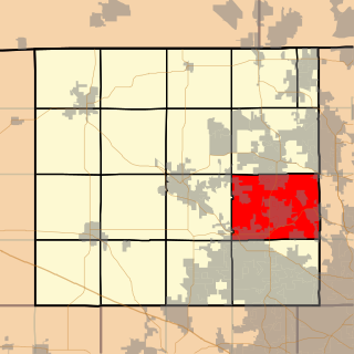
Sherman Township is a township in Pocahontas County, Iowa, USA.

Swan Lake Township is a township in Pocahontas County, Iowa, USA.

Garfield Township is a township in Pocahontas County, Iowa, USA.

Rubens is a ghost town in Pocahontas County, in the U.S. state of Iowa.

References

Coordinates: 42°51′53″N94°37′11″W / 42.8647°N 94.6197°W / 42.8647; -94.6197

Geographic coordinate system Coordinate system

A geographic coordinate system is a coordinate system that enables every location on Earth to be specified by a set of numbers, letters or symbols. The coordinates are often chosen such that one of the numbers represents a vertical position and two or three of the numbers represent a horizontal position; alternatively, a geographic position may be expressed in a combined three-dimensional Cartesian vector. A common choice of coordinates is latitude, longitude and elevation. To specify a location on a plane requires a map projection.