Preitenegg

Last updated
Preitenegg
Preitenegg Suedost Ortsansicht 23102010 001.jpg
AUT Preitenegg COA.jpg
Coat of arms
Austria adm location map.svg
Red pog.svg
Preitenegg
Location within Austria
Coordinates: 46°56′N14°55′E / 46.933°N 14.917°E / 46.933; 14.917 Coordinates: 46°56′N14°55′E / 46.933°N 14.917°E / 46.933; 14.917
Country Austria
State Carinthia
District Wolfsberg
Government
   Mayor Franz Kogler (ÖVP)
Area
[1]
  Total68.35 km2 (26.39 sq mi)
Elevation
1,076 m (3,530 ft)
Population
(2018-01-01) [2]
  Total932
  Density14/km2 (35/sq mi)
Time zone UTC+1 (CET)
  Summer (DST) UTC+2 (CEST)
Postal code
9451
Area code 04354
Website www.preitenegg.at

Preitenegg (Slovene : Pratnik) is a municipality in the district of Wolfsberg in the Austrian state of Carinthia.

Slovene language language spoken in Slovenia

Slovene or Slovenian belongs to the group of South Slavic languages. It is spoken by approximately 2.5 million speakers worldwide, the majority of whom live in Slovenia. It is the first language of about 2.1 million Slovenian people and is one of the 24 official and working languages of the European Union.

Bezirk Wolfsberg is a district of the state of Carinthia in Austria.

Austria Federal republic in Central Europe

Austria, officially the Republic of Austria, is a country in Central Europe comprising 9 federated states. Its capital, largest city and one of nine states is Vienna. Austria has an area of 83,879 km2 (32,386 sq mi), a population of nearly 9 million people and a nominal GDP of $477 billion. It is bordered by the Czech Republic and Germany to the north, Hungary and Slovakia to the east, Slovenia and Italy to the south, and Switzerland and Liechtenstein to the west. The terrain is highly mountainous, lying within the Alps; only 32% of the country is below 500 m (1,640 ft), and its highest point is 3,798 m (12,461 ft). The majority of the population speaks local Bavarian dialects as their native language, and German in its standard form is the country's official language. Other regional languages are Hungarian, Burgenland Croatian, and Slovene.

Contents

Geography

Preitenegg lies on the northeastern rim of Carinthia in the upper Lavant valley. The municipality stretches along the slopes of the Packalpe and Koralpe mountain ranges, both part of the Lavanttal Alps. In the east, the Pack Saddle mountain pass marks the boundary with the state of Styria. Due to its picturesque setting, the mountain village today strongly relies on tourism, including cross-country skiing in winter.

Lavanttal valley in Carinthia, Austria

The Lavant Valley lies in the Lavanttal Alps in southern Austria in the eastern part of the state of Carinthia. It covers just under 1,000 km2 (390 sq mi) and has a population of circa 60,000.

Koralpe mountain range

The Koralpe, also referred to as Koralm, is a mountain range in southern Austria which separates eastern Carinthia from southern Styria. The southern parts of the range extend into Slovenia. Running from north to south, it drains to the river Lavant in the west, and to the river Sulm in the east. Its highest elevation is the Große Speikkogel, a popular hiking destination and also a node for military radar airspace surveillance. In the south, in the Slovenian territory, it is contiguous with the Kozjak mountain range.

Lavanttal Alps mountain range

The Lavanttal Alps are part of the Central Eastern Alps in Austria and Slovenia, between the river Mur in the north and the Drava in the south.

The municipal area comprises the cadastral communities of Kleinpreitenegg, Oberauerling, Oberpreitenegg, Preitenegg, Unterauerling, and Unterpreitenegg.

A cadastral community or cadastral municipality, is a cadastral subdivision of municipalities in the nations of Austria, Bosnia and Herzegovina, Croatia, the Czech Republic, Serbia, Slovakia, the Italian provinces of South Tyrol, Trentino, Gorizia and Trieste, Slovenia, and the Netherlands. A cadastral community records property ownership in a cadastre, which is a register describing property ownership by boundary lines of the real estate.

History

St Nicholas parish church Preitenegg Pfarrkirche hl. Nikolaus 23102010 12.jpg
St Nicholas parish church

From the 11th century onwards, the upper Lavant valley belonged to the Bamberg ecclesiastical estates within the Duchy of Carinthia, ruled by episcopal ministeriales residing at Waldenstein Castle near Wolfsberg. The local St Nicholas Church was first mentioned in 1288, when the bailiwick ( Vogtei ) passed to the Bishop of Lavant.

Prince-Bishopric of Bamberg An ecclesiastical State of the Holy Roman Empire

The Prince-Bishopric of Bamberg was an ecclesiastical State of the Holy Roman Empire. It goes back to the Roman Catholic Diocese of Bamberg established at the 1007 synod in Frankfurt, at the behest of King Henry II to further expand the spread of Christianity in the Franconian lands. The bishops obtained the status of Imperial immediacy about 1245 and ruled their estates as Prince-bishops until they were subsumed to the Electorate of Bavaria in the course of the German Mediatisation in 1802.

Duchy of Carinthia

The Duchy of Carinthia was a duchy located in southern Austria and parts of northern Slovenia. It was separated from the Duchy of Bavaria in 976, and was the first newly created Imperial State after the original German stem duchies.

Ministerialis were people raised up from serfdom to be placed in positions of power and responsibility. In the Holy Roman Empire, in the High Middle Ages, the word and its German translations, Ministeriale(n) and Dienstmann, came to describe those unfree nobles who made up a large majority of what could be described as the German knighthood during that time. What began as an irregular arrangement of workers with a wide variety of duties and restrictions rose in status and wealth to become the power brokers of an empire. The ministeriales were not legally free people, but held social rank. Legally, their liege lord determined whom they could or could not marry, and they were not able to transfer their lords' properties to heirs or spouses. They were, however, considered members of the nobility since that was a social designation, not a legal one. Ministeriales were trained knights, held military responsibilities and surrounded themselves with the trappings of knighthood, and so were accepted as noblemen. Both women and men held the ministerial status, and the laws on ministeriales made no distinction between the sexes in how they were treated.

Preitenegg itself first appeared in a 1328 deed. The linear village arose on the historic country road (Packer Straße), originally only a mule track, that ran from Carinthia across the Pack Saddle to the Styrian capital Graz.

Duchy of Styria

The Duchy of Styria was a duchy located in modern-day southern Austria and northern Slovenia. It was a part of the Holy Roman Empire until its dissolution in 1806 and a Cisleithanian crown land of Austria–Hungary until its dissolution in 1918.

Graz Place in Styria, Austria

Graz is the capital of Styria and the second-largest city in Austria after Vienna. On 1 January 2019, it had a population of 328,276. In 2015, the population of the Graz larger urban zone who had principal residence status stood at 633,168.

In 1695 the Waldenstein estates were acquired by the noble House of Schönborn, in 1852 they passed to Henckel von Donnersmarck family. The present-day municipality was established in 1849. From 1930 to 1936 the Pack Saddle road was upgraded as a Bundesstraße federal highway. Preitenegg later was relieved of heavy traffic by the opening of the parallel Süd Autobahn motorway in the 1980s.

Henckel von Donnersmarck Austrian-German noble family

The Henckel von Donnersmarck family is an Austro-German noble family that originated in the former region of Spiš in Upper Hungary, now in Slovakia. The founder of the family was Henckel de Quintoforo in the 14/15th century. The original seat of the family was in Donnersmarck.

<i>Bundesstraße</i> denotation for German and Austrian national highways

Bundesstraße, abbreviated B, is the denotation for German and Austrian national highways.

Süd Autobahn road in Austria

The Süd Autobahn (A2) is a motorway (Autobahn) in Austria. Completed in 1999, it runs from the outskirts of Vienna south via the cities of Graz and Klagenfurt to the border of Italy at Arnoldstein, where it joins the Autostrada A23. With a total length of 377.3 km (234.4 mi), the A2 is Austria's longest motorway.

Politics

Seats in the municipal assembly (Gemeinderat) as of 2015 local elections:

Notable people

Related Research Articles

Wolfsberg, Carinthia Place in Carinthia, Austria

Wolfsberg[ˈvɔlfsbɛʁk] is a town in Carinthia, Austria, the capital of Wolfsberg District.

Sankt Paul im Lavanttal Place in Carinthia, Austria

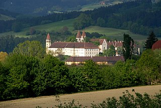
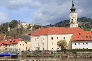
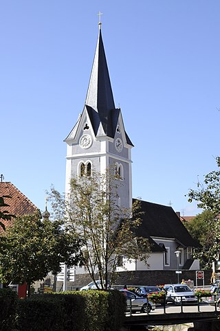
Sankt Paul im Lavanttal is a municipality of the Wolfsberg district in the Austrian state of Carinthia.

Albeck, Carinthia Place in Carinthia, Austria

Albeck is a municipality in the district of Feldkirchen in the Austrian state of Carinthia.

Reichenau, Carinthia Place in Carinthia, Austria

Reichenau is a municipality in the district of Feldkirchen in the Austrian state of Carinthia.

Greifenburg Place in Carinthia, Austria

Greifenburg is a market town in the district of Spittal an der Drau in the Austrian state of Carinthia.

Krems, Carinthia Place in Carinthia, Austria

Krems in Kärnten is a municipality in the district of Spittal an der Drau in Carinthia in Austria.

Mallnitz Place in Carinthia, Austria

Mallnitz is a municipality in the Spittal an der Drau District in Carinthia, Austria.

Mühldorf, Carinthia Place in Carinthia, Austria

Mühldorf is a municipality in the district of Spittal an der Drau in the Austrian state of Carinthia.

Oberdrauburg Place in Carinthia, Austria

Oberdrauburg is a market town in the district of Spittal an der Drau at the western rim of the Austrian state of Carinthia.

Radenthein Place in Carinthia, Austria

Radenthein is a town in Spittal an der Drau District, in the Austrian state of Carinthia.

Weissensee, Austria Place in Carinthia, Austria

Weissensee is a municipality in the district of Spittal an der Drau in Carinthia, Austria.

Stockenboi Place in Carinthia, Austria

Stockenboi is a municipality in the district of Villach-Land in the Austrian state of Carinthia.

Griffen, Austria Place in Carinthia, Austria

Griffen is a market town in the district of Völkermarkt in the Austrian state of Carinthia.

Bad Sankt Leonhard im Lavanttal Place in Carinthia, Austria

Bad Sankt Leonhard im Lavanttal is a spa town in the district of Wolfsberg in the Austrian state of Carinthia.

Lavamünd Place in Carinthia, Austria

Lavamünd is a market town in the district of Wolfsberg in the Austrian state of Carinthia.

Reichenfels Place in Carinthia, Austria

Reichenfels is a town in the district of Wolfsberg in the Austrian state of Carinthia.

Sankt Andrä Place in Carinthia, Austria

Sankt Andrä is a town in the district of Wolfsberg in Carinthia in Austria. It is named after Saint Andrew.

Sankt Georgen im Lavanttal Place in Carinthia, Austria

Sankt Georgen im Lavanttal is a town in the district of Wolfsberg in the Austrian state of Carinthia.

Obertilliach Place in Tyrol, Austria

Obertilliach is a municipality in the district of Lienz, in the Austrian state of Tyrol.

Eppenstein Place in Styria, Austria

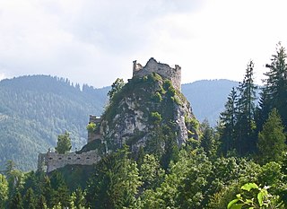
Eppenstein is a former municipality in the district of Murtal in the Austrian state of Styria. Since the 2015 Styria municipal structural reform, it is part of the municipality Weißkirchen in Steiermark.

References

  1. "Dauersiedlungsraum der Gemeinden Politischen Bezirke und Bundesländer - Gebietsstand 1.1.2018". Statistics Austria. Retrieved 10 March 2019.
  2. "Einwohnerzahl 1.1.2018 nach Gemeinden mit Status, Gebietsstand 1.1.2018". Statistics Austria. Retrieved 9 March 2019.