
Park City is a home rule-class city in Barren County, Kentucky, United States. The population was 614 at the 2020 census. It is the entrance to nearby Mammoth Cave National Park and to Diamond Caverns, a privately owned cave attraction. Exit 48 off I-65 is the only direct access exit to the Mammoth Cave National Park.
Moore Township is a civil township of Sanilac County in the U.S. state of Michigan. As of the 2000 census, it had a population of 1,262.

Parker is a city located in Armstrong County, Pennsylvania, United States. It is in the extreme northwestern portion of the county. The population was 695 at the 2020 census. The city was named for Judge John Parker, a lead surveyor of Lawrenceburg and founder/owner of Parker's Landing, the two villages combined to create Parker.
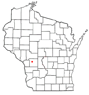
Angelo is a town in Monroe County, Wisconsin, United States. The population was 1,268 at the 2000 census. The unincorporated community of Farmers Valley is also located partially in the town.
Nett Lake is an unorganized territory in Saint Louis County, Minnesota, United States. The population was 272 at the 2000 census.

Shawboro is an unincorporated community located in Currituck County, North Carolina, United States.

Orexa is a town located in the province of Gipuzkoa, in the Autonomous Community of Basque Country, northern Spain.

Macomb is an unincorporated community in Wright County, Missouri, United States. It is located on Missouri Route K, approximately 1.5 mi (2.4 km) south of U.S. Route 60 and on the Burlington Northern Railroad line.
Macedon Center is a hamlet located within the Town of Macedon, Wayne County, New York, United States. It is located three miles (5 km) northwest of the hamlet of Macedon, at an elevation of 554 feet. The primary intersection in the hamlet is at N.Y. Route 31F, also known as Macedon Center Road, and Canandaigua Road.

The Central Bank of Mauritania is the central bank of Mauritania, in northwest Africa. The bank is located in the capital Nouakchott, just south of the Presidential palace. Its current Governor is Mohamed Lemine Ould Dhehby.

The James Ford Bell Library is a special collection of the University of Minnesota Libraries located on the University of Minnesota Minneapolis campus. It is named for its first donor and patron James Ford Bell, founder of the General Mills Corporation in Minneapolis, Minnesota. The collection consists of some 40,000 rare books, maps, manuscripts, broadsides, pamphlets and other materials documenting the history and impact of international trade and cultural exchange in the pre-modern era, before ca. 1800. Its materials range in date from 400 CE to 1825 CE, with the bulk of the collection concentrated between the years 1450 and 1790, the early modern period. The library is known for its globe gores copy of the 1507 Waldseemuller world map, and it acquired a copy of the 1602 Impossible Black Tulip Chinese world map in 2009. The scope of the collection is global and more than 15 languages are represented.
Ferry Village is a hamlet in the town of Grand Island in Erie County, New York, United States.

The Flora und Botanischer Garten Köln is a municipal formal park and botanical garden located adjacent to Cologne Zoological Garden at Amsterdamer Straße 34, Cologne, North Rhine-Westphalia, Germany. It is open daily without charge.
Judiciary Palace is a palace located in Nouakchott, Mauritania. It is located on the Avenue Gamal Abdel Nasser, between the Friday Mosque of Nouakchott and the headquarters of Mauritania Airlines.
The Old Fort is a fort in northeastern Nouakchott, Mauritania. It is located to the northeast of the Presidential Palace, near the Stadium of Ksar and College d'Application.
The Stadium of Ksar is a sports field in northeastern Nouakchott, Mauritania. It is located to the northeast of the Presidential Palace, near the Old Fort and College d'Applicatio.
WLHW is a Christian radio station licensed to Casey, Illinois, broadcasting on 91.5 MHz FM. The station is owned by American Hope Communications, Inc.
Dillwyn is an unincorporated community in Stafford County, Kansas, United States. It is located southwest of St. John, next to a railroad at NW 10th Rd and NW 70th Ave, about 1 mile north of U.S. Route 50 highway.
Stallings Crossroads is an unincorporated community in eastern Franklin County, North Carolina, United States. It is located east of Louisburg, at an elevation of 384 feet. The primary cross roads where the community is located are N.C. Highway 56, Fire Tower Road and Edward Best Road.
Potosi or Potosi Camp, was called Crystal City in the 1870s, a mining ghost town in Clark County, Nevada. It lies at an elevation of 5705 feet.
