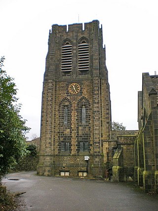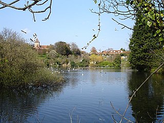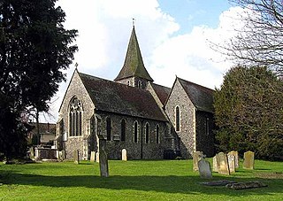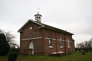
Faversham is a market town in Kent, England, 8 miles (13 km) from Sittingbourne, 48 miles (77 km) from London and 10 miles (16 km) from Canterbury, next to the Swale, a strip of sea separating mainland Kent from the Isle of Sheppey in the Thames Estuary. It is close to the A2, which follows an ancient British trackway which was used by the Romans and the Anglo-Saxons, and known as Watling Street. The name is of Old English origin, meaning "the metal-worker's village".

Preston is a coastal village and suburb of Weymouth in south Dorset, England. It is approximately 3 kilometres (2 mi) north-east of Weymouth town centre and 2 kilometres (1 mi) west of the village of Osmington.

Testerton is a small village and former civil parish, now in the parish of Pudding Norton, in the North Norfolk district, in the county of Norfolk, England. It is located between the village of Great Ryburgh and the market town of Fakenham. In 1931 the parish had a population of 53.

Morningthorpe is a village and former civil parish, now in the parish of Morningthorpe and Fritton in the South Norfolk district, in the county of Norfolk, England. It is situated some 20 kilometres (12 mi) south of the city of Norwich. The parish includes the villages of Morningthorpe and Fritton. The two villages are 1 km apart.

Preston or Preston Village is a suburb of Brighton and Hove, in the ceremonial county of East Sussex, England. It is to the north of the centre. Originally a village in its own right, it was eventually absorbed into Brighton with the development of the farmland owned by the local Stanford family, officially becoming a parish of the town in 1928. Stanford-owned land to the south of Preston Manor was given to the town and now makes up Preston Park, one of the largest parks in the now conjoined city of Brighton and Hove. The park hosts some of the city's major public events such as Brighton Pride.

Northowram is a village lying north-east of the town of Halifax in Calderdale, West Yorkshire, England. It stands on the north side of Shibden valley. Southowram stands on the southern side of the valley.

Brereton is a village and former civil parish, now in the parish of Brereton and Ravenhill, in the Cannock Chase district, in the county of Staffordshire, England.

Preston or Preston-next-Wingham is a civil parish and village in the valley of the Little Stour in the Dover District of Kent, England. The village is on the B2076 secondary road. The parish includes the hamlet of Elmstone. The main river through the area is a tributary of the River Stour. The suffix 'next-Wingham' distinguishes the area from Preston-next-Faversham.
Goodnestone is a village and former civil parish, now in the parish of Graveney with Goodnestone, in the Swale district of Kent, England. The village is mainly on the road 'Head Hill Road' towards Graveney. In 1961 the parish had a population of 58.

Davington is a suburb of Faversham, in the Swale district, in the county of Kent, England.

Buttsbury is a village and former 2,079-acre (8.4 km2) civil parish now in the parish of Stock, in the Chelmsford district of Essex, England. Its name is a contraction of Botulph's Pirie, a major saint who died in 680. It is sometimes surmised that the name refers to a tree under which St Botolph preached. In 1931, the civil parish had a population of 1709.

Stifford is an area and former civil parish in the town of Grays in Thurrock, Essex, England. Historically a single village, the area was broken up by the construction of the A13 in the 1900s and is now divided by the road into three communities, the urban areas of South Stifford and Stifford Clays and the small village of North Stifford. In 1931 the parish had a population of 2188. On 1 April 1936 the parish was abolished to form Thurrock.

Merston is a small village, an Anglican parish and former civil parish, now in the civil parish of Oving, in the Chichester district of West Sussex, England. It lies just south of the A259 road 2.4 miles (3.9 km) southeast of Chichester.

Houghton Saint Giles is a village and former civil parish, now in the parish of Barsham, in the North Norfolk district, in the English county of Norfolk. It has also been referred to as Houghton-le-Dale or Houghton-in-the-Hole. In 1931 the parish had a population of 142.

Preston Deanery is a village and former civil parish, now in the parish of Hackleton, in the West Northamptonshire district, in the ceremonial county of Northamptonshire, England. It is 4 miles (6 km) south of Northampton town centre and 1.5 miles (2 km) by road to the M1 London to Yorkshire motorway junction 15. It lies just off the B526 road from Northampton to Newport Pagnell, between Hackleton and Wootton, a former village which has become now a suburb of Northampton. The 2010 population estimate was 51.

Ousden is a village and civil parish in the West Suffolk district of Suffolk in eastern England. It is located around 6 miles (10 km) west of Bury St Edmunds and 72 miles (116 km) north of London, and as of 2011, its population is 266. The village has an Anglican church of St Peter's and a chapel in the cemetery dedicated to St Barnabas.

Seasalter is a village in the Canterbury district of Kent, England. Seasalter is on the north coast of Kent, between the towns of Whitstable and Faversham, facing the Isle of Sheppey across the estuary of the River Swale. The settlement of Yorkletts is included in the ward. It is approximately 6 miles (10 km) north of Canterbury.

St Catherine's Church, Preston-next-Faversham is an Anglican church in the Preston area of the town of Faversham in Kent, England.

Carrington is a village in the civil parish of Carrington and New Bolingbroke, in the East Lindsey district of Lincolnshire, England. It is situated approximately 7 miles (11 km) north from the market town of Boston.

Owthorne is an area of the town of Withernsea, in the civil parish of Withernsea, on the Holderness coast in the East Riding of Yorkshire, England.


