Pretoria, Georgia

Last updated
Pretoria, Georgia
Pretoria Station.JPG
Pretoria Station
USA Georgia location map.svg
Red pog.svg
Pretoria
Location in Georgia
Usa edcp location map.svg
Red pog.svg
Pretoria
Pretoria (the United States)
Coordinates: Community 31°30′15″N84°19′1″W / 31.50417°N 84.31694°W / 31.50417; -84.31694 Coordinates: Community 31°30′15″N84°19′1″W / 31.50417°N 84.31694°W / 31.50417; -84.31694
Country United States
State Georgia
County Dougherty
Elevation
187 ft (57 m)
Time zone UTC-5 (Eastern (EST))
  Summer (DST) UTC-4 (EDT)
ZIP code
31721
Area code 229

Pretoria is an unincorporated community located in Dougherty County in the U.S. state of Georgia. [1]

Contents

History

A post office called Pretoria was established in 1900, and remained in operation until 1917. [2] The community's name is a transfer from Pretoria, in South Africa. [3]

The Georgia General Assembly incorporated Pretoria as a town in 1907. [4] The town's municipal charter was repealed in 1995. [3]

Geography

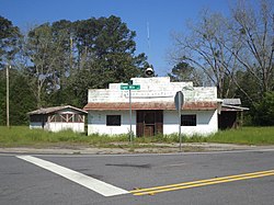
Pretoria's latitude is at 31.504 and its longitude is at -84.317. Its elevation rests at 187 feet. Pretoria appears on the Pretoria U.S. Geological Survey Map.n It rests on the intersections of Tarva Road, Eight Mile Road, and Georgia Highway 62 (Leary Road). Old Pretoria Road, Lonesome Road, Coakly Avenue, Aristedes Road, Slade Avenue, Legget Drive, Vanderbilt Drive and Bluebird Lane also rest in the area. Hunter Lake is the area's largest body of water and the Cooleewahee Creek runs through the town. There are signs welcoming one into the community as well as a 'Dougherty County Work Ready Community Sign'.

Schools

Pretoria has one school called Sherwood Christian Academy. This school is a private school which teaches grades K-12. Sherwood owns legacy park, a large sports complex most notable for its large cross. Sherwood Christian Academy is affiliated with Sherwood Baptist Church of Albany, Georgia.

Subdivisions

Related Research Articles

<span class="mw-page-title-main">Wayne County, Georgia</span> County in Georgia, United States

Wayne County is a county located in the southeastern part of the U.S. state of Georgia. As of the 2010 census, the population was 30,099. The county seat is Jesup.

<span class="mw-page-title-main">Oconee County, Georgia</span> County in Georgia, United States

Oconee County is a county located in the northeastern part of the U.S. state of Georgia. As of the 2010 census, the population was 32,808. The county seat is Watkinsville.

<span class="mw-page-title-main">Fulton County, Georgia</span> County in Georgia, United States

Fulton County is located in the north-central portion of the U.S. state of Georgia. As of the 2020 United States census, the population was 1,066,710, making it the state's most-populous county and its only one with over one million inhabitants. Its county seat and largest city is Atlanta, the state capital. Approximately 90% of the City of Atlanta is within Fulton County; the other 10% lies within DeKalb County. Fulton County is part of the Atlanta-Sandy Springs-Roswell, GA Metropolitan Statistical Area.

<span class="mw-page-title-main">Bethlehem, Georgia</span> Town in Georgia, United States

Bethlehem is a town in Barrow County in the U.S. state of Georgia. As of the 2020 census, it had a population of 715.

<span class="mw-page-title-main">Albany, Georgia</span> Place in Georgia, United States

Albany is a city in the U.S. state of Georgia. Located on the Flint River, it is the seat of Dougherty County, and is the sole incorporated city in that county. Located in southwest Georgia, it is the principal city of the Albany, Georgia metropolitan area. The population was 77,434 at the 2010 U.S. Census, making it the eighth-largest city in the state. It became prominent in the nineteenth century as a shipping and market center, first served by riverboats. Scheduled steamboats connected Albany with the busy port of Apalachicola, Florida. They were replaced by railroads. Seven lines met in Albany, and it was a center of trade in the Southeast. It is part of the Black Belt, the extensive area in the Deep South of cotton plantations. From the mid-20th century, it received military investment during World War II and after, that helped develop the region. Albany and this area were prominent during the civil rights era, particularly during the early 1960s as activists worked to regain voting and other civil rights. Railroad restructuring and reduction in the military here caused job losses, but the city has developed new businesses.

<span class="mw-page-title-main">Douglasville, Georgia</span> City in Georgia, United States

The city of Douglasville is the county seat of Douglas County, Georgia, United States. As of the 2020 census, the city had a population of 34,650, up from 30,961 in 2010 and 20,065 in 2000.

<span class="mw-page-title-main">Sandy Springs, Georgia</span> City in Georgia, United States

Sandy Springs is a city in northern Fulton County, Georgia and an inner ring suburb of Atlanta. The city's population was 108,080 at the 2020 census, making it Georgia's seventh-largest city. It is the site of several corporate headquarters, including UPS, Newell Brands, Inspire Brands, Focus Brands, Cox Enterprises, and Mercedes-Benz USA's corporate offices.

<span class="mw-page-title-main">Brookeville, Maryland</span> Town in Maryland, United States

Brookeville is a town in Montgomery County, Maryland, United States, located 20 km (12 mi) north of Washington, D.C., and 2 km (1.2 mi) north of Olney. Brookeville was settled by Quakers late in the 18th century and was formally incorporated as a town in 1808. Historically part of the local agricultural industry, since the 1950s Brookeville has developed rapidly into a suburban community of Washington, D.C. following the construction of the Georgia Avenue toll road. The population was 134 at the 2010 census.

<span class="mw-page-title-main">Athens, Georgia</span> Consolidated city–county in Georgia, United States

Athens, officially Athens–Clarke County, is a consolidated city-county and college town in the U.S. state of Georgia. Athens lies about 70 miles northeast of downtown Atlanta, and is a satellite city of the capital. The University of Georgia, the state's flagship public university and an R1 research institution, is in Athens and contributed to its initial growth. In 1991, after a vote the preceding year, the original City of Athens abandoned its charter to form a unified government with Clarke County, referred to jointly as Athens–Clarke County.

<span class="mw-page-title-main">Oakhurst, Decatur, Georgia</span>

Oakhurst is a historic neighborhood in the southwest corner of Decatur, Georgia, a suburb of Atlanta, Georgia. It is located south of downtown Decatur and approximately six miles east of downtown Atlanta. Oakhurst primarily consists of residences built in early 20th century and neighborhood businesses. It is roughly bounded by the City of Atlanta's Kirkwood neighborhood on the west ; the Atlanta city limits on the south; West College Ave. on the north; and South McDonough St. on the east. There is also a neighborhood near the College Heights Early Learning Center referred to as "College Heights", but it is part of Historic Oakhurst.

<span class="mw-page-title-main">Georgia State Route 62</span> State highway in Georgia

State Route 62 (SR 62) is a 62.1-mile-long (99.9 km) state highway in the southwestern part of the U.S. state of Georgia. It connects Columbia, Alabama with Albany.

<span class="mw-page-title-main">Winston, Georgia</span> Unincorporated community in Georgia, United States

Winston is an unincorporated community, formerly incorporated as a city, in southwestern Douglas County, Georgia, United States.

Gratis is an unincorporated community in Walton County, Georgia United States. The community is located between the cities of Monroe and Winder. The community's main intersection is at Gratis and Mt. Vernon Roads.

Apalachee is an unincorporated community in Morgan County, in the U.S. state of Georgia.

Fairfax is an unincorporated community in Ware County, in the U.S. state of Georgia.

Herod is an unincorporated community in Terrell County, in the U.S. state of Georgia.

Patten is an unincorporated community in Thomas County, in the U.S. state of Georgia.

Sand Hill is an unincorporated community in Carroll County, in the U.S. state of Georgia.

White Sulphur Springs is an unincorporated community in Meriwether County, in the U.S. state of Georgia.

References

  1. "Pretoria, Georgia GA Community". Georgia Hometown Locator. Retrieved 2011-06-04.
  2. "Post Offices". Jim Forte Postal History. Retrieved 25 May 2019.
  3. 1 2 Krakow, Kenneth K. (1975). Georgia Place-Names: Their History and Origins (PDF). Macon, GA: Winship Press. p. 181. ISBN   0-915430-00-2.
  4. Acts and Resolutions of the General Assembly of the State of Georgia. State printer. 1907. p. 887.