
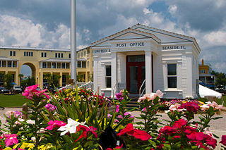
Battery Park City is a mainly residential 92-acre (37 ha) planned community and neighborhood on the west side of the southern tip of the island of Manhattan in New York City. It is bounded by the Hudson River on the west, the Hudson River shoreline on the north and south, and the West Side Highway on the east. The neighborhood is named for the Battery, formerly known as Battery Park, located directly to the south.
New Urbanism is an urban design movement that promotes environmentally friendly habits by creating walkable neighbourhoods containing a wide range of housing and job types. It arose in the United States in the early 1980s, and has gradually influenced many aspects of real estate development, urban planning, and municipal land-use strategies. New Urbanism attempts to address the ills associated with urban sprawl and post-Second World War suburban development.

Riverside South is an urban development project in the Lincoln Square neighborhood of the Upper West Side of Manhattan, New York City. It was originated by six civic associations – The Municipal Art Society, Natural Resources Defense Council, New Yorkers for Parks, Regional Plan Association, Riverside Park Fund, and Westpride – in partnership with real estate developer Donald Trump. The largely residential complex, located on the site of a former New York Central Railroad yard, includes Freedom Place and Riverside Center. The $3 billion project is on 57 acres (23 ha) of land along the Hudson River between 59th Street and 72nd Street.
William Hollingsworth "Holly" Whyte Jr. was an American urbanist, sociologist, organizational analyst, journalist and people-watcher. He identified the elements that create vibrant public spaces within the city and filmed a variety of urban plazas in New York City in the 1970s. After his book about corporate culture The Organization Man (1956) sold over two million copies, Whyte turned his attention to the study of human behavior in urban settings. He published several books on the topic, including The Social Life of Small Urban Spaces (1980).

Wood Wharf is a 23 acre site in Canary Wharf, London. It is currently under construction to provide offices, residential homes and retail space. The site is next to Canary Wharf. Wood Wharf will contain 5 million square feet of space, which will include 2 million sq ft of office space, 3,330 residential homes, 3.6 hectares of public spaces, and 380,000 sq ft of shops, restaurants and space for community use. It is estimated to be completed in 2023.

Mixed use is a type of urban development, urban design, urban planning and/or a zoning classification that blends multiple uses, such as residential, commercial, cultural, institutional, or entertainment, into one space, where those functions are to some degree physically and functionally integrated, and that provides pedestrian connections. Mixed-use development may be applied to a single building, a block or neighborhood, or in zoning policy across an entire city or other administrative unit. These projects may be completed by a private developer, (quasi-) governmental agency, or a combination thereof. A mixed-use development may be a new construction, reuse of an existing building or brownfield site, or a combination.
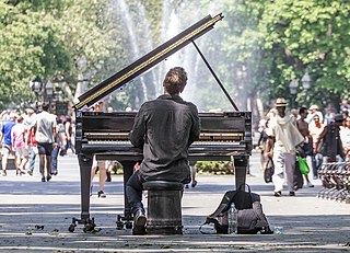
Placemaking is a multi-faceted approach to the planning, design and management of public spaces. Placemaking capitalizes on a local community's assets, inspiration, and potential, with the intention of creating public spaces that improve urban vitality and promote people's health, happiness, and well-being. It is political due to the nature of place identity. Placemaking is both a process and a philosophy that makes use of urban design principles. It can be either official and government led, or community driven grassroots tactical urbanism, such as extending sidewalks with chalk, paint, and planters, or open streets events such as Bogotá, Colombia's Ciclovía. Good placemaking makes use of underutilized space to enhance the urban experience at the pedestrian scale to build habits of locals.
Fred Kent is the founder and president of the nonprofit organization Project for Public Spaces. The organization is dedicated to creating public places that foster communities.

Hudson River Park is a waterfront park on the North River that extends from 59th Street south to Battery Park in the New York City borough of Manhattan. The park, a component of the Manhattan Waterfront Greenway, stretches 4.5 miles (7.2 km) and comprises 550 acres (220 ha), making it the second-largest park in Manhattan after the 843-acre (341 ha) Central Park.

The Trust for Public Land is a U.S. nonprofit organization with a mission to "create parks and protect land for people, ensuring healthy, livable communities for generations to come". Since its founding in 1972, the Trust for Public Land has completed 5,000 park-creation and land conservation projects across the United States, protected over 3 million acres, and helped pass more than 500 ballot measures—creating $70 billion in voter-approved public funding for parks and open spaces. The Trust for Public Land also researches and publishes authoritative data about parks, open space, conservation finance, and urban climate change adaptation. Headquartered in San Francisco, the organization is among the largest U.S. conservation nonprofits, with approximately 30 field offices across the U.S., including a federal affairs function in Washington, D.C.

In urban planning, walkability is the accessibility of amenities by foot. It is based on the idea that urban spaces should be more than just transport corridors designed for maximum vehicle throughput. Instead, it should be relatively complete livable spaces that serve a variety of uses, users, and transportation modes and reduce the need for cars for travel.

The East River Greenway is an approximately 9.44-mile-long (15.19 km) foreshoreway for walking or cycling on the east side of the island of Manhattan on the East River. It is part of the Manhattan Waterfront Greenway. The largest portions are operated by the New York City Department of Parks and Recreation. It is separated from motor traffic, and many sections also separate pedestrians from cyclists. The greenway is parallel to the Franklin D. Roosevelt East River Drive for a majority of its length.
OpenPlans is a non-profit that advocates for making the streets of New York City livable for all residents. Open Plans uses tactical urbanism, grassroots advocacy, policy and targeted journalism to promote structural reforms within city government that support livable streets, neighborhoods and the city-at-large. The organization was founded in 1999 by Mark Gorton, the creator of LimeWire.

The Domino Sugar Refinery is a mixed-use development and former sugar refinery in the neighborhood of Williamsburg in Brooklyn, New York City, along the East River. When active as a refinery, it was operated by the Havemeyer family's American Sugar Refining Company, which produced Domino brand sugar and was one of several sugar factories on the East River in northern Brooklyn.
Crowdfixing is a specific way of crowdsourcing, in which people gather together to fix public spaces of the local community. The main aim is to fight against deterioration of public places. Crowdfixing actions include cleaning flashmobs, mowing, repairing structures, and removing unsafe elements.
The Rudy Bruner Award for Urban Excellence (RBA) was established in 1986 by Cambridge, Massachusetts architect Simeon Bruner. The award is named after Simeon Bruner's late father, Rudy Bruner, founder of the Bruner Foundation. According to the Bruner Foundation, the RBA was created to increase understanding of the role of architecture in the urban environment and promote discussion of what constitutes urban excellence. The award seeks to identify and honor places, rather than people, that address economic and social concerns along with urban design.
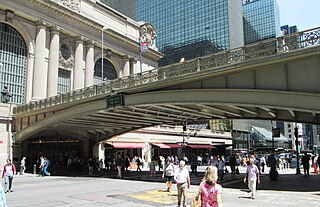
Pershing Square is a public plaza in Manhattan, New York City, located where Park Avenue and 42nd Street intersect in front of Grand Central Terminal. The main roadway of Park Avenue crosses over 42nd Street on the Park Avenue Viaduct, also known as the Pershing Square Viaduct. Two service roads, one northbound and one southbound, connect 42nd Street with the main roadway of Park Avenue, at 40th Street.

Essex Crossing is an under-construction mixed-use development in New York City's Lower East Side, at the intersection of Delancey Street and Essex Street just north of Seward Park. Essex Crossing will comprise nearly 2,000,000 sq ft (200,000 m2) of space on 6 acres and will cost an estimated US$1.1 billion. Part of the existing Seward Park Urban Renewal Area (SPURA), the development will sit on a total of nine city blocks, most of them occupied by parking lots that replaced tenements razed in 1967.

Tactical urbanism, also commonly referred to as guerrilla urbanism, pop-up urbanism, city repair, D.I.Y. urbanism, planning-by-doing, urban acupuncture, and urban prototyping, is a low-cost, temporary change to the built environment, usually in cities, intended to improve local neighbourhoods and city gathering places.

An elevated park refers to a park located above the normal ground (street) level. This type of a park has become more popular in the early 21st century, featuring in a number of urban renewal projects. While usually associated with repurposed transportation infrastructure, some elevated parks are designed on top of buildings.