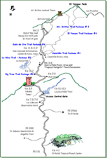
El Yunque National Forest, formerly known as the Caribbean National Forest, is a forest located in northeastern Puerto Rico. It is the only tropical rainforest in the United States National Forest System and the United States Forest Service. El Yunque National Forest is located on the slopes of the Sierra de Luquillo mountains, encompassing more than 28,000 acres of land, making it the largest block of public land in Puerto Rico.

Río Grande is a town and municipality of Puerto Rico located on the eastern edge of the Northern Coastal Valley, north of Las Piedras, Naguabo and Ceiba; east of Loíza and Canóvanas and west of Luquillo. Río Grande is spread over eight barrios and Río Grande Pueblo. It is part of the San Juan-Caguas-Guaynabo Metropolitan Statistical Area. A big portion of El Yunque National Forest, including El Yunque's peak, is located within the municipality.

Puerto Rico Highway 3(PR-3) at nearly 100 miles long, is the second-longest highway on Puerto Rico. It connects the San Juan neighborhood of Río Piedras to downtown Salinas indirectly around the eastern coast of the island. Highway 3 ranges from a three lane urban avenue in San Juan to a one lane rural road past Fajardo. While other roads connect San Juan, it runs the coastline of Puerto Rico east of San Juan, beginning in Río Piedras near Santurce and goes to Fajardo where it goes south paralleling the coastline to Humacao and Maunabo. It goes up to a mountain-scenic route and goes west to Salinas, where it meets PR-1.
Puerto Rico Highway 53 (PR-53) or unsigned Interstate PR3 is a main tollway that is parallel to Puerto Rico Highway 3, which goes from Fajardo to Salinas. Some segments are still in planning, but when finished it will be about 58 miles (93 km) in length. Two tunnels, about 0.6 mi (1 km) long each, in the towns of Yabucoa and Maunabo were completed in October 2008. It will connect the cities of Fajardo, Ceiba, Naguabo, Humacao, Yabucoa, Maunabo, Patillas, Arroyo, Guayama and Salinas, thus bordering the entire eastern and southeastern coasts of Puerto Rico. Its northern terminus is at PR-3 and PR-194 in Fajardo, and its south terminus is at PR-52 in Salinas.

Puerto Rico Highway 413 (PR-413) is a rural road located at the west point of Rincón, Puerto Rico, and is famous in the island for being the main access to beaches near Tres Palmas and the Rincón Lighthouse, where local and international surfing tournaments take place. It is named the Road to Happiness. This highway begins near PR-115 in downtown Rincón, near the west end of Barrio Ensenada. Then it passes trhough Barrio Puntas and ends at PR-115, near the south end of Barrio Río Grande, heading to Aguada, Puerto Rico.
Puerto Rico Highway 66 (PR-66) is a main tollway which parallels Puerto Rico Highway 3 going from the city of Carolina, Puerto Rico via a 3 loops cloverleaf interchange with PR-26 and PR-3, a major exit in the form of a Trumpet interchange in Canóvanas, Puerto Rico and ending in the municipality of Río Grande, Puerto Rico with an intersection of PR-3. It is only 19.5 kilometres (12.1 mi) long and has very few exits, which work mainly to minimize traffic in the congested Carolina area of PR-3.
Puerto Rico Highway 10 (PR-10) is a major highway in Puerto Rico. The primary state road connects the city of Ponce in the south coast to Arecibo in the north; it is also the shortest route between the two cities.

Puerto Rico Highway 116 (PR-116) is a main highway in the southwest part of Puerto Rico, beginning in Guánica, Puerto Rico at Puerto Rico Highway 2 to Lajas, Puerto Rico at Puerto Rico Highway 101.
Puerto Rico Highway 31 (PR-31) is a main, rural highway connecting Juncos at Puerto Rico Highway 198 to Naguabo at Puerto Rico Highway 3.
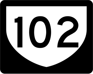
Puerto Rico Highway 102 (PR-102) is a main highway in the southwestern portion of the Porta del Sol region of Puerto Rico. It begins at Puerto Rico Highway 2 north of central Mayagüez and runs through the municipalities of Cabo Rojo and San Germán, coming to an end in downtown Sabana Grande.
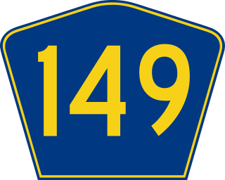
Puerto Rico Highway 149 (PR-149) is a secondary highway in Puerto Rico that connects the towns of Manatí in the north coast of Puerto Rico, from PR-22 to Juana Díaz in the south coast, ending at PR-1.

Puerto Rico Highway 185 (PR-185) is a main highway that connects Canóvanas, Puerto Rico to Juncos, Puerto Rico and is about 25 kilometers long. It begins in downtown of Canóvanas, very close to Puerto Rico Highway 3 and ends in Puerto Rico Highway 952 and Puerto Rico Highway 30 in Juncos.
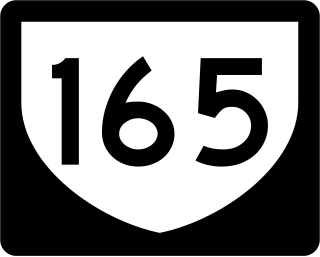
Puerto Rico Highway 165 (PR-165) is the road that goes from Naranjito to Guaynabo. The highway passes by Toa Alta, Toa Baja, Dorado, Levittown, Cataño and Guaynabo.

Puerto Rico Highway 142 (PR-142) is a north–south road that connects the northern region of Puerto Rico with the municipality of Corozal. With a length of about 8.2 kilometers (5.1 mi), PR-142 crosses the municipalities of Dorado, Toa Alta and Corozal, extending from PR-2 in Dorado to PR-159 near downtown Corozal.

Puerto Rico Highway 139 (PR-139) is a two-way secondary highway in the municipality of Ponce, Puerto Rico.

Puerto Rico Highway 506 (PR-506) is a two-lane tertiary highway in Ponce, Puerto Rico. The road runs south to north, joining PR-52, where PR-506 starts, to PR-14, where it ends. Its length is 2.0 km. The road is entirely within Barrio Coto Laurel.
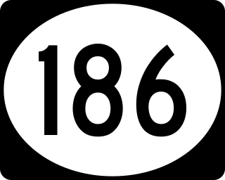
Puerto Rico Highway 186 (PR-186) is a road that travels from Canóvanas, Puerto Rico to Río Grande through the western side of El Yunque National Forest. This highway begins at PR-185 between Hato Puerco and Lomas barrios and ends at PR-3 in Guzmán Abajo.
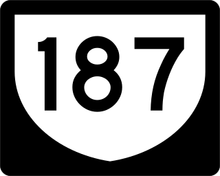
Puerto Rico Highway 187 (PR-187) is a road that travels from Río Grande, Puerto Rico to Carolina, passing through Loíza. This highway begins at its intersection with PR-3 and PR-66 in Guzmán Abajo and ends at PR-26 in Isla Verde.
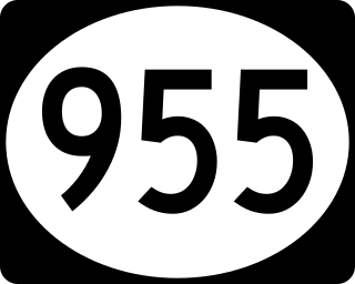
Puerto Rico Highway 955 (PR-955) is an east–west road located entirely in the municipality of Río Grande, Puerto Rico. With a length of 6.1 kilometers (3.8 mi), it begins at its intersection with PR-3 in Jiménez barrio, staying parallel to PR-3 through Zarzal barrio until its end at its junction with PR-3 and PR-968 in Mameyes II barrio.
Palmer is a small settlement and sector in the barrio Mameyes II of Río Grande, Puerto Rico.