Puerto de la Cruz

Last updated

Puerto de la Cruz
Municipality and city
Puerto de la Cruz Collage.jpg
Puerto de la Cruz, Top left: Panorama view of Puerto de la Cruz; Top right: Martianez Beach; Middle left: Laguna Martianez; Bottom left: Armas Square shopping area; Bottom right: View of Araucaria heterophylla tree in Loro Park
Bandera puerto de la cruz.png
Escudo puerto de la cruz.png
Puerto de la Cruz
Location of Puerto de la Cruz
Location map Spain Tenerife.png
Red pog.svg
Puerto de la Cruz
Coordinates: 28°25′N16°32′W / 28.417°N 16.533°W / 28.417; -16.533
Country Spain
Autonomous community Canary Islands
Province Santa Cruz de Tenerife
Government
  Alcalde (Mayor)Marco González Mesa (PSC-PSOE)
Area
  Total8.73 km2 (3.37 sq mi)
Elevation
4 m (13 ft)
Population
 (2018) [1]
  Total30,483
  Density3,500/km2 (9,000/sq mi)
Time zone UTC±0 (WET)
  Summer (DST) UTC+1 (WEST)
Postal code
38400
Official language(s) Spanish
Website Official website

Puerto de la Cruz is a city and municipality in the northern part of the island of Tenerife, Canary Islands, Spain. It was formerly known by its English translation, "Port of the Cross", although now it is known by its Spanish name in all languages. Puerto de la Cruz is located on the northern coast, 4 km (2 mi) northwest of La Orotava and 30 km (19 mi) west of Santa Cruz de Tenerife. The TF-5 motorway passes through the municipality. The population is 30,483 (2018 [2] ). In Spanish, the local inhabitants are known as Portuenses. With an area of 8.73 km2 (3 sq mi), the municipality is the smallest in Tenerife. The elevation of the town's centre is 9 m (30 ft) above sea level and the highest point being Las Arenas, a volcanic cone with an elevation of 249 m (817 ft).

Contents

Historical population

YearPopulation
199125,447
199624,542
200126,441
200230,466
200331,830
200430,088
201328,929
201830,483

Economy

Valle de La Orotava and Puerto de la Cruz were the first holiday resorts on the Canary Islands. Valle taoro.jpg
Valle de La Orotava and Puerto de la Cruz were the first holiday resorts on the Canary Islands.

Puerto de la Cruz occupies a prominent place in the history of tourism of the islands. The export economy established by the European colonizers after the conquest in the 15th century generated large commercial and passenger movements for decades. The first foreign visitors quickly felt drawn to the beneficial qualities of the weather in the Taoro Valley.

Before mass tourism existed in Puerto de la Cruz, minority tourism catered for privileged elites who were interested in climatology, botany and the tranquillity of the location. The proximity of the Canary Islands to Europe meant that travel for health reasons was a primary driver for launching modern tourism here. [4]

At the beginning of the 19th century, the environment of Puerto de la Cruz attracted researchers and travellers from Europe. At this stage Puerto de la Cruz was a leading cultural center accommodating many travellers and writers, including William Wilde, Alexander von Humboldt, or Sabin Berthelot. [ citation needed ]

Puerto de la Cruz therefore gained an illustrious reputation in Europe, and when it came to the subsequent advent of modern tourism, the city was at an advantage compared with other tourist sites.

Climate

Puerto de la Cruz enjoys a hot semi-arid climate (Köppen climate classification: BSh) bordering a tropical wet and dry climate, with warm winters and hot, dry summers.

History

Panorama of Valle de La Orotava Panom-puerto.jpg
Panorama of Valle de La Orotava

The city's origins date back to the early 16th century. It existed in 1502 as a coastal port, and as the dependent population center of La Orotava. In 1603 a church and its corresponding square were built.

It was originally a fishing village that grew as local trade was increasing. The port became the most important in the island when a volcano eruption destroyed Garachico in 1706. [5] The sugar trade gave way to wine, resulting in large scale social and economic development.

In the mid-17th century the inhabitants began to express their desire to form their own community, receiving the Royal Provision of Felipe IV on 3 May 1651, which empowered them to appoint a village head.

It belonged to the municipality of La Orotava, and in 1772, a municipal corporation was elected by the residents. It was known as Puerto de La Orotava, and it was not until 1808 that it obtained full municipal autonomy, changing its name to the current Puerto de la Cruz.

Tourism began to have an important role in the local economy in the late 19th century. It was in those years that the Grand Hotel Taoro was built and that old family houses began to be remodelled, for example as Marquesa or Monopol, transforming them into the first hotels in the city center. Finally, the real tourism boom came in the 1950s, when the city began its transformation into the tourist reference point of the island and of the archipelago.

During the second edition of the Ecological Film Festival of Nature in Puerto de la Cruz, at which guests were invited to give lectures and provide round tables, the Tenerife Manifesto was announced (29 May 1983). This text was a precursor of political ecology in Spain, and would initiate a process leading to the founding of the political party of the Greens.

Sites of interest

Monument to the waves, Lago Martianez (night view). Puerto de la Cruz, Tenerife. Lago Martianez-Monumento a las olas-Tenerife.jpg
Monument to the waves, Lago Martianez (night view). Puerto de la Cruz, Tenerife.

Tourism

Jardin Beach. Puerto de la Cruz Puerto teide.jpg
Jardín Beach. Puerto de la Cruz

Tourism is an important industry in Puerto de la Cruz, as evidenced by the number of large hotels visible on the skyline.

Puerto de la Cruz is frequented by Northern Europeans during the winter months, due to its mild climate, and is particularly popular over the Christmas and the New Year periods. The Western European contingent tends to consist of more mature couples vis-à-vis resorts such as Playa de las Americas. The summer months see more Spanish tourists, particularly during August when conditions on the Spanish mainland can be excessively hot.

Education

The British School of Tenerife has its Yeoward Campus in Puerto de la Cruz. [6]

Events

Faro, Puerto de la Cruz, Tenerife, Espana. Faro, Puerto de la Cruz, Tenerife, Espana, 2012-12-13, DD 01.jpg
Faro, Puerto de la Cruz, Tenerife, España.

The Tenerife Airshow (Festival de Aeromodelismo) (Spanish for 'Aeromodelling festival') is held every year near the harbour, usually in Europa Square. The airshow celebrated its 25th anniversary in 2006.

El Carnaval, held every year. Ash Wednesday is in the middle of Carnival.

"La Embarcacion de la Virgen del Carmen" (The Sea-setting of the Virgin Carmen), is held on 16 July. In latter years it has become "la Fiesta del Agua" (The Water Party), where copious amounts of water are thrown during the festivities.

It is preceded by "La Sardinada" (The Sardine Festival), where sardines are fried and sold the night before at San Telmo. Hundreds of people congregate in Charco Square and its fishing port, where festival goers participate in games, like the popular 'run-along-the grease-pole', which involves participants having to run along a greased pole and catch a flag to win the game. Because of the normally mild July weather, people go in T-shirt and shorts, or just bathing suits, and enjoy a quick dip in the waters of the port to help cool themselves down. The event starts around 12-1 o'clock in the afternoon and lasts until around 10–12 o'clock at night.

A few days before the main carnival procession a large papier mache sardine is wheeled through the streets, brought to the waterfront and "blessed" with "holy water" (normally petrol or lighter fluid) by a man dressed as a bishop. The sardine is then set alight, to huge applause. After this, a huge firework display ensues. The event is known as the "Burial of the Sardine".

Amongst the crowd at this event, "professional mourners" can be seen; these are invariably men in drag, who wail for comic effect.

Although the Burial of the Sardine rarely starts on time, the event always attracts crowds, and it is advised to arrive early at the harbour.

Photos

People

Sister cities

See also

Related Research Articles

<span class="mw-page-title-main">Canary Islands</span> Spanish archipelago and region in the Atlantic Ocean

The Canary Islands, also known informally as the Canaries, are a Spanish autonomous community and archipelago in Macaronesia in the Atlantic Ocean. At their closest point to the African mainland, they are 100 kilometres west of Morocco and the Western Sahara. They are the southernmost of the autonomous communities of Spain. The islands have a population of 2.2 million people and are the most populous special territory of the European Union.
<span class="mw-page-title-main">Province of Santa Cruz de Tenerife</span> Province of Spain

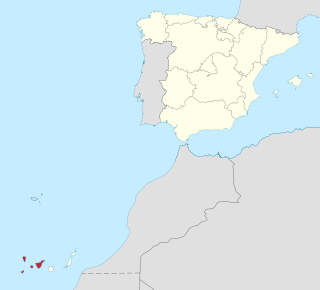
Province of Santa Cruz de Tenerife, also Province of Santa Cruz, is a province of Spain, consisting of the western part of the autonomous community of the Canary Islands. It consists of about half of the Atlantic archipelago: the islands of Tenerife, La Gomera, El Hierro, and La Palma. It occupies an area of 3,381 km2 (1,305 sq mi). It also includes a series of adjacent roques.
<span class="mw-page-title-main">Las Palmas</span> Municipality in Canary Islands, Spain

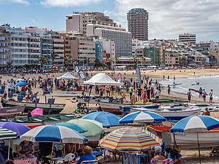
Las Palmas, officially Las Palmas de Gran Canaria, is a Spanish city and capital of Gran Canaria, in the Canary Islands, in the Atlantic Ocean.

<span class="mw-page-title-main">Gran Canaria</span> Spanish island of the Canary Islands

Gran Canaria, also Grand Canary Island, is the third-largest and second-most-populous island of the Canary Islands, an archipelago off the Atlantic coast of Northwest Africa and is part of Spain. As of 2019 the island had a population of 851,231 that constitutes approximately 40% of the population of the archipelago. Las Palmas de Gran Canaria, the capital of the island, is the biggest city of the Canary Islands and the ninth of Spain.

<span class="mw-page-title-main">Tenerife</span> Largest and most populous of Spains Canary Islands

Tenerife is the largest and most populous island of the Canary Islands. It is home to 43% of the total population of the archipelago. With a land area of 2,034 square kilometres (785 sq mi) and a population of 978,100 inhabitants as of January 2022, it is also the most populous island of Spain and of Macaronesia.

<span class="mw-page-title-main">Santa Cruz de Tenerife</span> Municipality in Canary Islands, Spain

Santa Cruz de Tenerife, commonly abbreviated as Santa Cruz, is a city, the capital of the island of Tenerife, Province of Santa Cruz de Tenerife, and one of the capitals of the Canary Islands, along with Las Palmas. Santa Cruz has a population of 206,593 (2013) within its administrative limits. The urban zone of Santa Cruz extends beyond the city limits with a population of 507,306 and 538,000 within urban area. It is the second largest city in the Canary Islands and the main city on the island of Tenerife, with nearly half of the island's population living in or around it.

Los Realejos is a town and a municipality in the northern part of the island of Tenerife, which is the biggest town in the Canary Islands. It is part of the province of Santa Cruz de Tenerife, Spain. The town is located 2 km (1.2 mi) from the north coast, 5 km (3.1 mi) southwest of Puerto de la Cruz, 6 km (3.7 mi) west of La Orotava, and 34 km (21 mi) southwest of the island's capital Santa Cruz de Tenerife. The inhabitants are known in Spanish as realejeros.

<span class="mw-page-title-main">Arona, Tenerife</span> Municipality in Canary Islands, Spain

Arona is a municipality in the southern part of the island of Tenerife in the Canary Islands, Spanish region and archipelago in the Atlantic Ocean, in Macaronesia. The municipality covers an area of 81.79 square kilometres comprising 4% of the island's area. The town of Arona is 59 km southwest of Santa Cruz de Tenerife, the island's capital. The population in 2017 was about 93,496. It is the third largest city in Tenerife, after, Santa Cruz de Tenerife and San Cristóbal de La Laguna. Arona has a pleasant climate with temperatures ranging from 20 to 25 degrees Celsius. Notable places include the tourist resorts of Los Cristianos, Playa de las Americas, Costa del Silencio and Las Galletas. Arona also features Punta Salemas, the southernmost point of the island of Tenerife. The TF-1 motorway passes through the municipality.

The Second Battle of Acentejo was a battle that took place on 25 December 1494 between the invading Spanish forces and the natives of the island of Tenerife, known as Guanches. The battle had been preceded by the Battle of Aguere, fought on 14-15 November that year, which had been a Castilian victory.

<span class="mw-page-title-main">Adeje</span> Municipality in Canary Islands, Spain

Adeje is a town and municipality in the southwestern part of the island of Tenerife, one of the Canary Islands, and part of the province of Santa Cruz de Tenerife, Spain. The town Adeje is located 4 km from the coast, 8 km north of the resort town Los Cristianos, 60 km southwest of the island capital Santa Cruz de Tenerife and about 17 km northwest of Tenerife South Airport.
<span class="mw-page-title-main">Orotava Valley</span>

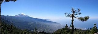
The Orotava Valley is an area in the northern part of the island of Tenerife, Canary Islands, Spain. The valley measures 10 kilometres (6.2 mi) by 11 km, and stretches from the north coast to about 2,000 m elevation, at the northern foot of Pico del Teide.

<span class="mw-page-title-main">La Orotava</span> Municipality in Canary Islands, Spain

La Orotava is a town and a municipality in the northern part of Tenerife, one of the Canary Islands of Spain. The area of the municipality stretches from the north coast to the mountainous interior, and includes the summit of the Teide volcano, Canary Islands' and Spain's highest point at 3,718 m. At 207.31 km2, it is the largest municipality of the island of Tenerife. The population is 41,255 (2013).

<span class="mw-page-title-main">La Victoria de Acentejo</span> Municipality in Canary Islands, Spain

La Victoria de Acentejo is a town and a municipality in the northern part of the island Tenerife, Canary Islands, Spain. It is located near the north coast, 2 km southwest of La Matanza de Acentejo, 7 km northeast of La Orotava and 22 km west of the island capital Santa Cruz de Tenerife. The TF-5 motorway passes through the municipality. The population is 9,069 (2013) and the area is 18.36 km2.
<span class="mw-page-title-main">Alajeró</span> Municipality in Canary Islands, Spain

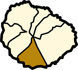
Alajeró is a municipality on the island of La Gomera in the province of Santa Cruz de Tenerife in the Canary Islands. It is located on the south coast, SW of the capital San Sebastián de la Gomera. As well as being a municipality, Alajeró is also the name of the administrative town that governs that municipality.
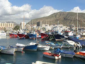
<span class="mw-page-title-main">Los Cristianos</span> Town in Canary Islands, Spain

Los Cristianos is a town in Spain with a population of 21,235 (2017), situated on the south coast of the Canary Island of Tenerife. Located in the municipality of Arona between the cone of the mountain Chayofita and the greater mountain Guaza. The town centre is around the Los Cristianos bay, but is rapidly expanding inland with modern development. The town is a popular tourist resort and includes a ferry port and two beaches.

<span class="mw-page-title-main">Sport in Tenerife</span>

On the island of Tenerife, in the Canary Islands, many sports are practiced, both outdoors and indoors in the various facilities available throughout the island.
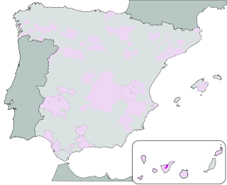
<span class="mw-page-title-main">Valle de la Orotava</span>

Valle de la Orotava is a Spanish Denominación de Origen Protegida (DOP) for wines located on the north-western coastline of Tenerife,, and acquired its DO in 1995.

<span class="mw-page-title-main">Menceyato of Taoro</span> Native kingdom of the Canary Islands

Taoro was one of nine Guanche menceyatos in which the island of Tenerife was divided at the time of the arrival of the conquering Spaniards.
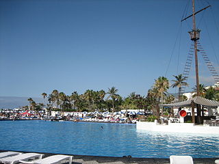
<span class="mw-page-title-main">Lago Martiánez</span>

Lago Martiánez is an open-air swimming pool complex located in Puerto de la Cruz. The leisure park with a total area of approximately 100,000 square meters is centered around an artificial lake. Lago Martiánez includes several islands, gardens, restaurants, bars, and terraces. Architect César Manrique designed the swimming pool complex with many volcanic rocks. Lago Martiánez is a mix of Manrique’s vision and local elements, such as bartizans, palisades and ocean views. In addition to the architectural structure, it also comprises a range of Manrique’s sculptures. Lago Martiánez, commonly known as "el Lago", was built in the so-called "Llanos de Martiánez" area, which was home to several natural pools. The first tourists visited Llanos de Martiánez at the end of the 19th century and at the beginning of the 20th century.

<span class="mw-page-title-main">Alfred Diston</span>

Alfred Diston was a British merchant and writer on a wide variety of subjects who lived in Puerto de la Cruz, Tenerife, between 1810 and 1861.

References

  1. Municipal Register of Spain 2018. National Statistics Institute.
  2. "Instituto Nacional de Estadística. (National Statistics Institute)".
  3. González, Lemus. Puerto de la Cruz, primer centro turístico en Canarias.
  4. González Lemus, "Clima y medicina. Los orígenes del turismo en Canarias", Santa Cruz de Tenerife, 2007.
  5. Puerto de la Cruz History citpuerto.com [ dead link ]
  6. "Find Us Archived 17 February 2016 at the Wayback Machine ." British School of Tenerife. Retrieved 13 February 2016. "YEOWARD C/ Irlanda, 1; Parque Taoro; 38400 Puerto de la Cruz"