
Drury is a rural town near Auckland, in northern New Zealand. Located 36 kilometres to the south of Auckland CBD, under authority of the Auckland Council. Drury lies at the southern border of the Auckland metropolitan area, 12 kilometres to the northeast of Pukekohe, close to the Papakura Channel, an arm of the Manukau Harbour.

Glenbrook is a rural and industrial area in the Auckland region of New Zealand.

Wellsford is a town on the Northland Peninsula in the northern North Island of New Zealand. It is the northernmost major settlement in the Auckland Region, and is 77 kilometres northwest of the Auckland CBD.

Parakai is a town in the North Island of New Zealand, sited 43 kilometres (27 miles) northwest of Auckland, close to the southern extremity of the Kaipara Harbour. Helensville is about 3 km (2 miles) to the south-east, and Waioneke is 22 km (14 miles) to the north-west.
Konini is a suburb in the west of Auckland, New Zealand, under the local governance of Auckland Council.
The suburb of Farm Cove is located in eastern Auckland, New Zealand. The suburb is in the Howick ward, one of the thirteen administrative divisions of Auckland city.
Bayswater is a suburb of Auckland in New Zealand. It lies on a peninsula which juts into the Waitemata Harbour. The suburb is in the North Shore ward, one of the thirteen administrative divisions of Auckland Council.

Belmont is a suburb of Auckland, New Zealand. The name Belmont, which means "good view or hill", derives from a farm estate called "Belmont" which was subdivided in 1885. The suburb is in the North Shore ward, one of the thirteen administrative divisions of Auckland Council.

Manaia is a rural town in South Taranaki District, New Zealand. Ōpunake is 29 km to the northwest, and Hāwera is 13 km to the southeast. Kaponga is 15 km north. State Highway 45 passes through the town. Manaia is named after the former Māori chief of the district, Hukunui Manaia.
Waimauku is a small locality in the Auckland Region of New Zealand. It comes under the jurisdiction of Auckland Council, and is in the council's Rodney ward. Waimauku is approximately 4 kilometres west of Huapai on State Highway 16 at the junction with the road to Muriwai Beach. Helensville is 16 km to the north-west. Waimauku is a Māori word which is literally translated as wai: stream and mauku: varieties of small ferns.
Alfriston is a small suburb of Auckland, New Zealand's largest city. Prior to November 2010 it was under the authority of the Papakura District Council and is now part of the enlarged Auckland city. The suburb is in the Manurewa-Papakura Ward, one of the thirteen administrative divisions of Auckland Council.
Ōpaheke is a suburb of Auckland, in northern New Zealand. It is located to the south of Papakura, and 32 kilometres south of the Auckland CBD. The suburb is the southernmost part of the Auckland metropolitan area.

Karaka is a small rural area in the south of Auckland, New Zealand. Formerly part of Franklin District and under the authority of the Franklin District Council, it is now part of Auckland Council following the amalgamation of the Auckland region's councils.

Stanley Bay on the North Shore, New Zealand is a small suburb near Devonport, Auckland. It is mostly residential. The Devonport Naval Base lies to the east of the bay on the south side of the Stanley Bay peninsula and is connected to storage facilities on the north side at Ngataringa Bay by a tunnel.

Opua is a locality in the Bay of Islands, in the sub-tropical Northland Region of New Zealand. It is notable as the first port for overseas yachts arriving in the country after crossing the Pacific Ocean. In the original 1870s plans for the town, it was named Newport. The town of Paihia is nearby, and the small settlement of Te Haumi is in between.
Campbells Bay is a suburb of Auckland in New Zealand.
The Gardens is a suburb of Auckland, New Zealand. It is located to the north of Manurewa East, east of Wiri and south of Totara Heights. It was formerly under the local governance of Manukau City Council until it was merged with all of Auckland's councils to form the Auckland 'super city' in 2010. It is now under the local governance of Auckland Council.
Manurewa East is a suburb of Auckland, New Zealand. Formerly part of Manukau City, it is now under the local governance of Auckland Council, following the merger of Manukau City Council with all of Auckland's other councils in 2010 to form a single authority.
Shamrock Park is an eastern suburb of the city of Auckland, New Zealand. The area is bounded on the northwest by Chapel Road and Kilkenny Drive, on the northeast by Whitford Road, and on the east by Mangemangeroa Creek. Shamrock Park has many of its streets named after Irish Towns.
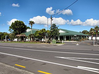
Patumahoe or Patumāhoe is a small town of Auckland, New Zealand. It is in the Franklin Ward of Auckland Council.

