Lucasville is a census-designated place (CDP) in Scioto County, Ohio, United States. The population was 2,757 at the 2010 census.
University Farm is a 445 hectare commercial research farm attached to the Sutton Bonington Campus of the University of Nottingham, England. It lies across the parishes of Sutton Bonington and Kingston on Soar. There are two further blocks of land in Clifton on the north bank of the River Trent and at Bunny Park in the village of Bunny. Both these block are several miles from the main campus.

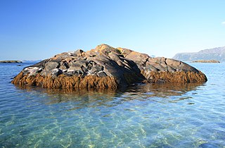
Lincoln Island is a wooded island in Lynn Canal in Alaska, United States. Located at 58°29′41″N134°59′40″W, the island is one kilometer northwest of larger Shelter Island and some 200 meters southeast of smaller Ralston Island. It is part of the Juneau City and Borough. The first European to sight the island was Joseph Whidbey, master of HMS Discovery during George Vancouver's 1791–1795 expedition, in 1794. It was named in 1868 by Commander R. W. Meade, USN, presumably for Abraham Lincoln.

Petersburg South No. 15 Precinct is located in Menard County, Illinois, United States. The population was 997 at the 2000 census.

Karolinowo is a village in the administrative district of Gmina Kcynia, within Nakło County, Kuyavian-Pomeranian Voivodeship, in north-central Poland. It lies approximately 8 kilometres (5 mi) west of Kcynia, 22 km (14 mi) south-west of Nakło nad Notecią, and 45 km (28 mi) west of Bydgoszcz.

Leinbachs is an unincorporated community in southern Bern Township, Pennsylvania, just northwest of Reading and the Reading Regional Airport. it is also located near Blue Marsh Lake. Leinbachs' proximity to these locations has given it significant growth in recent years. Commercial Growth includes the construction of a suburban development, warehouses, and other enterprises.
Bąbowo is a village in the administrative district of Gmina Mogilno, within Mogilno County, Kuyavian-Pomeranian Voivodeship, in north-central Poland.
Kowalewko is a village in the administrative district of Gmina Strzegowo, within Mława County, Masovian Voivodeship, in east-central Poland.

Borowce is a village in the administrative district of Gmina Troszyn, within Ostrołęka County, Masovian Voivodeship, in east-central Poland. It lies approximately 5 kilometres (3 mi) south of Troszyn, 13 km (8 mi) south-east of Ostrołęka, and 99 km (62 mi) north-east of Warsaw.

Myrcha is a village in the administrative district of Gmina Wiśniew, within Siedlce County, Masovian Voivodeship, in east-central Poland. It lies approximately 6 kilometres (4 mi) north-west of Wiśniew, 7 km (4 mi) south of Siedlce, and 86 km (53 mi) east of Warsaw.

Oleśnica is a village in the administrative district of Gmina Chodzież, within Chodzież County, Greater Poland Voivodeship, in west-central Poland. It lies approximately 4 kilometres (2 mi) west of Chodzież and 67 km (42 mi) north of the regional capital Poznań.

Łąkie Nowe is a village in the administrative district of Gmina Rakoniewice, within Grodzisk Wielkopolski County, Greater Poland Voivodeship, in west-central Poland. It lies approximately 5 kilometres (3 mi) south-west of Rakoniewice, 17 km (11 mi) south-west of Grodzisk Wielkopolski, and 57 km (35 mi) south-west of the regional capital Poznań.

Kawnice is a village in the administrative district of Gmina Golina, within Konin County, Greater Poland Voivodeship, in west-central Poland. It lies approximately 4 kilometres (2 mi) south-east of Golina, 9 km (6 mi) north-west of Konin, and 86 km (53 mi) east of the regional capital Poznań.

Wrightsville is an unincorporated community in Fairfield Township, Madison County, Ohio, United States. It is located at 39°51′40″N83°14′50″W, at the intersection of Ohio State Route 665 and Georgesville-Wrightsville Road, approximately four miles north of Kiousville. Some national maps mistakenly show Wrightsville in Franklin County.

Basket is a small unincorporated community in eastern Alsace Township, about 8 road miles from downtown Reading, Pennsylvania. The community is served by the Oley Valley School District.
The Battle of Danes Moor occurred between the Danes and the Saxons in 914 on Danes Moor between Culworth and Edgecote, north-east of Banbury, Oxfordshire, at a crossing of a tributary of the River Cherwell.

Zlokuchene Glacier is the 13 km long and 3.5 km wide glacier on Nordenskjöld Coast in Graham Land, Antarctica situated north of Risimina Glacier, east of Rogosh Glacier and south of the lower course of Drygalski Glacier. It is draining from Mrahori Saddle eastwards between Kyustendil Ridge and Lovech Heights to flow into Weddell Sea northwest of Pedersen Nunatak.
Knaufville is an unincorporated community in Mahoning County, in the U.S. state of Ohio.
Fox Ridge is an extinct town in Meade County, in the U.S. state of South Dakota. The GNIS classifies it as a populated place.

Charco is both a census-designated place (CDP) and a populated place in Pima County, Arizona, United States. The population was 52 at the 2010 census.


