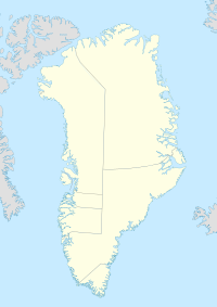
Nuuk is the capital of and most populous city in Greenland, an autonomous territory in the Kingdom of Denmark. Nuuk is the seat of government and the territory's largest cultural and economic center. The major cities from other countries closest to the capital are Iqaluit and St. John's in Canada and Reykjavík in Iceland. Nuuk contains a third of Greenland's population and its tallest building. Nuuk is also the seat of government for the Sermersooq municipality. In January 2023, it had a population of 19,604. Nuuk is considered a modernized city after the policy began in 1950.
Narsarsuaq is a settlement in the Kujalleq municipality in southern Greenland. It had 123 inhabitants in 2020. There is a thriving tourism industry in and around Narsarsuaq, whose attractions include a great diversity of wildlife, gemstones, tours to glaciers, and an airfield museum.

Nanortalik, formerly Nennortalik, is a town in Nanortalik Island, Kujalleq municipality, southern Greenland. With 1,185 inhabitants as of 2020, it is the eleventh-largest town in the country. The name Nanortalik means "Place of Polar Bears" or "Place Where the Polar Bears Go". It is the southernmost town in Greenland with a population of over 1,000.

Alluitsup Paa is a village in the Kujalleq municipality in southern Greenland. Alluitsup Paa had 202 residents in 2020. Presently, the community's religious activities take place in Qaqortoq.
Narsarmijit, formerly Narsaq Kujalleq and Frederiksdal, is a settlement in southern Greenland. It is located in the Kujalleq municipality near Cape Thorvaldsen. Its population was 66 in 2020. There has been a slow but steady pattern of emigration since the late 1950s.

Ammassivik is a settlement in the Kujalleq municipality in southern Greenland. The modern name is the Kalaallisut for "where you catch ammassaat (capelin)". Its population was 74 in 2010 and 32 in 2020.

Qeqertarsuatsiaat, formerly Fiskenæsset or Fiskernæs, is a settlement in the Sermersooq municipality in southwestern Greenland, located on an island off the shores of Labrador Sea. Its population was 169 in 2020.
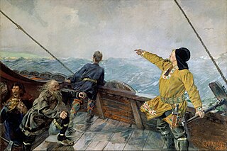
The Eastern Settlement was the first and by far the larger of the two main areas of Norse Greenland, settled c. AD 985 – c. AD 1000 by Norsemen from Iceland. At its peak, it contained approximately 4,000 inhabitants. The last written record from the Eastern Settlement is of a wedding in Hvalsey in 1408, placing it about 50–100 years later than the end of the more northerly Western Settlement.
The Western Settlement was a group of farms and communities established by Norsemen from Iceland around 985 in medieval Greenland. Despite its name, the Western Settlement was more north than west of its companion Eastern Settlement and was located at the bottom of the deep Nuup Kangerlua fjord.

Kujalleq is a municipality on the southern tip of Greenland, operational from 1 January 2009. The administrative center of the municipality is in Qaqortoq.
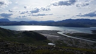
Tunulliarfik Fjord is a fjord near Qaqortoq in the Kujalleq municipality in southern Greenland. It is the inner section of Skovfjord (Skovfjorden). In times of the Norse settlement in southern Greenland, it was known as Eiriksfjord.

Moravian Brethren Mission House or Herrnhut House is a historical building in Nuuk, the capital of Greenland, established in 1747 from timber shipped to the United Brethren from the Netherlands. It was the centre of the Moravian Brethren Mission in Greenland and the missionaries operated across the west coast of Greenland from this building. Greenlander converts were reported saying, "If it can be so beautiful here on Earth, how wonderful must it not be in Heaven."

Old Nuuk may refer to several neighborhoods of Nuuk, the capital of Greenland.
Ikigait is a former community in Greenland about 3 kilometers west of Narsarmijit. It was the site of Herjólfr Bárðarson's farm Herjolfsnes, one of the easternmost of the Norse settlements during their colonization of Greenland.

Akunnaat is a former community in southern Greenland on the island of Akonemiok or Qeqertarsuatsiaat, 3 miles (4.8 km) from the trading post of Fisher's Inlet.
Umanak was a former Moravian mission in mid-western Greenland, located upfjord from Neu-Herrnhut.
Idlorpait is a former Moravian mission in southernmost Greenland located between the missions at Lichtenau and Friedrichsthal.
The Moravian missions in Greenland were established by the Moravian Church or United Brethren and operated between 1733 and 1900. They were operated under the auspices of the Royal Danish College of Missions until its dissolution in 1859 and were finally surrendered to the Lutheran Church of Denmark in 1900. Missionaries were allocated to the region and sometimes even sent wives who had been chosen for them and approved by the drawing of lots, a form of Cleromancy.

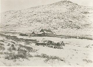
Sandnæs, often anglicized as Sandnes, was the largest Norse farmstead in the Western Settlement of medieval Greenland. Similarly with the Norwegian city of Sandnes, its name meant "Sandy Headland" in Old Norse. It was settled around AD 1000 and abandoned by the late 14th century. It was located at the site known as Kilaarsarfik today, at the head of the Ameralla Fjord south of modern Nuuk's peninsula.
Lindenow Fjord or Kangerlussuatsiaq, is a fjord in the King Frederick VI Coast, Kujalleq municipality, southern Greenland.