Banana Island Provincial Park is a provincial park in British Columbia, Canada. It is a small 10.4 hectare island in the South Thompson River, located approximately 35 kilometres east of Kamloops. There are no camping or recreational facilities, as it is an environmentally sensitive area. The island was designated as a provincial park on 30 April 1996 following recommendations from the Kamloops Land and Resource Management Plan to protect spring salmon spawning grounds and nesting grounds for several varieties of birds. It is used for nesting by Canada geese, Osprey and bald eagles, and other waterfowl and raptors. It is also a winter habitat for Tundra and Trumpeter swans. The island is vegetated with ponderosa pine and grassy undercover, and was historically used by the Neskonlith First Nation in accessing river resources.

Parts of this article have been adapted from the BC Parks website.

Tsʼilʔos Provincial Park is a provincial park in British Columbia, Canada. Tsʼilʔos is the official BC Parks designation for this provincial park, though sometimes it is written as "Ts'il-os", "Ts'yl-os", or "Tsylos". The "ʔ" in the name represents a glottal stop.

Sasquatch Provincial Park is a provincial park in Kent, British Columbia, Canada.

God's Pocket Marine Provincial Park is a provincial park in southwest British Columbia, Canada, established July 12, 1995. It is well known as a cold water scuba diving and kayaking destination. The park is 2,036 hectares in size, and includes two main islands, Hurst and Bell islands respectively, and many smaller isles.

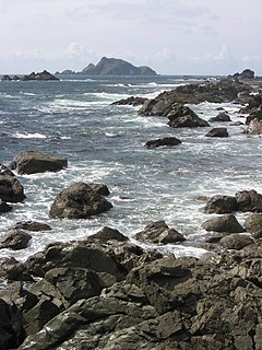
Juan de Fuca Provincial Park is a provincial park located on the west coast of Vancouver Island in British Columbia, Canada. The park was established on April 4, 1996 by combining three former parks - China Beach, Loss Creek, and Botanical Beach - into one provincial park. It is the location of the majority of the Juan de Fuca Marine Trail, which is a southern compliment to the West Coast Trail within Pacific Rim National Park Reserve.
Kentucky Alleyne Provincial Park is a provincial park in British Columbia. The park is located 38 kilometres south of Merritt, British Columbia.
Kikomun Creek Provincial Park is a provincial park in British Columbia, Canada.
Lawn Point Provincial Park is a provincial park in British Columbia, Canada.
Lower Tsitika River Provincial Park is a provincial park in British Columbia, Canada.

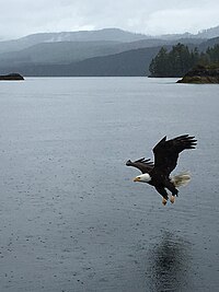
Marble River Provincial Park is a provincial park in British Columbia, Canada. The park is located on northern Vancouver Island. It is 14.19 km2 (5.48 sq mi) in area. The park protects an eagle nesting habitat near Quatsino Narrows in Quatsino Sound, a steelhead fishery, and an extensive waterfowl habitat. A 4.2 km (2.6 mi)-long biking or walking trail is available, as well as opportunities for wildlife viewing.
Mitlenatch Island Nature Provincial Park is a provincial park in British Columbia, Canada, located on Mitlenatch Island a small islet in the northern Strait of Georgia within the Strathcona Regional District.
Nickel Plate Provincial Park is a provincial park in British Columbia, Canada. Formerly known as Clearwater Park, it is located in the Similkameen District at the northeast corner of Nickel Plate Lake.
One Island Lake Provincial Park is a provincial park in British Columbia, Canada.

Stagleap Provincial Park is a provincial park in British Columbia, Canada. The park is approximately 1133 hectares. It is 34 kilometers west of Creston.
Sutherland River Provincial Park and Protected Area is a provincial park in British Columbia, Canada.
Winter Harbour is the western-most settlement on the west coast about 41 kilometres (25 mi) from the northwest tip of Vancouver Island, British Columbia. This unincorporated community on Winter Harbour is on the northern side of Quatsino Sound at the mouth.
Kyuquot Sound is a complex of coastal inlets, bays and islands on northwestern Vancouver Island in the Canadian province of British Columbia.
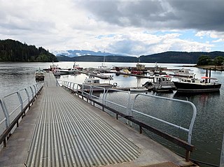
Quatsino Sound is a complex of coastal inlets, bays and islands on northwestern Vancouver Island in the Canadian province of British Columbia. It is the northernmost of the five sounds that pierce the west coast of Vancouver Island, the others being Kyuquot Sound, Nootka Sound, Clayoquot Sound, and Barkley Sound.
Solander Island Ecological Reserve is a 7.7 ha protected area on an island 1.5 km (0.9 mi) west of Brooks Peninsula Provincial Park off the northwest coast of Vancouver Island in British Columbia, Canada. It was established in 1971. The reserve is closed to the public to protect the habitat of nesting seabirds.