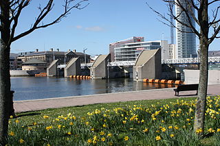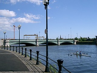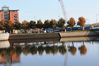

Queen Elizabeth Bridge is a bridge over the River Lagan in Belfast, Northern Ireland, which opened in 1966.


Queen Elizabeth Bridge is a bridge over the River Lagan in Belfast, Northern Ireland, which opened in 1966.
The concept of a new bridge over the Lagan was first officially discussed in August 1959 within the Belfast Corporation Improvement Committee, with the purpose of it being to alleviate the traffic bottlenecks at the current city centre bridges. It was decided that the bridge would be placed beside Queen's Bridge to avoid river flow turbulences, which may have affected the existing bridge's foundations. A tunnel was also considered but was rejected for cost reasons. Over the next few years, the proposals were expanded into a larger programme of works, known as the "Lagan bridge scheme", which also included a large gyratory and one-way system to connect the bridges to the Sydenham Bypass (necessitating the demolition of 145 houses at Bridge End), two flyovers and seven pedestrian subways. [1] [2]
In March 1963, the total cost of the scheme was estimated at £3 million, however by the time of completion this had risen to £4 million. In August, the construction contract was awarded to Charles Brand and Son Ltd for £3,749,213 1s. 5d. Soon construction began with the first pile driven in October. The demolitions at Bridge End were completed in January 1965 and by December of the same year, most of the roadworks were nearing completion. [1] [2] [3]
The decision on the name of the bridge in February 1966 proved controversial. The Unionist Party group in Belfast Corporation initially voted by 20 votes to 18 for the name Carson Bridge, after the former leader of their party, with the alternative being Somme Bridge. However, the Governor of Northern Ireland, Lord Erskine, intervened to ensure that a more politically neutral name was chosen, which caused unionists to criticise him for "interfering" in the affairs of Northern Ireland. A new name, Queen Elizabeth Bridge, was then chosen and was supported by both unionists and nationalists. Sir Cecil McKee took credit for the name, although it had earlier been reported that it was believed to be the Governor's idea. [4] [5] [6]
The Bridge opened to traffic, along with the other elements of the scheme, on Sunday 3 April 1966. It was then officially opened by the Queen and Duke of Edinburgh on 4 July, however their visit was marred by both a concrete block being dropped on their car from a height and a bottle being thrown at it as they made their way through the city centre. [2] [7] [8]

Belfast is the capital city and principal port of Northern Ireland, standing on the banks of the River Lagan and connected to the open sea through Belfast Lough and the North Channel. It is second to Dublin as the largest city on the island of Ireland with a population in 2021 of 345,418 and a metro area population of 671,559.

Lisburn is a city in Northern Ireland. It is 8 mi (13 km) southwest of Belfast city centre, on the River Lagan, which forms the boundary between County Antrim and County Down. First laid out in the 17th century by English and Welsh settlers, with the arrival of French Huguenots in the 18th century, the town developed as a global centre of the linen industry.

The Lagan Valley is an area of Northern Ireland between Belfast and Lisburn. The River Lagan rises on Slieve Croob in County Down and flows generally northward discharging into Belfast Lough. For a section, the river forms part of the border between the counties of Antrim and Down.

The River Lagan is a major river in Northern Ireland which runs 53.5 mi (86.1 km) from the Slieve Croob mountain in County Down to Belfast where it enters Belfast Lough, an inlet of the Irish Sea. The Lagan forms much of the border between County Antrim and County Down in the east of Ulster. It rises as a tiny, fast-moving stream near to the summit of Slieve Croob; Transmitter Road runs nearby. It runs to Belfast through Dromara, Donaghcloney and Dromore. On the lower slopes of the mountain, it combines with a branch from Legananny Mountain, just opposite Slieve Croob. The river then turns east to Magheralin into a broad plain between the plateaus of Antrim and Down.

The M1 is a motorway in Northern Ireland. It is the longest motorway in Northern Ireland and runs for 38 miles (61 km) from Belfast to Dungannon through County Antrim, County Down, County Armagh and County Tyrone. It forms part of the route via the A1 in Northern Ireland between Belfast and Dublin as well as being a part of the unsigned European E01 and E18 routes.
The Laganside Corporation was a non-departmental public body formed by the Laganside Development Order 1989 with the goal of regenerating large sections of land in Belfast, Northern Ireland adjacent to the River Lagan. This development area was expanded in 1996 to include areas closer to the city centre.

Dromore is a small market town and civil parish in County Down, Northern Ireland. It lies within the local government district of Armagh City, Banbridge and Craigavon. It is 19 miles (31 km) southwest of Belfast, on the A1 Belfast–Dublin road. The 2011 Census recorded a population of 6,395.
Lagan College is an integrated secondary school in Belfast, Northern Ireland. It holds a total of around 1540 students. It was formed in 1981 as the first integrated school in Northern Ireland and contains students of mainly Roman Catholic and Protestant faiths, however students from other faiths also attend the school.

The M3 is an urban motorway 0.8 miles (1.3 km) in length owned by Siac Construction and Cintra, S.A. that connects the M2 in north Belfast, Northern Ireland to the A2 Sydenham Bypass in east Belfast. It is the shortest motorway in Northern Ireland, and one of the busiest, carrying 60,000 vehicles per day as of 2005. It has a permanent speed limit of 50 mph (80 km/h).

The Lagan Weir, in Belfast, Northern Ireland, crosses the River Lagan between the Queen Elizabeth Bridge and the M3 cross-harbour bridge. Prior to the building of the weir, the river would be subject to tidal fluctuations, and low tide would expose mudflats, which were unsightly and emitted a strong odour, particularly in the summer months. Opened in 1994, the weir was seen by the Laganside Corporation as a catalyst for its redevelopment projects and was judged to be the "centrepiece" of that effort. The weir also incorporates a footbridge.

The Royal Victoria Hospital commonly known as "the Royal", the "RVH" or "the Royal Belfast", is a hospital in Belfast, Northern Ireland. It is managed by the Belfast Health and Social Care Trust. The hospital has a Regional Virus Centre, which is one of the four laboratories in the United Kingdom on the WHO list of laboratories able to perform PCR for rapid diagnosis of influenza A (H1N1) virus infection in humans.

Albert Bridge is a bridge in Belfast, Northern Ireland. Its three flat arches span the River Lagan. It was completed in 1890 by Belfast city surveyor J C Bretland and is named after Prince Albert Victor. It is located close to the city centre between East Bridge Street and the Albertbridge Road.

Cregagh is an area southeast of Belfast in County Down, Northern Ireland. It is the name of a townland and has been adopted as the name of an electoral ward of Belfast City council. The townland dates back to medieval times, when it was part of the territory held by the O'Neills of Clannaboy. The area is centred on the Cregagh Road. The Woodstock/Cregagh Road is a continuous arterial route in the city, with the Woodstock making up the lower half of the route and the Cregagh the upper half. It runs from the Albertbridge Road, close to the Short Strand, to the A55 Outer Ring road.

The A5 is a major primary route in Northern Ireland. It links the city of Derry in County Londonderry with Aughnacloy, County Tyrone via the towns of Strabane and Omagh. Just south of Aughnacloy is the border with the Republic of Ireland, where the A5 meets the N2 to Dublin. Between them the A5 and N2 are the main road link between County Donegal in the Republic and Dublin.

Queen's Quay is a section of the River Lagan, in the western Titanic Quarter of the city of Belfast, Northern Ireland.

The Blackstaff River is a watercourse in County Antrim, Northern Ireland. It rises on the eastern slope of the Black Mountain before flowing down into the Bog Meadows and passing under the city of Belfast, where it enters the River Lagan. Much of its course has been culverted and built upon since the 19th century, making it largely invisible today. Its tributaries include the Forth or Clowney River, which meets it beneath the Broadway Roundabout in West Belfast.

Paul Jonathan Givan is a Northern Irish unionist politician, serving as Minister of Education since February 2024. Givan served as First Minister of Northern Ireland from June 2021 to February 2022, the youngest person to hold that office. He has been a Member of the Legislative Assembly for Lagan Valley since 2010.

Emma Little-Pengelly is a Northern Irish barrister and Democratic Unionist Party (DUP) politician serving as the deputy First Minister of Northern Ireland since February 2024. She has been a Member of the Legislative Assembly (MLA) for Lagan Valley since May 2022, when she was co-opted (appointed) to replace DUP party leader Sir Jeffrey Donaldson, who declined to take up his seat following the 2022 election.

Lagan Railway Bridge is a railway and pedestrian bridge across the River Lagan in Belfast, slightly north of Belfast Central railway station. The next bridge upstream is the Albert Bridge, whilst the next downstream is Queen's Bridge.
54°36′0.86″N5°55′13.78″W / 54.6002389°N 5.9204944°W