RAF Gailes

Last updated

RAF Gailes
Ensign of the Royal Air Force.svg
Fullarton, Ayrshire, in  Scotland
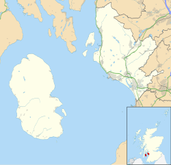
North Ayrshire UK location map.svg
Red pog.svg
RAF Gailes
Shown within North Ayrshire
United Kingdom adm location map.svg
Red pog.svg
RAF Gailes
RAF Gailes (the United Kingdom)
Coordinates 55°35′10″N4°38′56″W / 55.586°N 4.649°W / 55.586; -4.649
Type Royal Air Force station
Site information
Owner Ministry of Defence
Controlled by Royal Air Force
Site history
Built1950 (1950)
In use1950-1978 (1978)
Battles/wars Cold War

Royal Air Force Gailes or more simply RAF Gailes is a former Royal Air Force ROTOR radar station in Ayrshire, Scotland.

History

RAF Gailes was built on the site of the earlier RAF Fullarton The buildings from the old GCI station were cleared by December 1950. [1]

The station was short lived, becoming redundant when RAF Killard Point (Northern Ireland) became operational, in September 1956. The Signals Unit at Gailes was disbanded and the station placed on care and maintenance. [1]

In 1962, the station was taken over by civilian staff from Air Traffic Control at Prestwick Airport. [1]

Gailes was finally closed in 1978 and the buildings demolished when the Radar station staff moved to Atlantic House in Prestwick. [1]

Related Research Articles

Royal Air Force Bishopscourt or more simply RAF Bishopscourt is a former Royal Air Force airfield, radar control and reporting station located on the south east coast of Northern Ireland, approximately 5.8 miles (9.3 km) from Downpatrick, County Down, Northern Ireland and 24.7 miles (39.8 km) from Belfast, Northern Ireland. A Marconi AMES Type 84 radar was located on the airfield and an AMES Type 80 radar was located at Killard Point, Ballyhornan. An AMES Type 93 mobile radar was also located on the airfield from 1989 until the station closed.

<span class="mw-page-title-main">ROTOR</span> 1950s British air defence radar system

ROTOR was an elaborate air defence radar system built by the British Government in the early 1950s to counter possible attack by Soviet bombers. To get it operational as quickly as possible, it was initially made up primarily of WWII-era systems, notably the original Chain Home radars for the early warning role, and the AMES Type 7 for plotting and interception control. Data from these stations was sent to a network of control stations, mostly built underground, using an extensive telephone and telex network.

<span class="mw-page-title-main">RAF Boulmer</span>

Royal Air Force Boulmer or more simply RAF Boulmer is a Royal Air Force station near Alnwick in Northumberland, England, and is home to Aerospace Surveillance and Control System (ASACS) Force Command, Control and Reporting Centre (CRC) Boulmer.

<span class="mw-page-title-main">RAF Buchan</span>

Royal Air Force Buchan or more simply RAF Buchan is a former Royal Air Force station near Peterhead in Aberdeenshire, Scotland.

<span class="mw-page-title-main">RAF Fylingdales</span> Royal Air Force base in Yorkshire, England

Royal Air Force Fylingdales or more simply RAF Fylingdales is a Royal Air Force station on Snod Hill in the North York Moors, England. Its motto is "Vigilamus". It is a radar base and is also part of the Ballistic Missile Early Warning System (BMEWS). As part of intelligence-sharing arrangements between the United States and United Kingdom, data collected at RAF Fylingdales are shared between the two countries. Its primary purpose is to give the British and US governments warning of an impending ballistic missile attack. A secondary role is the detection and tracking of orbiting objects; Fylingdales is part of the United States Space Surveillance Network. As well as its early-warning and space-tracking roles, Fylingdales has a third function – the Satellite Warning Service for the UK. It keeps track of spy satellites used by other countries, so that secret activities in the UK can be carried out when they are not overhead. The armed services, defence manufacturers and research organisations, including universities, take advantage of this facility.

<span class="mw-page-title-main">RRH Benbecula</span> Royal Air Force radar site in the Western Isles, Scotland

Remote Radar Head Benbecula or RRH Benbecula, is an air defence radar station operated by the Royal Air Force. It is located at Cleitreabhal a'Deas, 17 kilometres (11 mi) from Lochmaddy on the isle of North Uist in the Outer Hebrides of Scotland.

<span class="mw-page-title-main">RAF Saxa Vord</span> Royal Air Force air defence radar on Unst, Shetland, Scotland, United Kingdom

Remote Radar Head Saxa Vord or RRH Saxa Vord, is a Royal Air Force radar station located on the island of Unst, the most northern of the Shetland Islands in Scotland. As of July 2019 it is once more a fully operational radar station, after closure in 2006. The station's motto Praemoneo de Periculis reflects its role. RAF Saxa Vord is further north than Saint Petersburg in Russia, and on the same latitude as Anchorage, Alaska. The station was named after Saxa Vord, which is the highest hill on Unst at 935 ft (285 m). It holds the unofficial British record for wind speed, which in 1992 was recorded at 197 mph (317 km/h) — just before the measuring equipment blew away.

<span class="mw-page-title-main">RRH Staxton Wold</span> Royal Air Force base in North Yorkshire, England

RemoteRadarHeadStaxton Wold or RRH Staxton Wold is an air defence radar station operated by the Royal Air Force, located near Scarborough in North Yorkshire, England. As it has been a radar site continuously since 1939, it has a claim to be the oldest working radar station in the world.

Royal Air Force Prestwick otherwise known as RAF Prestwick, was a RAF unit based at the NATS air traffic control centre, adjacent to Glasgow Prestwick Airport, South Ayrshire, in south west Scotland. The unit was home to the Scottish Air Traffic Control Centre (Military) which provided an air traffic control service to military aircraft operating within its area of responsibility. Prestwick was also home to a Distress and Diversion (D&D) Cell which provided assistance to both military and civil aircraft in an emergency.

Royal Air Force Fullarton or more simply RAF Fullarton is a former Royal Air Force Ground Control Intercept station, situated in Ayrshire, Scotland.

<span class="mw-page-title-main">67th Special Operations Squadron</span> Military unit

The 67th Special Operation Squadron, nicknamed the Night Owls, is an active United States Air Force unit operating the Lockheed MC-130J Commando II. It is based at RAF Mildenhall, Suffolk, in the United Kingdom and assigned to the 752d Special Operations Group. It was originally activated at RAF Sculthorpe in 1952, transferred to Morón Air Base in Spain in 1966, relocated to RAF Woodbridge, Suffolk, in 1970, transferred to RAF Alconbury, Cambridgeshire in 1992 and, finally, moved to RAF Mildenhall in 1995. The 67th SOS is tasked with flying single or multi-ship low-level air refueling missions for special operations helicopters, infiltration, exfiltration and resupply of special operations forces by airdrop or airland.

Fullarton is a small area in Irvine, North Ayrshire. It is situated close to Irvine Bay and is next to several industrial estates, large supermarkets and retail stores and the town centre itself. Stagecoach Western buses operate the local bus services in the area. Fullarton is only 8 miles from Prestwick Airport and 25 miles from the city of Glasgow.

<span class="mw-page-title-main">RAF Lindholme</span> Royal Air Force base in Yorkshire, England

Royal Air Force Lindholme or more simply RAF Lindholme is a former Royal Air Force station in South Yorkshire, England. It was located 3.9 miles (6.3 km) south of Thorne and 6.9 miles (11.1 km) north east of Doncaster and was initially called RAF Hatfield Woodhouse.

<span class="mw-page-title-main">RAF Goldsborough</span> Former Royal Air Force radar base in Yorkshire, England

Royal Air Force Goldsborough or more simply RAF Goldsborough is a former Royal Air Force station located in North Yorkshire, England.

<span class="mw-page-title-main">RAF Holmpton</span> Royal Air Force base in Yorkshire, England

Royal Air Force Holmpton or more simply RAF Holmpton is a former Royal Air Force Cold War era nuclear bunker that was built in the 1950s as an early warning radar station as part of the ROTOR Radar Defence Programme. Located just south of the village of Holmpton, in the East Riding of Yorkshire, England, RAF Holmpton remained a part of the Defence Estate right up to 8 December 2014 when it was sold into private ownership after 62 years of military service.

HMS<i> Gannet </i>(stone frigate)

HMS Gannet is a forward operating base of the Royal Navy's Fleet Air Arm located at Glasgow Prestwick Airport, South Ayrshire in Scotland.

<span class="mw-page-title-main">Quick Reaction Alert</span>

Quick Reaction Alert (QRA) is state of readiness and modus operandi of air defence maintained at all hours of the day by NATO air forces. The United States usually refers to Quick Reaction Alert as 'Airspace Control Alert'.

Royal Air Force Danby Beacon or more simply RAF Danby Beacon was an early warning radar Royal Air Force station that formed part of the Chain Home network of radar stations built by the Royal Air Force immediately prior to the Second World War.

<span class="mw-page-title-main">RAF Aird Uig</span> Former RAF base in Scotland

Royal Air Force Aird Uig was a Royal Air Force radar station located on the western edge of the Isle of Lewis in the Outer Hebrides, Scotland. The main masts and operations room were located north of the village of Aird Uig on Gallan Head, with a separate domestic site nearer to the village, five-eighths mile further south.

<span class="mw-page-title-main">Bent Rigg radar station</span> Former Royal Air Force radar site in North Yorkshire, England

Bent Rigg Radar Station,, was a radar site located at Bent Rigg, 0.6 miles (1 km) south of Ravenscar, North Yorkshire, England. Several radar stations had been located in the Ravenscar area from 1938, but a more permanent site was built at Bent Rigg in 1941, which was crewed by technicians and other staff from the Royal Air Force. Bent Rigg, and the wider location around Ravenscar, was deemed "attractive" for the siting of long-range finding equipment. It was originally part of the Coastal Defence/Chain Home Low (CD/CHL) system, designed to detect shipping. Later, it was upgraded with more powerful equipment as part of the Chain Home Extra Low (CHEL). The last recorded use of the station was in September 1944, and it is believed that the site closed soon afterwards.

References

  1. 1 2 3 4 "RAF Fullarton and RAF Gailes". Subterranea Britannica. Retrieved 22 August 2009.