| Raccoon Creek Group | |
|---|---|
| Stratigraphic range: Carboniferous | |
| Type | Group |
| Sub-units | |
| Location | |
| Region | |
| Country | |

The Raccoon Creek Group is a geologic group in Indiana. It preserves fossils dating back to the Carboniferous period.
| Raccoon Creek Group | |
|---|---|
| Stratigraphic range: Carboniferous | |
| Type | Group |
| Sub-units | |
| Location | |
| Region | |
| Country | |
The Raccoon Creek Group is a geologic group in Indiana. It preserves fossils dating back to the Carboniferous period.
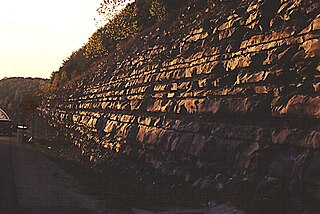
The Brazil Formation is a geologic formation in Indiana consisting of shale, sandstone, clay, and coal. It preserves fossils dating back to the Carboniferous period
The Brazil Formation was named in 1902 for the city of Brazil, located in Clay County, Indiana. It originally included rocks between the bottom of the Petersburg Coal and the top of the Mansfield Sandstone. In 1922, a new survey resulted in restrictions to include only rocks between the Lower Block Coal Member and what was at the time called Coal II. In 1976, it was amended again to include rocks between the upper part of Minshall Coal Member and the lower part of Lower Block Coal Member.
The formation is made up of shale, sandstone, clay, and coal. Thickness is measured between 40 and 90 feet. [1]
The Caseyville Formation is a geologic formation in Kentucky. It preserves fossils dating back to the Carboniferous period.
The Mansfield Formation is a geologic formation in Indiana. It preserves fossils dating back to the Carboniferous period.
The Tradewater Formation is a geologic formation in Kentucky. It preserves fossils dating back to the Carboniferous period .
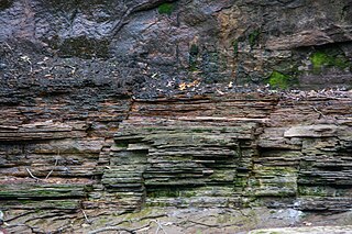
The Staunton Formation is a geologic formation in Indiana [2] consisting of sandstone, shale, and coalbeds. [3] [4]
The formation was named by E. R. Cumings to refer to the exposed rocks found near Staunton, Clay County. Later surveys resulted in the inclusion of the Perth Limestone Member into the Staunton Formation, having previously belonged to the Brazil Formation.
The Staunton Formation is made up of sandstone and shale (75 to 150 feet), and coalbeds (up to 8). [3]

The geology of India is diverse. Different regions of India contain rocks belonging to different geologic periods, dating as far back as the Eoarchean Era. Some of the rocks are very deformed and altered. Other deposits include recently deposited alluvium that has yet to undergo diagenesis. Mineral deposits of great variety are found in the Indian subcontinent in huge quantities. Even India's fossil record is impressive in which stromatolites, invertebrates, vertebrates and plant fossils are included. India's geographical land area can be classified into the Deccan Traps, Gondwana and Vindhyan.
The geology of Shropshire is very diverse with a large number of periods being represented at outcrop. The bedrock consists principally of sedimentary rocks of Palaeozoic and Mesozoic age, surrounding restricted areas of Precambrian metasedimentary and metavolcanic rocks. The county hosts in its Quaternary deposits and landforms, a significant record of recent glaciation. The exploitation of the Coal Measures and other Carboniferous age strata in the Ironbridge area made it one of the birthplaces of the Industrial Revolution. There is also a large amount of mineral wealth in the county, including lead and baryte. Quarrying is still active, with limestone for cement manufacture and concrete aggregate, sandstone, greywacke and dolerite for road aggregate, and sand and gravel for aggregate and drainage filters. Groundwater is an equally important economic resource.
The geology of Illinois includes extensive deposits of marine sedimentary rocks from the Palaeozoic, as well as relatively minor contributions from the Mesozoic and Cenozoic. Ice age glaciation left a wealth of glacial topographic features throughout the state.

The San Juan Basin is a geologic structural basin located near the Four Corners region of the Southwestern United States. The basin covers 7,500 square miles and resides in northwestern New Mexico, southwestern Colorado, and parts of Utah and Arizona. Specifically, the basin occupies space in the San Juan, Rio Arriba, Sandoval, and McKinley counties in New Mexico, and La Plata and Archuleta counties in Colorado. The basin extends roughly 100 miles (160 km) N-S and 90 miles (140 km) E-W.

The Geology of Bangladesh is affected by the country's location, as Bangladesh is mainly a riverine country. It is the eastern two-thirds of the Ganges and Brahmaputra river delta plain stretching to the north from the Bay of Bengal. There are two small areas of slightly higher land in the north-centre and north-west composed of old alluvium called the Madhupur Tract and the Barind Tract, and steep, folded, hill ranges of older (Tertiary) rocks along the eastern border.

The Pennsylvanian Pottsville Formation is a mapped bedrock unit in Pennsylvania, western Maryland, West Virginia, Ohio, and Alabama. It is a major ridge-former in the Ridge-and-Valley Appalachians of the eastern United States. The Pottsville Formation is conspicuous at many sites along the Allegheny Front, the eastern escarpment of the Allegheny or Appalachian Plateau.

The Raton Formation is a geological formation of Upper Cretaceous and Paleocene age which outcrops in the Raton Basin of northeast New Mexico and southeast Colorado.

The Bedford Shale is a shale geologic formation in the states of Ohio, Michigan, Pennsylvania, Kentucky, West Virginia, and Virginia in the United States.
The Mississippian Borden Formation is a mapped bedrock unit in Kentucky, Indiana, Illinois, Ohio, West Virginia, and Tennessee. It has many members, which has led some geologists to consider it a group rather than a formation.

The Bluefield Formation is a geologic formation in West Virginia. It preserves fossils dating back to the Mississippian subperiod of the Carboniferous period. Sediments of this age formed along a large marine basin lying in the region of what is now the Appalachian Plateau. The Bluefield Formation is the lowest section of the primarily siliciclastic Mauch Chunk Group, underlying the Stony Gap Sandstone Member of the Hinton Formation and overlying the limestone-rich Greenbrier Group.
The Cleveland Shale, also referred to as the Cleveland Member, is a shale geologic formation in the eastern United States.
The Pennington Formation is a geologic formation named for Pennington Gap, Virginia. It can be found in outcrops along Pine Mountain and Cumberland Mountain in Kentucky, Virginia, and Tennessee, where it is the uppermost Mississippian-age formation. The name has also been applied to similar Mississippian strata in the Cumberland Escarpment of eastern Kentucky, though the rocks in that area were later renamed to the Paragon Formation.
The Albert Formation is a stratigraphic unit of Early Mississippian (Tournaisian) age in the Moncton Subbasin of southeastern New Brunswick. It was deposited in a lacustrine environment and includes fossils of fish and land plants, as well as trace fossils. It also includes significant deposits of oil shale. The oil shale beds are the source rocks for the petroleum and natural gas that has been produced from Albert Formation reservoirs at the Stoney Creek and McCully fields. In addition, the solid asphalt-like hydrocarbon albertite was mined from the Albert Formation at Albert Mines between 1854 and 1884.
The geology of Nebraska is part of the broader geology of the Great Plains of the central United States. Nebraska's landscape is dominated by surface features, soil and aquifers in loosely compacted sediments, with areas of the state where thick layers of sedimentary rock outcrop. Nebraska's sediments and sedimentary rocks lie atop a basement of crystalline rock known only through drilling.
The geology of Ohio formed beginning more than one billion years ago in the Proterozoic eon of the Precambrian. The igneous and metamorphic crystalline basement rock is poorly understood except through deep boreholes and does not outcrop at the surface. The basement rock is divided between the Grenville Province and Superior Province. When the Grenville Province crust collided with Proto-North America, it launched the Grenville orogeny, a major mountain building event. The Grenville mountains eroded, filling in rift basins and Ohio was flooded and periodically exposed as dry land throughout the Paleozoic. In addition to marine carbonates such as limestone and dolomite, large deposits of shale and sandstone formed as subsequent mountain building events such as the Taconic orogeny and Acadian orogeny led to additional sediment deposition. Ohio transitioned to dryland conditions in the Pennsylvanian, forming large coal swamps and the region has been dryland ever since. Until the Pleistocene glaciations erased these features, the landscape was cut with deep stream valleys, which scoured away hundreds of meters of rock leaving little trace of geologic history in the Mesozoic and Cenozoic.
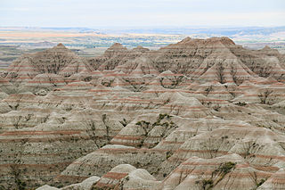
The geology of South Dakota began to form more than 2.5 billion years ago in the Archean eon of the Precambrian. Igneous crystalline basement rock continued to emplace through the Proterozoic, interspersed with sediments and volcanic materials. Large limestone and shale deposits formed during the Paleozoic, during prevalent shallow marine conditions, followed by red beds during terrestrial conditions in the Triassic. The Western Interior Seaway flooded the region, creating vast shale, chalk and coal beds in the Cretaceous as the Laramide orogeny began to form the Rocky Mountains. The Black Hills were uplifted in the early Cenozoic, followed by long-running periods of erosion, sediment deposition and volcanic ash fall, forming the Badlands and storing marine and mammal fossils. Much of the state's landscape was reworked during several phases of glaciation in the Pleistocene. South Dakota has extensive mineral resources in the Black Hills and some oil and gas extraction in the Williston Basin. The Homestake Mine, active until 2002, was a major gold mine that reached up to 8000 feet underground and is now used for dark matter and neutrino research.
The geology of the Gower Peninsula in South Wales is central to the area's character and to its appeal to visitors. The peninsula is formed almost entirely from a faulted and folded sequence of Carboniferous rocks though both the earlier Old Red Sandstone and later New Red Sandstone are also present. Gower lay on the southern margin of the last ice sheet and has been a focus of interest for researchers and students in that respect too. Cave development and the use of some for early human occupation is a further significant aspect of the peninsula's scientific and cultural interest.

The Arkoma Basin is a peripheral foreland basin that extends from central west Arkansas to south eastern Oklahoma. The basin lies in between the Ozark Uplift and Oklahoma Platform to the north and Ouachita Mountains to the south and with an area of approximately 33,800 mi2. Along the southern edge of the basin, the Choctaw Fault is the boundary that separates the mountains from the basin itself. This basin is one of seven that lie along the front of the Ouachita and Appalachian mountain systems. This basin is Oklahoma's fourth largest in terms of natural gas production. Oil has been extracted locally, but not on a commercial scale. Coal was the first natural resource used commercially within the basin. Surface mapping of coal seams in the early part of the 20th century lead to the discovery of sub-surface features that indicated the presence of natural gas. Mansfield, Arkansas was the site of the first natural gas discovery in 1902.

The Sergipe-Alagoas Basin is a continental margin basin in the Sergipe and Alagoas states of northeastern Brazil, about 20 to 50 kilometres wide onshore, but with its widest extension offshore, more precisely 13,000 km2 onshore and 40,000 km2 offshore. In general, "Sergipe-Alagoas Basin" refers to the Sergipe and Alagoas sub-basins, but it also consists of the Jacuípe and Cabo sub-basins. Studies of the basin's geology date back to the first half of the 19th century, when J. Henderson in 1821 published preliminary notes on the region's geology.
The Carbondale Group is a Middle Pennsylvanian aged unit found in the Illinois Basin. This geologic unit is made up of siliciclastic rock and Coal beds.
| | This article about a specific stratigraphic formation in Indiana is a stub. You can help Wikipedia by expanding it. |