
Koochiching County is a county in the U.S. state of Minnesota. As of the 2010 census, the population was 13,311. Its county seat is International Falls. A portion of the Bois Forte Indian Reservation is in the county. A small part of Voyageurs National Park extends into its boundary, with Lake of the Woods County to its northwest.

The Ojibwe, Ojibwa, Chippewa, or Saulteaux are an Anishinaabe people in what is currently southern Canada and the northern Midwestern United States. In the United States, they have the fifth-largest population among Native American peoples, surpassed in number only by the Navajo, Cherokee, Choctaw and Sioux. In Canada, they are the second-largest First Nations population, surpassed only by the Cree. They are one of the most numerous Indigenous Peoples north of the Rio Grande.

The Saulteaux, otherwise known as the Plains Ojibwe, are a First Nations band government in Ontario, Manitoba, Saskatchewan, Alberta and British Columbia, Canada. They are a branch of the Ojibwe who pushed west. They formed a mixed culture of woodlands and plains Indigenous customs and traditions.
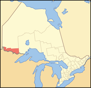
Rainy River District is a district and census division in Northwestern Ontario in the Canadian province of Ontario. It was created in 1885. It is the only division in Ontario that lies completely in the Central Time Zone, except for the township of Atikokan observing Eastern Standard Time year-round. Its seat is Fort Frances. It is known for its fishing and its location on the US border opposite International Falls, Minnesota, and Baudette, Minnesota.

The Rainy River is a river, approximately 137 miles (220 km) long, forming part of the Canada–United States border separating Northwestern Ontario and northern Minnesota.
Bois Forte Indian Reservation is an Indian reservation formed for the Bois Forte Band of Chippewa.
Bois Forte Band of Chippewa are an Ojibwe Band located in northern Minnesota, along the border between the United States and Canada. Their landbase is the Bois Forte Indian Reservation, of which the Nett Lake Indian Reservation holdings are the largest of their reservation holdings. The Bois Forte Band is one of six constituent members of the Minnesota Chippewa Tribe. In 2007, the Minnesota Chippewa Tribe reported having 3,052 people enrolled through the Bois Forte Reservation as members of the Bois Forte Band.

Rainy Lake is a freshwater lake with a surface area of 360 square miles (932 km2) that straddles the border between the United States and Canada. The Rainy River issues from the west side of the lake and is harnessed to make hydroelectricity for US and Canadian locations. International Falls, Minnesota and the much smaller city of Ranier, Minnesota are situated opposite Fort Frances, Ontario, on either side of the Rainy River. Rainy Lake and Rainy River establish part of the boundary between the US state of Minnesota and the Canadian province of Ontario.
Treaty 3 was an agreement entered into on October 3, 1873, by Chief Mikiseesis on behalf of the Ojibwe First Nations and Queen Victoria. The treaty involved a vast tract of Ojibwe territory, including large parts of what is now northwestern Ontario and a small part of eastern Manitoba, to the Government of Canada. Treaty 3 also provided for rights for the Waasaakode Anishinaabe and other Ojibwe, through a series of agreements signed over the next year. The treaty was modified in 1875 when Nicolas Chatelain negotiated an adhesion that created a reserve, surveyed as reserve 16A, for Metis families connected to Mikiseesis' Rainy Lake Band. Reserve 16A and the Rainy Lake Band reserve were unified in 1967.
The Lake Superior Chippewa are a large number of Ojibwe (Anishinaabe) bands living around Lake Superior; this territory is considered part of northern Michigan, Wisconsin, and Minnesota in the United States. They migrated into the area by the seventeenth century, encroaching on the Eastern Dakota people who historically occupied the area. The Ojibwe defeated the Eastern Dakota and had their last battle in 1745, after which the Dakota Sioux migrated west into the Great Plains. While sharing a common culture and Anishinaabe language, this group of Ojibwe is highly decentralized, with at least twelve independent bands in this region.

The Couchiching First Nation is a Saulteaux First Nation band government in the Canadian province of Ontario, who live on the Couchiching 16A and Agency 1 reserves in the Rainy River District near Fort Frances.
Nigigoonsiminikaaning First Nation, formerly known as the Nicickousemenecaning First Nation and as the Red Gut First Nation, is a Saulteaux First Nation band government who inhabit the banks of Rainy Lake of the Rainy River District in Northwestern Ontario, Canada. As of January, 2008, the First Nation had a population of 290 registered people. As of 2017, it has approximately 130 on-reserve members.

Lac La Croix First Nation is a Saulteaux First Nation band government who reside in the Rainy River District of northwestern Ontario, Canada, along the Ontario-Minnesota border. It is approximately 200 km northwest of Thunder Bay, Ontario. As of January 2008, the First Nation had a registered population of 398 people, of which their on-Reserve population was 273.
The Naicatchewenin First Nation, also known as the Anishinaabeg of Nagaajiwanaang and formerly known as Northwest Bay First Nation, inhabited a region in Ontario that was cited in the Northwest Angle Treaty of 1873, also known as Treaty 3. Nagaajiwanaang is located approximately 60 kilometres (37 mi) northwest of Fort Frances, with the community of Devlin 50 kilometres (31 mi) to the south on Highway 11. The city of Thunder Bay lies 420 kilometres (260 mi) to the east and Winnipeg is 450 kilometres (280 mi) to the northwest.
Pwi-Di-Goo-Zing Ne-Yaa-Zhing Advisory Services is a non-profit Regional Chiefs' Council located in the Rainy River District, Ontario, Canada, serving seven First Nations by providing advisory services and training which will enhance the overall management skills and opportunities of the area's First Nations.
Border Lakes Ojibwe is a dialect of the Ojibwe language spoken in the Lake of the Woods area of Ontario at the intersection of the borders of Ontario, Minnesota, and Manitoba. Communities in the Border Lakes dialect area have sometimes been treated as a part of the Western Ojibwe (Saulteaux) dialect, but dialect survey research conducted in the 1980s and 1990s analyses it as a separate dialect closely related to Saulteaux Ojibwe.

Seine River First Nation, previously known as the Rivière la Seine Band, is an Ojibwe First Nation reserve located roughly 300 kilometres (190 mi) west of Thunder Bay, Ontario. As of November 2011, the First Nation had a total registered population of 725, of which 327 lived on their own reserve.
Rainy River First Nations is an Ojibwe First Nation band government in Emo, Ontario, Canada.
Big Grassy First Nation is an Ojibwe or Ontario Saulteaux First Nation band government located in Rainy River District, Ontario near Morson, Ontario.
Ojibways of Onigaming First Nation is an Ojibwe or Ontario Saulteaux First Nation located in Kenora District, Ontario near Nestor Falls, Ontario. Together with the Big Grassy First Nation, Ojibways of Onigaming First Nation is a successor apparent to the former Assabaska Band of Saulteaux. Total registered population in February, 2012, was 737, of which the on-reserve population was 445. The First Nation is a member of the Anishinabeg of Kabapikotawangag Resource Council, a regional tribal council that is a member of the Grand Council of Treaty 3.
![A-na-cam-e-gish-ca (Enakamigishkang / "[Traces of] Foot Prints [upon the Ground]"), Rainy Lake Ojibwe chief, painted by Charles Bird King during the 1826 Treaty of Fond du Lac; published in History of the Indian Tribes of North America. A-na-cam-e-gish-ca.jpg](http://upload.wikimedia.org/wikipedia/commons/thumb/5/5a/A-na-cam-e-gish-ca.jpg/338px-A-na-cam-e-gish-ca.jpg)