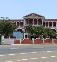
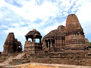
Jagraon is a city and a municipal council, a rural police district and a sub-division of the Ludhiana district in the Indian state of Punjab. Jagraon is more than three centuries old. Jagraon is at almost the geographical center of the state, 16 kilometres (9.9 mi) from the Satluj River. It is 37 km (23 mi) from its district headquarters Ludhiana, 29 km (18 mi) from Moga, 31 km (19 mi) from Nakodar and 54 miles from Barnala.
Badami Bagh is a cantonment town on the outskirts of Srinagar in the Indian-administered Jammu and Kashmir of Kashmir region. A portion of Indian army in the valley resides in the Badami Bagh cantonment. Badami Bagh Cantonment is the headquarters of the Indian Army's 15 Corps. The cantonment is established on the two road sides of Jammu–Srinagar National Highway.

Byadagi is a popular town in Haveri district, in the state of Karnataka, it is agricultural business centre.

Chikkodi is a town, taluka and one of three Subdivisional headquarter, in the Belagavi district of Karnataka, India. Chikodi, Athani, Hukkeri, Raybag, Nipani and Kagwad are the taluks that come under Chikodi Subdivision. It is 75 kilometers from the city of Belgaum, 65 kilometers from Kolhapur, 51 kilometers from Miraj, 160 kilometers from Hubli, and 570 kilometers from the capital of Karnataka state, Bangalore. Chikodi has many district level offices but it is not designated as a district by the Government of Karnataka. It is one of the major cities that lie in the border between Karnataka and Maharashtra states.
Konnur is a municipal council in the Belagavi District of Karnataka, India. It is located at 16.2°N 74.75°E and has an average elevation of 606 metres (1988 feet).

Madhugiri is a city in Tumkur district in the Indian state of Karnataka. The city derives its name from a hillock, Madhu-giri (honey-hill) which lies to its south. Madhugiri is one of the 34 educational districts of the Karnataka state.
Sankeshwar is a town located in Hukkeri taluka, Belagavi district, in Karnataka. It is located on AH47. It is about 50 km north-east from Belgaum. It is located on the bank of the Hiranyakeshi river.

Sinnar is a city and a municipal council in Sinnar taluka of Nashik district in the Indian state of Maharashtra. Sinnar is the third largest city in Nashik district after Nashik and Malegaon.

Turuvekere is a panchayat town and Taluk in Tumakuru district in the Indian state of Karnataka.
Fatehabad is a town in Agra district in the state of Uttar Pradesh, India. It is nearly 35 km south-east of Agra in the direction of Etawah. The historical name of the town is Samugarh.
Raya is a town and a nagar panchayat in the Mathura district of the Indian state of Uttar Pradesh. It was founded by Rai Sen, a Godar Jat. Raya formed a quarter of Tappa Raya, a chiefship in the pargana of Mahawan during the Mughal time. The descendants of Rai Sen remained in control of Tappa Raya till the revolt of 1857 during which their chief Raja Devi Singh Godar was hanged by the Britishers.
Yusufpur Mohammadabad is a town and a Township in Ghazipur district in the Indian state of Uttar Pradesh. Haydaria village near Mohammadabad is the starting point of Purvanchal Expressway.
Chinchali is a village in Raybag Taluk, Belagavi District, Karnataka, India. It is located near the state boundary with Maharashtra, approximately 84 kilometres north of the district seat Belgaum, and 10 kilometres northeast of the taluk seat Raibag. In the year 2011, the village has a population of 18,986.
Kuruburu is a village in Chintamani Taluk in the Chikballapur district in the state of Karnataka, India.
Diggewadi is a village in Raybag taluk in Belgaum Panchayat in the southern state of Karnataka, India. The official language of Diggewadi is Kannada.
Kerur is a town in Bagalkot district in Karnataka, which located on NH 218. It has an average elevation of 617 meters (2024 feet). It's the birthplace of Jagadish Shettar, a former Chief Minister of Karnataka. Kerur is a Town Panchayat city in the district of Bagalkot, Karnataka. The Kerur city is divided into 16 wards for which elections are held every five years. The Kerur Town Panchayat has a population of 19,731 of which 9,929 are males while 9,802 are females as per report released by Census India 2011.
Mungurwadi is a town in Gadhinglaj Taluka of Kolhapur district in Maharashtra, India. In 2001 it had a population of 3,271, but as of 2011, it has a population of 12,199. It is a major market place and the tenth largest settlement in Gadhinglaj taluka. Mungurwadi is about 24 km from Gadhinglaj, 29 km from second-largest settlement Kadgaon and 12 km from National Highway 48 (NH48).
Talikoti also Talikot is a taluq in Vijaypur district in the northern part of the Indian state of Karnataka, about 85 kilometres to the southeast of Vijayapura city. It lies on the river called Doni. It is famous for the Battle of Talikota in 1565.
Manakawad is a village in Dharwad district of Karnataka, India.
Korhalli is a large village located in Almel Taluk in Bijapur District of Karnataka State, India.


