
A ring road is a road or a series of connected roads encircling a town, city or country. The most common purpose of a ring road is to assist in reducing traffic volumes in the urban centre, such as by offering an alternate route around the city for drivers who do not need to stop in the city core. Ring roads can also serve to connect suburbs to each other, allowing efficient travel between them.
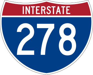
Interstate 278 (I-278) is an auxiliary Interstate Highway in New Jersey and New York in the United States. The road runs 35.62 miles (57.32 km) from US Route 1/9 (US 1/9) in Linden, New Jersey, northeast to the Bruckner Interchange in the New York City borough of the Bronx. The majority of I-278 is in New York City, where it serves as a partial beltway and passes through all five of the city's boroughs. I-278 follows several freeways, including the Union Freeway in Union County, New Jersey; the Staten Island Expressway (SIE) across Staten Island; the Gowanus Expressway in southern Brooklyn; the Brooklyn–Queens Expressway (BQE) across northern Brooklyn and Queens; a small part of the Grand Central Parkway in Queens; and a part of the Bruckner Expressway in the Bronx. I-278 also crosses multiple bridges, including the Goethals, Verrazzano-Narrows, Kosciuszko, and Robert F. Kennedy bridges.
King's Highway 409, commonly referred to as Highway 409 and historically as the Belfield Expressway, is a 400-series highway in the Canadian province of Ontario that extends from Highway 401 in Toronto to Pearson International Airport, west of Highway 427, in Mississauga. It is a short freeway used mainly as a spur route for traffic travelling to the airport or Highway 427 northbound from Highway 401 westbound, as these route movements are not accommodated at the complex interchange between Highways 401 and 427.

U.S. Route 280 is a spur of U.S. Highway 80. It currently runs for 392 miles (631 km) from Blitchton, Georgia, at US 80 to Birmingham, Alabama at I-20/I-59. For much of its route, US 280 travels through rural areas and smaller cities in southern Georgia and east central Alabama. Once the highway approaches Birmingham, it is a major suburban route. Numerous shopping centers are located on US 280 throughout northern Shelby County and southern Jefferson County.
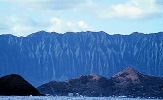
Koʻolau Range is a name given to the dormant fragmented remnant of the eastern or windward shield volcano of the Hawaiian island of Oʻahu. It was designated a National Natural Landmark in 1972.

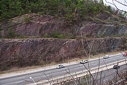
Red Mountain is a long ridge running southwest-northeast and dividing Jones Valley from Shades Valley south of Birmingham, Alabama. It is part of the Ridge-and-Valley region of the Appalachian mountains. The Red Mountain Formation of hard Silurian rock strata lies exposed in several long crests, and was named "Red Mountain" because of the rust-stained rock faces and prominent seams of red hematite iron ore. The mountain was the site of several mines that supplied iron ore to Birmingham's iron furnaces. Most of Birmingham's television and radio stations have transmission towers located on Red Mountain.

Interstate 280 (I-280) is a 17.85-mile (28.73 km) Interstate Highway in the US state of New Jersey. It provides a spur from I-80 in Parsippany–Troy Hills, Morris County, east to Newark and I-95 in Kearny, Hudson County. In Kearny, access is provided toward the Holland Tunnel and Lincoln Tunnel to New York City. The western part of the route runs through suburban areas of Morris and Essex counties, crossing the Watchung Mountains. Upon reaching The Oranges, the setting becomes more urbanized and I-280 runs along a depressed alignment before ascending again in Newark. I-280 includes a vertical-lift bridge, the William A. Stickel Memorial Bridge, over the Passaic River between Newark and East Newark/Harrison. The highway is sometimes called the Essex Freeway. I-280 interchanges with several roads, including the Garden State Parkway in East Orange and Route 21 in Newark.

Interstate 95 (I-95) is part of the Interstate Highway System and runs from Miami, Florida, to the Canada–United States border near Houlton, Maine. In the US state of New York, I-95 extends 23.50 miles (37.82 km) from the George Washington Bridge in New York City to the Connecticut state line at Port Chester. The George Washington Bridge carries I-95 across the Hudson River from New Jersey into New York City. There, I-95 runs across Upper Manhattan on the Trans-Manhattan Expressway for 0.81 miles (1.30 km) through Washington Heights. It continues east across the Harlem River on the Alexander Hamilton Bridge and onto the Cross Bronx Expressway. In the Bronx, I-95 leaves the Cross Bronx at the Bruckner Interchange, joining the Bruckner Expressway to its end. North of the interchange with Pelham Parkway, it then continues northeast via the New England Thruway out of New York City into Westchester County and to the Connecticut state line, where I-95 continues on the Connecticut Turnpike.
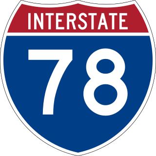
Interstate 78 (I-78) is a part of the Interstate Highway System that runs from Union Township, Lebanon County, Pennsylvania, to New York City. In the US state of New York, I-78 extends 0.5 miles (0.80 km). The entirety of I-78 consists of the Holland Tunnel, which crosses under the Hudson River from New Jersey and ends at an exit rotary in Lower Manhattan. The tunnel and its approaches are maintained by the Port Authority of New York and New Jersey (PANYNJ).

U.S. Highway 90 Business is a business route of U.S. Highway 90 located in and near New Orleans, Louisiana. It runs 14.25 miles (22.93 km) in a general east–west direction from US 90 in Avondale to a junction with Interstate 10 (I-10) and US 90 in the New Orleans Central Business District.

Loop 375 is a beltway that partially encircles the city of El Paso, Texas. The beltway is mostly a freeway, except for its northern section, which includes at-grade intersections. The highway passes through various areas of El Paso, funneling traffic within and around the city. The road is known locally under different names, as Woodrow Bean Transmountain Drive in the northern section, Purple Heart Memorial Freeway in the northeastern section, Joe Battle Boulevard in the eastern section, the César Chávez Border Highway in the southern section, and the Border West Expressway on the southwest section.
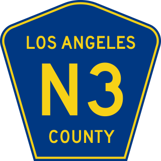
The Angeles Forest Highway is a 25-mile (40 km) road over the San Gabriel Mountains in Los Angeles County, California. It connects the Los Angeles Basin with the Antelope Valley and western Mojave Desert. Maintained by the Los Angeles County Department of Public Works, the highway is designated as County Route N-3 (CR N-3) or Forest Highway 59 (FH 59); the route numbers are unsigned, but noted on many maps.

In Alabama, Interstate 20 (I-20) travels 214.7 miles (345.5 km) through the center of the state. It enters the state from Mississippi near Cuba, and travels northeastward through Tuscaloosa and Birmingham. At Birmingham, I-20 turns eastward and heads through Oxford before crossing the Georgia state line near Lebanon. Other cities on the route include Livingston, Bessemer, and Pell City.

Acaste is a genus of extinct trilobite of the order Phacopida which lived throughout the Silurian period. Though many species had been included, it now has only one species, Acaste downingiae. It is characterized by a convex dorsal surface, an absence of spines, a shortening of the head-shield and a general rounding off of all angles.

The Elton B. Stephens Expressway, more commonly referred to locally as the Red Mountain Expressway, is a limited-access freeway serving as a north–south connection between Homewood and Mountain Brook south of Red Mountain with I-20/I-59 just to the northeast of downtown Birmingham. It was named for local businessman and philanthropist Elton Bryson Stephens, Sr., who chaired the Birmingham and Jefferson County Freeway and Expressway Committee. The expressway was largely built over the former path of 26th Street North and South. It runs through the Red Mountain Expressway Cut, designated a National Historic Landmark in 1987.

Brock Gap is a natural pass across Shades Mountain in Hoover, Alabama, most notable as being the location used by the South & North Railroad (S&N) to reach the Birmingham area in the late 19th century from the mineral deposits to the south, spurring economic development in the area.

The Birmingham metropolitan area, sometimes known as Greater Birmingham, is a metropolitan area in north central Alabama centered on Birmingham, Alabama, United States.
Highway revolts have occurred in cities and regions across the United States. In many cities, there remain unused highways, abruptly terminating freeway alignments, and short stretches of freeway in the middle of nowhere, all of which are evidence of larger projects which were never completed. In some instances, freeway revolts have led to the eventual removal or relocation of freeways that had been built.
The Delhi–Dehradun Expressway, also known as National Highway 72A (NH 72A), is an under-construction, 210 kilometres (130 mi) long, 12/6 lane access-controlled expressway, which will connect Delhi, the national capital of India, with Dehradun, the capital of the Indian state of Uttarakhand. It will pass through the states of Delhi, Uttar Pradesh and Uttarakhand, and will pass through the cities of Baghpat, Baraut, Shamli and Saharanpur. It will have two spurs, or link roads, to ensure connectivity with cities lying nearby to its route: one 50.7-kilometre-long (31.5 mi), six-lane Saharanpur–Roorkee–Haridwar Expressway, and another 121-kilometre-long (75 mi), six-lane Ambala–Shamli Expressway. It is being built at a cost of around ₹ 13,000 crore, and will reduce both travel time and distance, from around 5-6 hours to only 2.5 hours, and from around 280 kilometres (170 mi) to 210 kilometres (130 mi). It will be completed by January 2024. It connect to Char Dham Highway in Uttarakhand.

.JPG)