Reedness Junction railway station

Last updated

Reedness Junction
My photo of Reedness Junction in 2021.jpg
Reedness Junction in 2021
General information
Location Reedness, East Riding of Yorkshire
England
Coordinates 53°39′11″N0°51′00″W / 53.65311°N 0.84993°W / 53.65311; -0.84993 Coordinates: 53°39′11″N0°51′00″W / 53.65311°N 0.84993°W / 53.65311; -0.84993
Grid reference SE761180
Other information
StatusDisused
History
Original companyGoole and Marshland Light Railway
Pre-grouping Axholme Joint Railway
Post-groupingJoint LMS and LNER
Key dates
8 January 1900opened for goods
10 August 1903 [1] opened for passengers
17 July 1933closed

Reedness Junction railway station was a railway junction near Reedness, East Riding of Yorkshire, England on the Axholme Joint Railway. [2] Immediately to the west of the station, the Fockerby Branch, which continued eastwards, turned off from the main line to Epworth, which curved to the south. [3]

Contents

History

The Goole and Marshland Light Railway was one of the early lines to be authorised under the Light Railway Act of 1896, which was designed to ease the problems facing the building of rural railways. Four railways were authorised by the Light Railway Order of 16 August 1898, one from the Doncaster to Goole main line at Marshland Junction to Reedness, another from Reedness to Adlingfleet, a branch to Swinefleet and another to Luddington. The first was built as authorised, but the remainder were replaced by a line which followed the course of the second to Eastoft, and then ran to Fockerby via Luddington. [4]

Another Light Railway Order was obtained on 11 March 1899, for a line from Haxey Junction via Epworth and Crowle North to join the Goole and Marshland Railway at Reedness Junction. Both railways negotiated with the North Eastern Railway in January 1900, and the larger company agreed to take over the lines. [5] The station was opened for goods traffic on 8 January 1900. A Directors' train, consisting of a contractor's engine and two open trucks, ran on 26 June 1900, and included a trial run to Crowle over the Isle of Axholme Light Railway line. Another inspection, on behalf of the North Eastern Railway before purchasing the line, passed through the station and along the Fockerby Branch to Luddington, as the final section to Garthorpe, later renamed as Fockerby station, had not been completed. Eastoft station was noted to be complete, and the inspector expected Reedness Junction, Luddington and Garthorpe to be finished to a similar standard. [6]

The inspector recommended that a 5,000-imperial-gallon (23,000 L) water tank should be installed at Reedness, with a petroleum gas-engine capable of filling it in two hours, and two water columns, one to fill locomotives on the main line and another in the sidings. He also noted that there was no signalling, but he expected the company to install such equipment as the Board of Trade required. [7]

When the takeover of both lines occurred at the beginning of 1903, the North Eastern Railway was acting jointly with the Lancashire and Yorkshire Railway, and the line became the Axholme Joint Railway, although its official title from 17 February 1904 was the Isle of Axholme Joint Railway (NE and L&Y Joint). The Goole and Marshland line and the Isle of Axholme Light Railway line from Reedness to Crowle were opened for passengers and goods traffic on 10 August 1903, with the line southwards to Haxey Junction following in January 1905, once it was completed. [8]

A 1914 Railway Clearing House junction diagram showing (left) railways in the vicinity of Reedness Junction Goole York Hillhouse RJD 83.jpg
A 1914 Railway Clearing House junction diagram showing (left) railways in the vicinity of Reedness Junction

As built, the junction was to the west of the station, which had two platforms, one on the main line and another on the Fockerby Branch. There were sidings to the north of the single lines, accessible from the Fockerby Branch, and a loop just beyond the sidings. The station master's house was situated between the two lines, and there were wooden buildings used as a signal cabin and a ticket office. A water tank supported by a tall brick tower was located to the north of the sidings. It fed three water columns, and was supplied by a pumping station at Shipcote Drain, 1.25 miles (2 km) from the station. The connecting pipe was 2 inches (5 cm) in diameter and was not always adequate. A second tank was erected near the pumping station, but after consideration, the cost of replacing the pipe with a 4-inch (10 cm) one was not thought to be justified. [9]

The railway company held a heated debate in 1906, when Colonel Thompson requested permission for a group of about 16 female potato pickers to be allowed to walk from the station through Reedness Goods Yard, and then cross over Swinefleet Warping Drain by walking along the main line of the railway. His request was to reduce the distance that the ladies had to walk to work each day, and was granted, although the Colonel had to indemnify the railway against claims if any of them were involved in an accident while following this route. [10]

There is some doubt as to the name of the station, as the Railway Clearing House map and some tickets showed it as Reedness, while NER promotional materials and other tickets showed it as Reedness Jct. There is no evidence for a station nameboard, and consequently no photographic evidence either. Traffic was sparse, since the village of Swinefleet was 3 miles (4.8 km) away, and Reedness was 4 miles (6.4 km). [11]

The station closed after the last passenger service on 15 July 1933. The line through the station remained open for goods traffic until 1965. [12] Despite its name, the junction and station were in the adjacent parish of Swinefleet, although both the Fockerby Branch and the main line to Epworth passed through the parish of Reedness to the east of the station. [13]

Preceding station Disused railways Following station
Goole
Line closed, station open
  Axholme Joint Railway   Eastoft
Line and station closed
   Crowle North
Line and station closed

Bibliography

Related Research Articles

<span class="mw-page-title-main">North Lincolnshire</span> Unitary authority and borough in England

North Lincolnshire is a unitary authority area in Lincolnshire, England, with a population of 167,446 in the 2011 census. The borough includes the towns of Scunthorpe, Brigg, Haxey, Crowle, Epworth, Bottesford, Kirton in Lindsey and Barton-upon-Humber. North Lincolnshire is part of the Yorkshire and Humber region.

<span class="mw-page-title-main">Epworth, Lincolnshire</span> Town and civil parish in Lincolnshire, England

Epworth is a town and civil parish in the Isle of Axholme, North Lincolnshire, England. The town lies on the A161, about halfway between Goole and Gainsborough. As the birthplace of John Wesley and Charles Wesley, it has given its name to many institutions associated with Methodism. Their father, Samuel Wesley, was the rector from 1695 to 1735.

<span class="mw-page-title-main">Crowle, Lincolnshire</span> Town in North Lincolnshire, England

Crowle is a market town in the civil parish of Crowle and Ealand, on the Isle of Axholme in North Lincolnshire, England. The civil parish had a population at the 2011 census of 4,828. The town lies on the Stainforth and Keadby Canal.

<span class="mw-page-title-main">Axholme Joint Railway</span> Successor to the Goole and Marshland Railway and Axholme Light Railway

The Axholme Joint Railway was a committee created as a joint enterprise between the Lancashire and Yorkshire Railway (L&Y) and the North Eastern Railway (NER) and was established by the North Eastern Railway Act of 31 July 1902. It took over the Goole and Marshland Railway, running from Marshland Junction near Goole to Reedness Junction and Fockerby, and the Isle of Axholme Light Railway, running from Reedness Junction to Haxey Junction. Construction of the Goole and Marshland Railway had begun in 1898, and by the time of the takeover in early 1903, was virtually complete. The Isle of Axholme Light Railway was started in 1899, but only the section from Reedness Junction to Crowle was complete at the takeover. The northern section opened on 10 August 1903, and the line from Crowle to Haxey Junction opened for passengers on 2 January 1905.
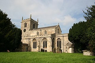
<span class="mw-page-title-main">Isle of Axholme</span> Region on the border of Lincolnshire and Yorkshire in England

The Isle of Axholme is a geographical area in England: a part of North Lincolnshire that adjoins South Yorkshire. It is located between the towns of Scunthorpe and Gainsborough, both of which are in the traditional West Riding of Lindsey, and Doncaster.

<span class="mw-page-title-main">Boothferry (district)</span> Former local borough in Yorkshire, England

The Borough of Boothferry was, from 1 April 1974 to 1 April 1996, a local government district with borough status within the non-metropolitan county of Humberside. The district is now split between the East Riding of Yorkshire and North Lincolnshire.

<span class="mw-page-title-main">Isle of Axholme Rural District</span>

Isle of Axholme was a rural district in Lincolnshire, Parts of Lindsey from 1894 to 1974. It was formed under the Local Government Act 1894 based on the Lincolnshire parts of the Thorne rural sanitary district and two parishes of the Goole RSD.

<span class="mw-page-title-main">Luddington, Lincolnshire</span> Village in North Lincolnshire, England

Luddington is a village, part of the civil parish of Luddington with Haldenby, on the Isle of Axholme in North Lincolnshire, England. The population of the civil parish at the 2011 census was 419. It is 6 miles (10 km) north-west from Scunthorpe, 6 miles south-east from Goole and 18 miles (29 km) north-east from Doncaster.
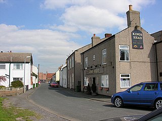
<span class="mw-page-title-main">Swinefleet</span> Village and civil parish in the East Riding of Yorkshire, England

Swinefleet is a village and civil parish in the East Riding of Yorkshire, England. It is situated approximately 2 miles (3.2 km) south-east of the town of Goole on the A161 road from Goole to Crowle. It lies on the south bank of the River Ouse. According to the 2011 UK census, Swinefleet parish had a population of 787, an increase on the 2001 UK census figure of 748. The main centre of population is at the extreme north of the parish, close to the River Ouse. The southern part of the parish is part of Swinefleet and Reedness Moors, and is characterised by drainage ditches and a few farm buildings.

Reedness is a village and civil parish in the East Riding of Yorkshire, England. It is situated approximately 3 miles (4.8 km) east of the town of Goole and lies on the south bank of the River Ouse.
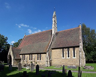
<span class="mw-page-title-main">Eastoft</span> Village and civil parish in North Lincolnshire, England

Eastoft is a village and civil parish in North Lincolnshire, England. It is situated within the Isle of Axholme, 3 miles (5 km) north-east from Crowle, and on the A161 road.
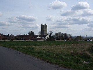
<span class="mw-page-title-main">Haxey</span> Town in North Lincolnshire, England

Haxey is a town and civil parish on the Isle of Axholme in North Lincolnshire, England. It is directly south of Epworth, south-west of Scunthorpe, north-west of Gainsborough, east of Doncaster and north-west of Lincoln, with a population of 4,584 at the 2011 census. The town was regarded as the historic capital of the Isle of Axholme.

Garthorpe is a village in North Lincolnshire, England. It is situated approximately 8 miles (13 km) south-east from Goole, 1 mile (1.6 km) west from the River Trent, and in the Isle of Axholme. Together with Fockerby, which is contiguous with the village, Garthorpe forms a civil parish of about 500 inhabitants, measured as 418 in the 2011 census.

<span class="mw-page-title-main">Haxey and Epworth railway station</span> Former railway station in Lincolnshire, England

Haxey and Epworth railway station served the towns of Haxey and Epworth on the Isle of Axholme, Lincolnshire, England. It closed to passengers in 1959 and completely in 1964.

<span class="mw-page-title-main">Haxey Junction railway station</span> Former railway station in England

Haxey Junction railway station was a station south of the town of Haxey, on the Isle of Axholme in Lincolnshire, England. It was the terminus of the Axholme Joint Railway which ran from Marshland Junction near Goole, and was adjacent to Haxey and Epworth station on the Great Northern and Great Eastern Joint Railway line which ran from Doncaster to Lincoln. Both stations are now closed, although the former Great Northern and Great Eastern Joint Railway line is still operational.

<span class="mw-page-title-main">Crowle North railway station</span> Railway station in Crowle, Lincolnshire, England

Crowle North railway station, officially known as Crowle railway station, was a station that served the market town of Crowle, on the Isle of Axholme in Lincolnshire, England on the Axholme Joint Railway. The North designation was used to avoid confusion with Crowle railway station on a neighbouring line.

<span class="mw-page-title-main">Eastoft railway station</span> Railway station in Eastoft, Lincolnshire, England

Eastoft railway station was a station in Eastoft, Lincolnshire on the Axholme Joint Railway.

The Bawtry to Haxey railway line was a line built on the border of Nottinghamshire, Lincolnshire and Yorkshire, opening in 1912. It was part of an earlier scheme to convey coal from a new colliery at Tickhill to Grimsby for export. After authorisation, its promoters did not proceed with construction, and when the South Yorkshire Joint Railway was built, serving Tickhill and other developing pits, that line was a better outlet for the minerals and the promoters lost interest in the Tickhill line.

<span class="mw-page-title-main">Swinefleet Warping Drain</span> Artificial waterway in the East Riding of Yorkshire, England

Swinefleet Warping Drain is an artificial waterway in the English county of the East Riding of Yorkshire, which was built to allow silt to be deposited on the peat moors, but now functions as a land drainage channel. It was constructed by Ralph Creyke, and the first section was completed in 1821.

References

  1. Passenger Railway Stations by M.Quick page 360
  2. British Railways Atlas. 1947. p. 16
  3. Booth 1998 , p. 4
  4. Judge 1994 , pp. 5, 9
  5. Judge 1994 , p. 16
  6. Judge 1994 , pp. 23–25
  7. Judge 1994 , p. 26
  8. Judge 1994 , pp. 53–57
  9. Judge 1994 , pp. 68–74
  10. Judge 1994 , p. 68
  11. Judge 1994 , p. 68
  12. Historic England. "Axholme Joint Railway (59202)". Research records (formerly PastScape). Retrieved 23 May 2011.
  13. Ordnance Survey, 1:25,000 map, 2006