
An unincorporated area is a region not governed by a local municipal corporation. Similarly, an unincorporated community is a settlement not governed by its own local municipal corporation, but is administered as part of larger administrative divisions, such as a township, parish, borough, county, city, canton, state, province, or country. Occasionally, municipalities dissolve or disincorporate, which may happen if they become fiscally insolvent, and services become the responsibility of a higher administration. Widespread unincorporated communities and areas are a distinguishing feature of the United States and Canada. Most other countries of the world have either no unincorporated areas at all, or these are very rare; typically remote, outlying, sparsely populated, or uninhabited areas.

Matatiele is a town located in the northern part of the Eastern Cape Province of South Africa. According to the South African National Census of 2011, its 12,466 residents and 4,107 households make Matatiele the largest populated town in the Matatiele Local Municipality.

Edenvale is a small city on the East Rand in Gauteng, South Africa. The greater Edenvale area has an estimated population of 70,000, including Greenstone, Harmelia, Highway Gardens, Buurendal and Croydon. Edenvale is part of the Ekurhuleni Metropolitan Municipality. It lies about halfway between the O.R. Tambo International Airport and the Johannesburg city centre and is located 12 km by road from Sandton and about 9 km from the closest Gautrain station.

Matzikama Local Municipality is a local municipality which governs the northernmost part of the Western Cape province of South Africa, including the towns of Vredendal, Vanrhynsdorp, Klawer and Lutzville, and the surrounding villages and rural areas. As of 2011 it had a population of 67,147. It forms part of the West Coast District Municipality, and has municipality code WC011.

Riverbend is a suburb of Johannesburg, South Africa. It is located in Region B of the City of Johannesburg Metropolitan Municipality.
Ivory Park is a densely populated residential area in the Gauteng province of South Africa. It is located in Region 2 of the City of Johannesburg.
Mayfair is a suburb of Johannesburg, South Africa. The suburb is west of the Johannesburg CBD and is adjacent to Fordsburg. It is located in Region F of the City of Johannesburg Metropolitan Municipality.
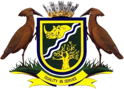
Vhembe is one of the 5 districts of Limpopo province of South Africa. It is the northernmost district of the country and shares its northern border with Beitbridge district in Matabeleland South, Zimbabwe and on the east with Gaza Province in Mozambique. Vhembe consist of all territories that were part of the former Venda Bantustan, however, two large densely populated districts of the former Tsonga homeland of Gazankulu, in particular, Hlanganani and Malamulele were also incorporated into Vhembe, hence the ethnic diversity of the District. The seat of Vhembe is Thohoyandou, the capital of the former Venda Bantustan. According to 2011 census, the majority of Vhembe residents, about 800,000, speak TshiVenda as their mother language, while 400,000 speak Xitsonga as their home language. However, the Tsonga people are in majority south of Levubu River and they constitute more than 85% of the population in the south of the historic river Levubu, while the Venda are the minority south of Levubu, at 15%. The Northern Sotho speakers number 27,000. The district code is DC34.

In geography, statistics and archaeology, a settlement, locality or populated place is a community in which people live. The complexity of a settlement can range from a small number of dwellings grouped together to the largest of cities with surrounding urbanized areas. Settlements may include hamlets, villages, towns and cities. A settlement may have known historical properties such as the date or era in which it was first settled, or first settled by particular people.

Mier was a local municipality within the ZF Mgcawu District Municipality in the Northern Cape province of South Africa. Its area includes the South African portion of one of the world's largest conservation areas, the Kgalagadi Transfrontier Park. The main settlement in the municipality is the town of Rietfontein.

The distribution of white South Africans is fairly evenly spread. They currently make up 8-9% of the total population and are around 4.5–5 million. They are found in large numbers in practically every province in South Africa but always as a minority. They are high in concentration in large cities.

Matatiele Local Municipality is a Category B municipality located in the Alfred Nzo District of Eastern Cape in South Africa. It adjoins Lesotho to the north, Elundini to the south-west, and Greater Kokstad to the east and its 4,352 km² makes the Matatiele Local Municipality largest of four municipalities in the district at almost half of its geographical area. [1]

Greater Kokstad Local Municipality is an administrative area in the Harry Gwala District of KwaZulu-Natal in South Africa. Kokstad is derived from Dutch, and it means "town of Kok". It was named after Adam Kok III.

Ntabankulu Local Municipality is a local municipality in Alfred Nzo District Municipality in the Wild Coast Region of the Eastern Cape Province in South Africa.
Islington is a settlement in the Ehlanzeni District Municipality in the Mpumalanga Province of South Africa. It is located east of Acornhoek.
Coronation is a populated place in the Emalahleni Local Municipality, Nkangala District Municipality in the Mpumalanga Province of South Africa.

Lehlaka Park is a populated place in the Emalahleni Local Municipality of the Nkangala District Municipality in the Mpumalanga Province of South Africa.
Ikageng is a populated place in the Emalahleni Local Municipality of the Nkangala District Municipality in the Mpumalanga Province of South Africa.
Landau Colliery is a populated place in the Emalahleni Local Municipality of the Nkangala District Municipality in the Mpumalanga Province of South Africa.
Springbok is a populated place in the Emalahleni Local Municipality of the Nkangala District Municipality in the Mpumalanga Province of South Africa.

