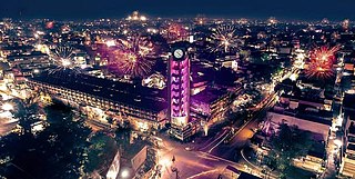
Jalgaon is a city in Maharashtra, India. The city is located in North Maharashtra in the subregion of Khandesh, and serves as the administrative headquarters of its namesake district, the Jalgaon district. Situated on Asian Highway 53 and 76.3 Km from 'Ajanta Caves'.
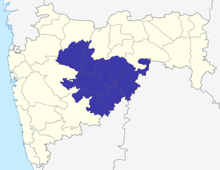
Marathwada is a proposed state and geographical region of the Indian state of Maharashtra. It was formed during the Nizam's rule and was part of the then Hyderabad State. The region coincides with the Aurangabad division of Maharashtra. It borders the states of Karnataka and Telangana, and it lies to the west of the Vidarbha and east of Uttar Maharashtra regions of Maharashtra. The largest city of Marathwada is Aurangabad. Its people speak Marathi and Deccani Urdu.

Nanded is a city in Maharashtra state, India. It is the tenth largest city in the state and the seventy-ninth most populated city in India. It is the second largest city in Marathwada region. It is the district headquarters of Nanded district.

Osmanabad District, officially known as Dharashiv District, is an administrative district in the Marathwada region in the Indian state of Maharashtra. The district headquarter is located at Osmanabad. The District of Osmanabad derives its name from the last ruler of Hyderabad, the 7th Nizam, Mir Osman Ali Khan, of which the region was a part till 1947. This region was earlier part of The Hyderabad State until Independence.This primarily rural district occupies an area of 7,569 km2 (2,922 sq mi) of which 241.4 km2 (93.2 sq mi) is urban and has a population of 1,657,576 of which 16.96% were urban.
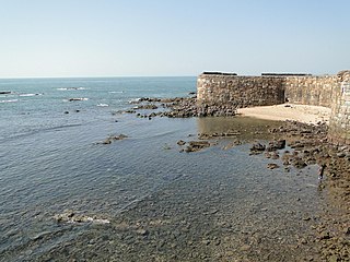
Sindhudurg district is an administrative district of the Konkan division in India, which was carved out of the erstwhile Ratnagiri district. The district headquarters are located at Oros. The district occupies an area of approximately 5,207 km2 and has a population of 849,651, of which 12.59% were urban. As of 2011, it is the least populous district of Maharashtra.
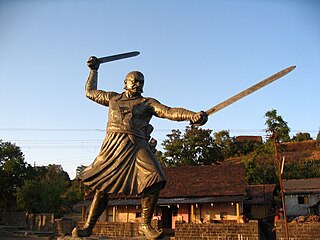
Kolhapur district is a district in the Maharashtra state of India. The city of Kolhapur is its district headquarter. It is situated near Panchaganga river.
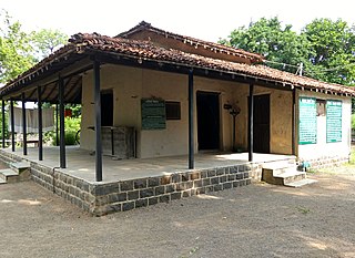
Wardha District is in the state of Maharashtra in western India. This district is a part of Nagpur Division. The city of Wardha is the administrative headquarter of the district. Hinganghat, Pulgaon, Arvi and Wardha are the major cities in the District. The District had a population of 1,300,774, of which 26.28% were urban as of 2011.

Osmanabad, officially known as Dharashiv, is a city and a municipal council in Osmanabad district in the Indian state of Maharashtra. The city is the administrative headquarter of Osmanabad district. It is the seventh largest city in Marathwada, and the 39th largest city in Maharashtra by population.

Latur district is a district in Maharashtra state of India. Latur city is the district headquarters and is the 16th largest city in the state of Maharashtra. The district is primarily agricultural. Urban population comprises 25.47% of the total population.
Udgir is the second largest city in Latur district and Municipal Corporation of the Indian state of Maharashtra. It is located in the Marathwada division of the state. The city is located very close to the borders of Karnataka and Telangana states. Udgir is home to the historical Udgir Fort. The town and nearby villages rely mainly on agriculture, which serves as a major source of income for the population. Udgir city is proposed to be become district, Before independence Udgir was a part of Bidar District Hyderabad kingdom under the rule of Nizam Asifjah VI, After integration of Hyderabad kingdom into India it became part of Osmanabad district Now it is part of Latur District
Deoni is a town and administrative centre of Deoni Taluka in Latur subdivision of Latur district in the Indian state of Maharashtra. Deoni has a total area of 415.32 km2.
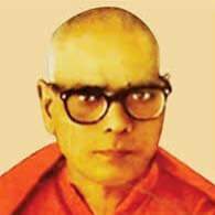
Swami Ramanand Tirtha was an Indian politician, freedom fighter, educator and social activist who led the Hyderabad liberation struggle during the reign of Osman Ali Khan, the last Nizam of Hyderabad State. Swami Ramanand Tirtha was the principal leader of the Hyderabad State Congress. Before taking Sanyasa, his family name was Vyenkatesh Bhagvanrao Khedgikar.

Latur is a city and Tehsil place in Latur district in the Maharashtra state of India,Before 1982 city is a part of Osmanabad district. The city is a tourist hub surrounded by many historical monuments Kharosa Caves. The most spoken language in Latur is Marathi. The city's quality of education attracts students from all over Maharashtra. It is a drought prone area with acute water shortage in its city and rural areas. The economy is agriculture intensive, but in recent years is also dependent on Educational sector and its allied activities. Industrial development is minimal in the district. Latur is 43 kilometers from the epicenter of the devastating 1993 Latur earthquake.

Ahmedpur is a constituency of the Maharashtra Legislative Assembly, in Maharashtra, India. It is in Latur district and is a part of Latur Lok Sabha constituency.
Latur Taluka is an administrative subdivision (taluka) of Latur District in Maharashtra, India.

Marathwada Liberation Day, also known as Marathwada Mukti Sangram Din, is celebrated in Maharashtra on 17 September annually. It marks the anniversary of Marathwada's integration with India when the Indian military, liberated State of Hyderabad, and defeated the Nizam on 17 September 1948, 13 months after Indian independence.
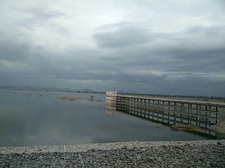
Mancherial district is a district located in the northern region of the Indian state of Telangana. The district comprises 18 mandals and two revenue divisions – Mancherial and Bellampalli. The district headquarters is located at Mancherial town. It is surrounded by Komaram Bheem, Nirmal, Jagtial, Peddapalli and Bhupalpally districts of Telangana and with Maharashtra state.
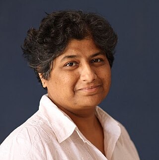
Meena Seshu is an activist for sex workers' rights. She is the founder of the non-governmental organisation (NGO) SANGRAM which is aimed at empowering sex workers. She created Veshya Anyay Mukti Parishad (VAMP), a collective of people in sex work. Seshu is based in Sangli, Maharashtra,and SANGRAM and VAMP work in Maharashtra and Karnataka.
National Highway 548B, commonly referred to as NH 548B is a national highway in India. It is a spur road of National Highway 48. NH-548B traverses the states of Maharashtra and Karnataka in India.

Ramesh Kashiram Karad, commonly known as Ramesh Appa Karad, is an Indian politician from Maharashtra state and a member of Maharashtra Legislative Council from Bharatiya Janata Party and district president of Bharatiya Janata Party Latur.


