| ||||
|---|---|---|---|---|
| Route information | ||||
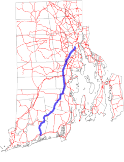
| Length | 3.1 mi [1] (5.0 km) | |||
| Major junctions | ||||
| South end | ||||
| North end | ||||
| Location | ||||
| Counties | Providence | |||
| Highway system | ||||
| ||||

Route 128 is a 3.1 miles (5.0 km) state highway in the U.S. state of Rhode Island. The highway links U.S. Route 6A (US 6A), US 6 and US 44.
A state highway, state road, or state route is usually a road that is either numbered or maintained by a sub-national state or province. A road numbered by a state or province falls below numbered national highways in the hierarchy. Roads maintained by a state or province include both nationally numbered highways and un-numbered state highways. Depending on the state, "state highway" may be used for one meaning and "state road" or "state route" for the other.

Rhode Island, officially the State of Rhode Island and Providence Plantations, is a state in the New England region of the United States. It is the smallest state in area, the seventh least populous, the second most densely populated, and it has the longest official name of any state. Rhode Island is bordered by Connecticut to the west, Massachusetts to the north and east, and the Atlantic Ocean to the south via Rhode Island Sound and Block Island Sound. It also shares a small maritime border with New York. Providence is the state capital and most populous city in Rhode Island.
U.S. Route 6 (US 6) is a major east–west road in the U.S. state of Rhode Island. Nationally, the route continues west to Bishop, California and east to Provincetown, Massachusetts. In western Rhode Island, it forms part of one of several routes between Hartford, Connecticut and Providence, Rhode Island, and was planned to be replaced by Interstate 895. The part of I-895 that was built, from Interstate 895 to Olneyville, is now part of US 6. At Olneyville, US 6 joins Route 10 and heads east towards downtown Providence, where it turns south on Interstate 95 and east on Interstate 195. US 6 splits from I-195 in East Providence, crossing into Massachusetts on Warren Avenue. The whole route of US 6 is a state highway maintained by the Rhode Island Department of Transportation.