Richton Park, Illinois

Last updated

Village of Richton Park
Richton park welcome sign.png
Richton Park welcome sign
Richton Park Seal.png
Motto(s): 
"Proud Past; Bright Future"
Cook County Illinois Incorporated and Unincorporated areas Richton Park Highlighted.svg
Location of Richton Park in Cook County, Illinois.
Illinois in United States (US48).svg
Location of Illinois in the United States
Coordinates: 41°28′55″N87°43′31″W / 41.48194°N 87.72528°W / 41.48194; -87.72528
CountryUnited States
StateIllinois
County Cook
Township Rich
Area
[1]
  Total4.40 sq mi (11.41 km2)
  Land4.39 sq mi (11.37 km2)
  Water0.01 sq mi (0.03 km2)
Population
 (2020)
  Total12,775
  Density2,908.70/sq mi (1,123.08/km2)
Time zone UTC-6 (CST)
  Summer (DST) UTC-5 (CDT)
ZIP Code(s)
60471, 60443
Area code 708
FIPS code 17-63706
Wikimedia CommonsRichton Park, Illinois
Website www.richtonpark.org

Richton Park is a village and a south suburb of Chicago in Cook County, Illinois, United States. The population was 12,775 at the 2020 census. [2]

Contents

History

Richton Park sits along the Sauk Trail, a major trail used by the several Native American tribes for travel. By the 1840s German migrants settled in the area and created a small farming community.

The village was named after a Richton in Vermont, the native home of a first settler. [3]

On the evening of June 7, 2008, an EF2 tornado went through portions of Richton Park, damaging homes and businesses. [4]

Geography

Richton Park is located at 41°28′55″N87°43′31″W / 41.48194°N 87.72528°W / 41.48194; -87.72528 (41.481992, -87.725352). [5]

The village is bordered by Matteson to the north, Park Forest to the east, and University Park to the south.

According to the 2021 census gazetteer files, Richton Park has a total area of 4.40 square miles (11.40 km2), of which 4.39 square miles (11.37 km2) (or 99.73%) is land and 0.01 square miles (0.03 km2) (or 0.27%) is water. [6]

Demographics

Historical population
CensusPop.Note
1930 137
1940 107−21.9%
1950 232116.8%
1960 933302.2%
1970 2,558174.2%
1980 9,403267.6%
1990 10,52311.9%
2000 12,53319.1%
2010 13,6468.9%
2020 12,775−6.4%
U.S. Decennial Census [7]
2010 [8] 2020 [9]

As of the 2020 census [10] there were 12,775 people, 5,244 households, and 3,298 families residing in the village. The population density was 2,900.77 inhabitants per square mile (1,119.99/km2). There were 5,487 housing units at an average density of 1,245.91 per square mile (481.05/km2). The racial makeup of the village was 6.64% White, 86.61% African American, 0.28% Native American, 0.78% Asian, 0.01% Pacific Islander, 1.80% from other races, and 3.87% from two or more races. Hispanic or Latino of any race were 4.24% of the population.

There were 5,244 households, out of which 25.6% had children under the age of 18 living with them, 36.78% were married couples living together, 20.50% had a female householder with no husband present, and 37.11% were non-families. 35.87% of all households were made up of individuals, and 15.24% had someone living alone who was 65 years of age or older. The average household size was 3.32 and the average family size was 2.52.

The village's age distribution consisted of 19.6% under the age of 18, 14.8% from 18 to 24, 20.1% from 25 to 44, 32% from 45 to 64, and 13.6% who were 65 years of age or older. The median age was 42.1 years. For every 100 females, there were 94.5 males. For every 100 females age 18 and over, there were 87.4 males.

The median income for a household in the village was $63,777, and the median income for a family was $82,208. Males had a median income of $49,393 versus $43,399 for females. The per capita income for the village was $28,756. About 8.3% of families and 11.4% of the population were below the poverty line, including 8.6% of those under age 18 and 25.1% of those age 65 or over.

Richton Park village, Illinois – Racial and ethnic composition
Note: the US Census treats Hispanic/Latino as an ethnic category. This table excludes Latinos from the racial categories and assigns them to a separate category. Hispanics/Latinos may be of any race.
Race / Ethnicity (NH = Non-Hispanic)Pop 2010 [8] Pop 2020 [9] % 2010% 2020
White alone (NH)1,54380411.31%6.29%
Black or African American alone (NH)11,15610,98881.75%86.01%
Native American or Alaska Native alone (NH)12210.09%0.16%
Asian alone (NH)136941.00%0.74%
Pacific Islander alone (NH)810.06%0.01%
Some Other Race alone (NH)19340.14%0.27%
Mixed Race or Multi-Racial (NH)2952912.16%2.28%
Hispanic or Latino (any race)4775423.50%4.24%
Total13,64612,775100.00%100.00%

Education

Matteson School District 162 is headquartered in Richton Park and serves portions of the village. [11]

Elementary School District 159 serves portions of Richton Park.

Rich Township High School Fine Arts and Communications Campus and Southland College Preparatory Charter High School are the two public high schools that serve Richton Park, both schools are located in the village.

The Richton Park Public Library District has served the village since 1972.

Transportation

The Richton Park station provides Metra commuter rail service along the Metra Electric District. Trains travel north to Millennium station in Chicago, and south to University Park station. [12]

Notable places

Government

Richton Park is in Illinois's 2nd congressional district.

Related Research Articles

<span class="mw-page-title-main">Broadview, Illinois</span> Village in Illinois, United States

Broadview is a village in Cook County, Illinois, 12 miles (19 km) west of downtown Chicago. As of the 2020 census it had a population of 7,998.

<span class="mw-page-title-main">Calumet Park, Illinois</span> Village in Illinois, United States

Calumet Park is a village in Cook County, Illinois. The population was 7,025 at the 2020 census.

<span class="mw-page-title-main">Country Club Hills, Illinois</span> City in Illinois, United States

Country Club Hills is a city in Cook County, Illinois, United States. It is a suburb and south of Chicago. The population was 16,775 at the 2020 census.

<span class="mw-page-title-main">Flossmoor, Illinois</span> Village in Illinois, United States

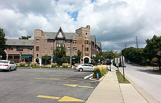
Flossmoor is a village in Cook County, Illinois, United States. The population was 9,704 at the 2020 census. Flossmoor is approximately 24 miles south of The Loop/Downtown Chicago. It is closely tied to neighboring Homewood, sharing a high school and park district.

<span class="mw-page-title-main">Ford Heights, Illinois</span> Village in Illinois, United States

Ford Heights is a village and a suburb of Chicago in Cook County, Illinois, United States. The population was 1,813 at the 2020 census. Many of the area’s first settlers were African American and since its incorporation in 1949 the village has remained predominantly Black. Due to the lack of commercial activity and financial stability, the village has declined over the years. Urban renewal efforts were attempted in the 1960s, although the village has continued to decline.

<span class="mw-page-title-main">Forest View, Illinois</span> Village in Illinois, United States

Forest View is a village in Cook County, Illinois, United States. Per the 2020 census, the population was 792. It is primarily an industrial corridor adjacent to the Chicago neighborhood of Garfield Ridge, which is on the village's southern border.

<span class="mw-page-title-main">Frankfort, Illinois</span> Village in Illinois, United States

Frankfort is a village in Will County and Cook County in the U.S. state of Illinois. It is a southern suburb of Chicago, and is approximately 28 miles south of the city. As of the 2020 census, the population was 20,296.

<span class="mw-page-title-main">Hanover Park, Illinois</span> Village in Illinois, United States

Hanover Park is a village in Cook and DuPage counties in the U.S. state of Illinois, a suburb of Chicago. The population was 37,470 at the 2020 census. Ontarioville is a neighborhood within the village.

<span class="mw-page-title-main">Indian Head Park, Illinois</span> Village in Illinois, United States

Indian Head Park is a village in Cook County, Illinois, United States, slightly north of the intersection of Interstate 294 and Interstate 55. The village is south of Western Springs, west of Countryside, north and east of Burr Ridge. Per the 2020 census, the population was 4,065. The village's ZIP code is 60525.

<span class="mw-page-title-main">La Grange Park, Illinois</span> Village in Illinois, United States

La Grange Park is a village in Cook County, Illinois, United States. According to the 2020 census, the population was 13,475.

<span class="mw-page-title-main">Lynwood, Illinois</span> Village in Illinois, United States

Lynwood is a village in Cook County, Illinois, United States and a suburb of Chicago. The population was 9,116 at the 2020 census.

<span class="mw-page-title-main">Matteson, Illinois</span> Village in Illinois, United States

Matteson is a village in Cook County, Illinois, United States. The population was 19,073 at the 2020 census. It is a suburb of Chicago.

<span class="mw-page-title-main">Merrionette Park, Illinois</span> Village in Illinois, United States

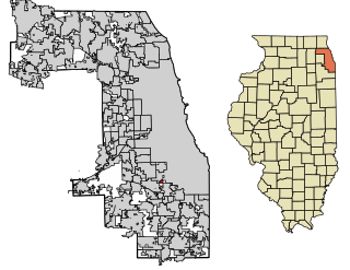
Merrionette Park is a village in Cook County, Illinois, United States. The population was 1,969 as of the 2020 census.

<span class="mw-page-title-main">Palos Park, Illinois</span> Village in Illinois, United States

Palos Park is a village in southwestern Cook County, Illinois, United States. Per the 2020 census, the population was 4,899.

<span class="mw-page-title-main">Park Forest, Illinois</span> Village in Illinois, United States

Park Forest is a village located south of Chicago in Cook County, Illinois, with a small southern portion in Will County, Illinois, United States. The village was originally designed by Loebl Schlossman & Bennett as a planned community for veterans returning from World War II. As of the 2020 census, the village had a population of 21,687.

<span class="mw-page-title-main">Stickney, Illinois</span> Village in Illinois, United States

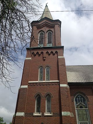
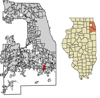
Stickney is a village in Cook County, Illinois, United States. The village is named for Alpheus Beede Stickney, a railroad executive who played a central role in establishing the Clearing Industrial District. Per the 2020 census, the population was 7,110. It was well known in the 1920s and early 1930s as the home for several bordellos linked to mobster Al Capone's empire.

<span class="mw-page-title-main">University Park, Illinois</span> Village in Illinois, United States

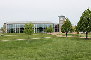
University Park is a village in Will County with a small portion in Cook County in the U.S. state of Illinois. It is a south suburb of Chicago. The village is one of the region's few planned communities; it was developed in the 1960s as Wood Hill, then Park Forest South, and finally University Park. Governors State University was established in the village in 1969. The village population was 7,145 at the 2020 census.

<span class="mw-page-title-main">Indian Creek, Illinois</span> Village in Illinois, United States

Indian Creek is a village in Vernon Township, Lake County, Illinois, United States. It is part of the Chicago metropolitan area. Per the 2020 census, the population was 536. Police services are provided by Lake County Sheriff and fire/EMS services by the Countryside Fire Protection District.

<span class="mw-page-title-main">Frankfort Square, Illinois</span> Census-designated place in Illinois, United States

Frankfort Square is a census-designated place (CDP) in Will County, Illinois, United States. Per the 2020 census, the population was 8,968.

<span class="mw-page-title-main">Rich Township, Cook County, Illinois</span> Township in Illinois, United States

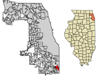
Rich Township is one of 29 townships in Cook County, Illinois, United States located south of Chicago. As of the 2020 census, its population was 76,138. Richton Park serves as the governmental seat for the township.

References

  1. "2020 U.S. Gazetteer Files". United States Census Bureau. Retrieved March 15, 2022.
  2. "Quick factS: Richton Park village, Illinois". U.S. Census Bureau. Retrieved October 4, 2021.
  3. Illinois Central Magazine. Illinois Central Railroad Company. 1922. p. 45.
  4. "June 7, 2008 Severe Weather Event".
  5. "US Gazetteer files: 2010, 2000, and 1990". United States Census Bureau. February 12, 2011. Retrieved April 23, 2011.
  6. Bureau, US Census. "Gazetteer Files". Census.gov. Retrieved June 29, 2022.
  7. "Decennial Census of Population and Housing by Decades". US Census Bureau.
  8. 1 2 "P2 Hispanic or Latino, and Not Hispanic or Latino by Race – 2010: DEC Redistricting Data (PL 94-171) - Richton Park village, Illinois". United States Census Bureau .
  9. 1 2 "P2 Hispanic or Latino, and Not Hispanic or Latino by Race – 2020: DEC Redistricting Data (PL 94-171) - Richton Park village, Illinois". United States Census Bureau .
  10. "Explore Census Data". data.census.gov. Retrieved June 28, 2022.
  11. "Home page Archived 2013-04-15 at archive.today . Matteson School District 162. Retrieved on December 8, 2012. "4601 Sauk Trail, Richton Park, IL 60471"
  12. "RTA System Map" (PDF). Retrieved February 1, 2024.