
Maiden Castle is an Iron Age hill fort 1.6 miles (2.6 km) south west of Dorchester, in the English county of Dorset. Hill forts were fortified hill-top settlements constructed across Britain during the Iron Age.

Durrington Walls is the site of a large Neolithic settlement and later henge enclosure located in the Stonehenge World Heritage Site in England. It lies 2 miles (3.2 km) north-east of Stonehenge in the parish of Durrington, just north of Amesbury.
Hambledon Hill is a prehistoric hill fort in Dorset, England, situated in the Blackmore Vale five miles northwest of Blandford Forum. The hill itself is a chalk outcrop, on the southwestern corner of Cranborne Chase, separated from the Dorset Downs by the River Stour. It is owned by the National Trust.

Badbury Rings is an Iron Age hill fort in east Dorset, England. It was in the territory of the Durotriges. In the Roman era a temple was located immediately west of the fort, and there was a Romano-British town known as Vindocladia a short distance to the south-west.

Hod Hill is a large hill fort in the Blackmore Vale, 3 miles (5 km) north-west of Blandford Forum, Dorset, England. The fort sits on a 143 m (469 ft) chalk hill of the same name that lies between the adjacent Dorset Downs and Cranborne Chase. The hill fort at Hambledon Hill is just to the north. The name probably comes from Old English "hod", meaning a shelter, though "hod" could also mean "hood", referring to the shape of the hill.

Dunkery Beacon at the summit of Dunkery Hill is the highest point on Exmoor and in Somerset, England. It is also the highest point in southern England outside of Dartmoor.

Yarnbury Castle is the site of a multiphase, multivallate Iron Age hillfort near the village of Steeple Langford, Wiltshire, England. The site covers an area of 28.5 acres (11.5 ha), and was extensively surveyed and investigated by the Royal Commission on the Historical Monuments of England in 1991, with finds of Iron Age and Romano-British pottery, Iron Age and Roman coins, and burials of human remains. There is much evidence of prolonged and extensive settlement of the site, including evidence of around 130 structures of various sizes, most probably representing a mix of round houses, pits, and other features.
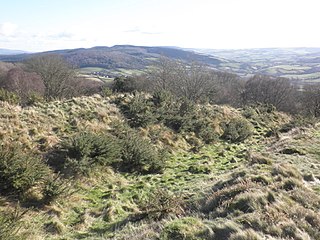
Bury Castle is an Iron Age hill fort near Selworthy, Somerset, England. It has been scheduled as an ancient monument.

The Cerne Abbas Giant is a hill figure near the village of Cerne Abbas in Dorset, England. 55 metres (180 ft) high, it depicts a standing nude male figure with a prominent erection and wielding a large club in its right hand. Like many other hill figures it is outlined by shallow trenches cut in the turf and backfilled with chalk rubble. The figure is listed as a scheduled monument of England and the site is owned by the National Trust.

Ladle Hill is a 10.5-hectare (26-acre) biological Site of Special Scientific Interest west of Kingsclere in Hampshire. It is also a Scheduled Monument.

Scratchbury Camp is the site of an Iron Age univallate hillfort on Scratchbury Hill, overlooking the Wylye valley about 1km northeast of the village of Norton Bavant in Wiltshire, England. The fort covers an area of 37 acres (15 ha) and occupies the summit of the hill on the edge of Salisbury Plain, with its four-sided shape largely following the natural contours of the hill.

Cholesbury Camp is a large and well-preserved Iron Age hill fort on the northern edge of the village of Cholesbury in Buckinghamshire, England. It is roughly oval-shaped and covers an area, including ramparts, of 15 acres (6.1 ha), and measures approximately 310 m (1,020 ft) north-east to south-west by 230 m (750 ft) north-west to south-east. The interior is a fairly level plateau which has been in agricultural use since the medieval period. The hill fort is now a scheduled ancient monument.

At 258 metres, Bell Hill is one of the highest hills in the county of Dorset, England and a high point on the Wessex Ridgeway.
Castle Rings is a univallate hill fort in the parish of Donhead St Mary in Wiltshire in England. The fort is a Scheduled Ancient Monument, with a list entry identification number of 1005698. Castle Rings has been dated to the Iron Age and is situated at an altitude of 228 metres (748 ft) upon Upper Greensand sandstone beds. The main bulk of the fort enclosure lies within the boundaries of Donhead St Mary parish but some of the outlying earthworks are situated in the neighbouring Sedgehill and Semley parish. In the mid-1980s a metal detectorist unearthed a hoard of stater coins of the Durotriges tribe within the hill fort.

Trevelgue Head, also known as Porth Island, is a headland a short distance north-east of Newquay, in Cornwall, England. It is adjacent to Porth and is at the eastern end of Newquay Bay.

The Walton Common banjo enclosure is a banjo enclosure on Walton Common, to the north of Walton in Gordano, Somerset, England. It appears to date to the late Iron Age, and may have been a high-status settlement. The term "banjo" refers to the shape. It is a round enclosure approached by a straight avenue, with the enclosure and avenue bounded by banks and ditches. The banks have been worn down and the ditches filled in over time, so it is scarcely noticeable from the ground. It showed up on photographs from the air taken in 1930 and 1946. Since then the site has become more overgrown and is hard to detect even from the air.

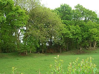
Wraxall Camp, or Failand Camp, is a small round earthwork in Somerset. The remains are indistinct and thickly covered by woods, but it appears to have been an Iron Age farmstead, and not a defensive structure.

Chalbury Hillfort is an Iron Age hillfort about 1 mile (1.6 km) south-east of the village of Bincombe in Dorset, England.

Cadson Bury is an Iron Age hillfort about 2 miles (3.2 km) south-west of Callington, in Cornwall, England.

Buzbury Rings is an Iron Age hillfort about 2 miles (3.2 km) east of Blandford Forum and 1 mile (1.6 km) northwest of the village of Tarrant Keyneston, in Dorset, England.


