References
- ↑ U.S. Geological Survey Geographic Names Information System: Rio, Georgia
- ↑ Krakow, Kenneth K. (1975). Georgia Place-Names: Their History and Origins (PDF). Macon, GA: Winship Press. p. 189. ISBN 0-915430-00-2.
Municipalities and communities of Spalding County, Georgia, United States | ||
|---|---|---|
| Cities | 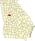 | |
| Town | ||
| CDPs | ||
| Unincorporated communities | ||
| Footnotes | ‡This populated place also has portions in an adjacent county or counties | |
33°16′48″N84°22′55″W / 33.28000°N 84.38194°W
| | This Spalding County, Georgia state location article is a stub. You can help Wikipedia by expanding it. |