Rio Formoso

Last updated
Rio Formoso
RIO FORMOSO - CASARIO.jpg
Rio Formoso old Colonial Houses
Bandeira Rio Formoso.jpg
Brazil location map.svg
Red pog.svg
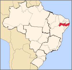
Rio Formoso
Rio Formoso located in Brazil Map
Coordinates: 8°40′S35°09′W / 8.667°S 35.150°W / -8.667; -35.150
Country Flag of Brazil.svg Brazil
State Pernambuco
Region Zona da mata
Area
  Total
239.8 km2 (92.6 sq mi)
Elevation
5 m (16 ft)
Population
 (2020 [1] )
  Total
23,628
Time zone UTC−3 (BRT)

Rio Formoso (English: River Handsome), is a municipality in Pernambuco with 23,628 inhabitants.

Contents

Geography

The municipality contains part of the strictly protected Saltinho Biological Reserve, a 562 hectares (1,390 acres) conservation unit created in 1983. [2]

Beaches

There are the only two beaches in Rio Formoso. The major attraction is the estuary of the Formoso River. Has an extensive area of coconut trees, sand banks and natural reefs.

Economy

The main economic activities in Rio Formoso are based in food and beverage industry and agribusiness. Especially, coconuts, sugarcane, and creations of cattle.

Economic Indicators

Population [3] GDP x(1000 R$). [4] GDP pc (R$) PE
21.815128.3916.1070.21%

Economy by Sector 2006

Primary sector Secondary sector Service sector
11.74%40.87%47.39%

Health Indicators

[5]

HDI (2000)Hospitals (2007)Hospitals beds (2007)Children's Mortality every 1000 (2005)
0.62116534.1

See also

References

  1. IBGE 2020
  2. Unidade de Conservação: Reserva Biológica de Saltinho (in Portuguese), MMA: Ministério do Meio Ambiente, retrieved 2016-04-17{{citation}}: CS1 maint: publisher location (link)
  3. Population 2009 Rio Formoso, page 34, IBGE
  4. Rio Formoso 2007 GDP IBGE page 31 Archived 2016-03-04 at the Wayback Machine
  5. "PE State site - City by city profile". Archived from the original on 2009-08-04. Retrieved 2009-07-28.