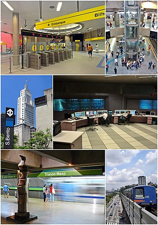
The São Paulo Metro, commonly called the Metrô, is a rapid transit system that forms part of the urban railways that serves the city of São Paulo, alongside the São Paulo Metropolitan Trains Company (CPTM), both forming the largest metropolitan rail transport network of Latin America. The six lines in the metro system operate on 104.4 kilometres (64.9 mi) of route, serving 89 stations. The metro system carries about 4,000,000 passengers a day.
The Companhia Paulista de Trens Metropolitanos (CPTM) is a rapid transit and commuter rail company owned by the São Paulo State Department for Metropolitan Transports. It was created on 28 May 1992, from several railroads that already existed in Greater São Paulo, Brazil.
São Bernardo do Campo is a Brazilian municipality in the state of São Paulo.
Luz Station is a commuter rail and intercity rail station in the Bom Retiro district of São Paulo, Brazil, serving RFFSA, the intercity rail network of Brazil, CPTM Line 7-Ruby, Line 11-Coral and Line 13–Jade (Airport-Express). It has subway connections to São Paulo Metro Line 1-Blue and ViaQuatro Line 4-Yellow via its underground metro station of the same name.
Ribeirão Pires is a city in the Metropolitan Region of the city of São Paulo, in the state of São Paulo, Brazil. It is part of the "ABC Region” of Greater São Paulo. The population is 124,159 in an area of 99.1 km2. The elevation is 763 m.
Rio Grande da Serra is a municipality in the state of São Paulo in Brazil. It is located approximately 49 kilometres (30 mi) by road southeast of the centre of the city of São Paulo. It is part of the Metropolitan Region of São Paulo. The population is 51,436 in an area of 36.34 km2.
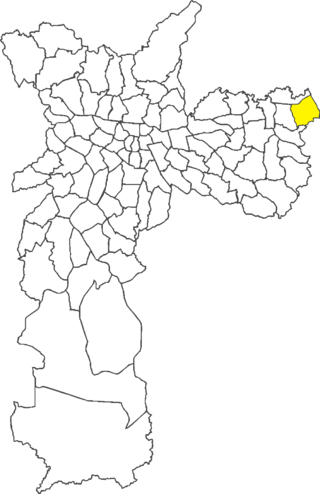
Itaim Paulista is a district in the subprefecture of the same name in the city of São Paulo, Brazil. The name Itaim comes from Tupi and means Little Stone.
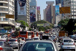
Transport in São Paulo plays a key role in the daily lives of the people of São Paulo and offers various methods of public transport that are offered in the city, including a complex bus system run by SPTrans, and various subway and railway lines. A contactless smartcard is used to pay fares for the buses, subway, and railway systems. São Paulo also has three airports.
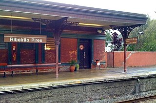
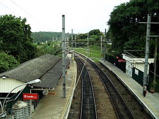
Ribeirão Pires–Antônio Bespalec is a train station on CPTM Line 10 (Turquoise), located in the city of Ribeirão Pires.
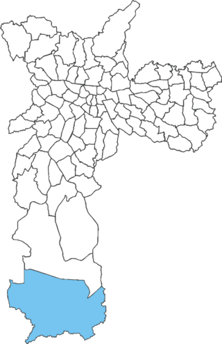
Marsilac is one of 96 districts of São Paulo, Brazil, located in the extreme south tip of the city in the subprefecture of Parelheiros. Its name is a tribute to engineer Jose Alfredo Marsilac, who developed many techniques for building roads and tunnels, even after losing 99% of his vision from being hit by a bomb in the Revolution of 1932.

Line 5 (Lilac) (Portuguese: Linha 5–Lilás) is one of the six lines that make up the São Paulo Metro and one of the 13 lines that make up the Metropolitan Rail Transportation Network. The line transports about 600,000 people every business day, and since August 2018 it is operated by the private company ViaMobilidade.
Line 8 (Diamond) (Portuguese: Linha 8–Diamante), formerly Line B (Gray), is a line of the São Paulo Metropolitan Trains system in Greater São Paulo, Brazil. Since 27 January 2022, ViaMobilidade operates the line for 30 years, along with Line 9-Emerald.
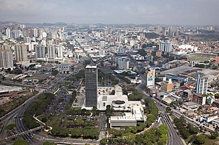
Line 18 (Bronze) (Portuguese: Linha 18–Bronze) was a project of the São Paulo Metro. It would link São Paulo to the southeast portion of the Greater São Paulo, ending in São Bernardo do Campo. The line was expected to be the first São Paulo Metro Line to go beyond the city limits.
The São Mateus–Jabaquara metropolitan corridor (Portuguese: Corredor Metropolitano São Mateus-Jabaquara), also called ABD Corridor (Corredor ABD) is a bus rapid transit line in Brazil, linking the city of São Paulo to three neighboring cities, Diadema, São Bernardo do Campo and Santo André, as well as (indirectly) Mauá. Operations started in 1988. Its other name references one letter per city (A for Santo André, B for São Bernardo do Campo, and D for Diadema), the same way the ABC region in Greater São Paulo is named.
Calmon Viana is a train station on CPTM Lines Line 11-Coral and 12-Sapphire, located in Calmon Viana, district of Poá.

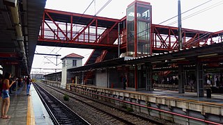
São Miguel Paulista is a train station belonging to CPTM Line 12-Sapphire, located in the city of São Paulo.

Varginha will be a train station on ViaMobilidade Line 9-Emerald, in the district of Grajaú in São Paulo. It is part of a plan of the State Government to extend the Line Emerald in 4.5 kilometres (2.8 mi) towards south of the city, from Grajaú station. It is being rebuilt in the place where was located the old Varginha station, which belonged to the Jurubatuba branch, of the extinct FEPASA.
Vila Clarice is a train station on CPTM Line 7-Ruby, located in the district of Pirituba in São Paulo.
Service 710 is a commuter rail service operated by Companhia Paulista de Trens Metropolitanos in the Greater São Paulo, Brazil. It is a route that unifies both lines 7-Ruby and 10-Turquoise of the metropolitan rail network of the state of São Paulo. It offers a service from Jundiaí to Rio Grande da Serra stations and from Francisco Morato to Mauá during peak hours. Outside the Francisco Morato-Mauá loop, commuter will have to leave the train and wait for the next one to proceed, with a 12 minutes headway.

The São Paulo Metropolitan Train is a public transit rail system implanted in Greater São Paulo, serving 23 of its 39 municipalities. It has 273 km (170 mi) of length, 7 lines and 94 stations, transporting approximately 3 million passengers per day. Currently, it is operated by the state-owned company Companhia Paulista de Trens Metropolitanos (CPTM), but two of the lines were auctioned to ViaMobilidade, which began operating their administrations in January 2022.

