The River Avon is a river in the southwest of England. To distinguish it from a number of other rivers of the same name, it is often called the Bristol Avon. The name 'Avon' is loaned from an ancestor of the Welsh word afon, meaning 'river'.
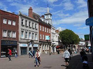
Nuneaton is a market town in Warwickshire, England, close to the county border with Leicestershire to the north-east. Nuneaton's population at the 2021 census was 88,813, making it the largest town in Warwickshire. Nuneaton's urban area, which also includes the large villages of Bulkington and Hartshill, had a population of 99,372 at the 2021 census.

Warwickshire is a ceremonial county in the West Midlands of England. It is bordered by Staffordshire and Leicestershire to the north, Northamptonshire to the east, Oxfordshire and Gloucestershire to the south, and Worcestershire and the West Midlands county to the west. The largest settlement is Nuneaton and the county town is Warwick.

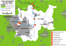
The River Tame is a river in the West Midlands of England, and one of the principal tributaries of the River Trent. The Tame is about 95 km (59 mi) long from the source at Oldbury to its confluence with the Trent near Alrewas, but the main river length of the entire catchment, i.e. the Tame and its main tributaries, is about 285 km (177 mi).
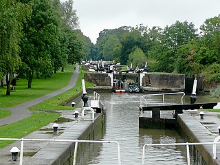
The Warwickshire ring is a connected series of canals forming a circuit around the West Midlands area of England. The ring is formed from the Coventry Canal, the Oxford Canal, the Grand Union Canal, the Stratford-upon-Avon Canal and the Birmingham and Fazeley Canal. It is a popular route with tourists due to its circular route and mixture of urban and rural landscapes.
Polesworth is a large village and civil parish in the North Warwickshire district of Warwickshire, England. It is situated close to the northern tip of Warwickshire, adjacent to the border with Staffordshire. It is 3 miles (5 km) east of Tamworth, and is 4.5 miles (7 km) northwest of Atherstone.

The River Salwarpe is a 20.4 miles (32.8 km) long river in Worcestershire, England. It is a left bank tributary of the River Severn, which it joins near Hawford.

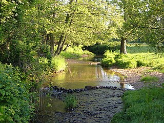
The River Sence is a river which flows in Leicestershire, England. The tributaries of the Sence, including the Saint and Tweed, fan out over much of western Leicestershire from Charnwood Forest and Coalville in the north-east to Hinckley and almost to Watling Street in the south and south-west. Its watershed almost coincides with Hinckley and Bosworth Borough of Leicestershire, which was formed in 1974 by amalgamation of Market Bosworth Rural District and Hinckley Urban District. It flows into the Anker, which in turn flows into the River Tame. It is part of the wider River Trent catchment, which covers much of central England. In 1881, Sebastian Evans wrote that the usual names for this river were Shenton Brook and Sibson Brook.

The River Seven is a river in North Yorkshire, England. It rises on Danby High Moor, in the middle of the North York Moors, and flows south for about 15 miles (24 km) to meet the River Rye, at Brawby.

Shuttington is a village and civil parish in North Warwickshire, England, situated north-east of Tamworth, Staffordshire. In the 2001 census, the parish, which also includes Alvecote, had a population of 563, decreasing to 536 at the 2011 census. The River Anker flows through the parish, with Shuttington north-east of the river, and Alvecote south of it. The West Coast Main Line passes through Alvecote, with the Coventry Canal parallel to it and a marina south of the canal. Most of the parish is rural, including the village of Shuttington, although there was colliery alongside the railway at Alvecote.

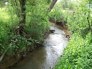
The River Bourne flows for 10.9 miles (17.6 km) through North Warwickshire, England, and is a tributary of the River Tame. In the 19th century, the river with its undeveloped catchment close to Birmingham, was selected to provide a source of clean drinking water for the city.
The River Tale is a small river that drains the southern slopes of the Blackdown Hills, in Devon, England. It is a tributary of the River Otter and 8.8 miles (14.2 km) in length. Its name is derived from getæl meaning "quick, active or swift"; however, the river is noted as being "sluggish". One theory is that its name was transferred from Tala Water, a tributary of the nearby River Tamar. The river is the site of ongoing efforts to reintroduce the water vole, which is thought to be extinct in Devon.

The Bow Brook is a substantial brook that flows for 28.8 miles (46.3 km) through Worcestershire, England. It is a lower tributary of the River Avon which it joins near Defford downstream of Eckington Bridge. Its principal tributaries include the Stoulton, Dean, and Seeley brooks.
The Badsey Brook, also known as the Broadway Brook, is a small brook that flows through Worcestershire, England. It is a lower tributary of the River Avon, which it joins near Offenham upstream of Evesham. Its principal tributary is the Bretforton Brook.
Hodge Beck is a stream that flows through the North York Moors national park in North Yorkshire, England. It is a tributary of the River Dove which it joins near Welburn south of Kirkbymoorside. The beck is 14 miles (23 km) long and has a total catchment area of 58 square kilometres (22 sq mi).

Roe Beck also known as the River Roe in its lower reaches, is a beck that flows through Cumbria, England. It is a lower tributary of the River Caldew which it joins near Gaitsgill south of Dalston. The total length of the beck including Peel Gill is 20.8 kilometres (12.9 mi) and it has a catchment of 69 square kilometres (27 sq mi), which includes the area of its major tributary the River Ive.
Bedburn Beck is a 16.8 kilometres (10.4 mi) long, upper tributary of the River Wear in County Durham, England. The beck and its tributaries, including the Euden, Harthorpe and South Grain becks, have a catchment of 76 square kilometres (29 sq mi), much of which is covered by the coniferous Hamsterley Forest.

Crimple Beck or the River Crimple is a beck which flows through North Yorkshire, England. It is a tributary of the River Nidd which it joins between Little Ribston and Walshford north of Wetherby. The beck is 15.5 miles (24.9 km) long, and has a total catchment area of 80 square kilometres (31 sq mi), which drains the area around Harrogate. Its tributaries include the Park Beck.