
The Isle of Wight is a county in the English Channel, two to five miles off the coast of Hampshire, from which the Solent separates it. It is the largest and second-most populous island in England. Referred to as 'The Island' by residents, the Isle of Wight has resorts that have been popular holiday destinations since Victorian times. It is known for its mild climate, coastal scenery, and verdant landscape of fields, downland, and chines. The island is historically part of Hampshire and is designated a UNESCO Biosphere Reserve.
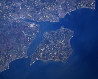
The Solent is a strait between the Isle of Wight and Great Britain. It is about 20 miles long and varies in width between 2+1⁄2 and 5 mi, although the Hurst Spit which projects 1+1⁄2 mi (2.4 km) into the Solent narrows the sea crossing between Hurst Castle and Colwell Bay to just over 1 mi (1.6 km).
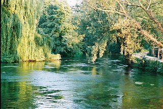
The River Test is a chalk stream in Hampshire in the south of England. It rises at Ashe near Basingstoke and flows southwards for 40 miles (64 km) to Southampton Water. Settlements on the Test include the towns of Stockbridge and Romsey. Below the village of Longparish, the river is broadly followed by the Test Way, a long-distance footpath.
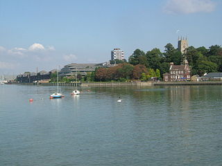
The River Medway is a river in South East England. It rises in the High Weald, East Sussex and flows through Tonbridge, Maidstone and the Medway conurbation in Kent, before emptying into the Thames Estuary near Sheerness, a total distance of 70 miles (113 km). About 13 miles (21 km) of the river lies in East Sussex, with the remainder being in Kent.

Yarmouth is a town, port and civil parish in the west of the Isle of Wight, off the south coast of England. The town is named for its location at the mouth of the small Western Yar river. The town grew near the river crossing, originally a ferry, which was replaced with a road bridge in 1863.

The River Ribble runs through North Yorkshire and Lancashire in Northern England. It starts close to the Ribblehead Viaduct in North Yorkshire, and is one of the few that start in the Yorkshire Dales and flow westwards towards the Irish Sea.

Freshwater is a large village and civil parish at the western end of the Isle of Wight, England. The southern, coastal part of the village is Freshwater Bay, named for the adjacent small cove. Freshwater sits at the western end of the region known as the Back of the Wight or the West Wight, a popular tourist area.

Newtown is a small village in the civil parish of Calbourne, Newtown and Porchfield, on the Isle of Wight, England. In medieval times it was a thriving borough.
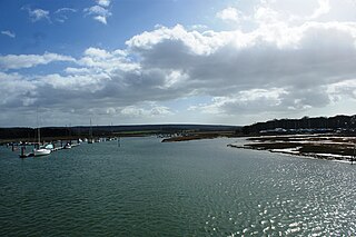
The River Yar on the Isle of Wight, England, rises near the beach at Freshwater Bay, on the south coast, and flows only a few miles north to Yarmouth where it meets the Solent. Most of the river is a tidal estuary. Its headwaters have been truncated by erosion of the south coast.

The River Yar on the Isle of Wight, England, rises in a chalk coomb in St. Catherine's Down near Niton, close to the southern tip of the island. It flows across the Lower Cretaceous rocks of the eastern side of the island, through the gap in the central Upper Cretaceous chalk ridge of the Island at Yarbridge, then across the now drained Brading Haven to Bembridge Harbour in the northeast.
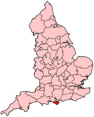
Isle of Wight is a constituency represented in the House of Commons of the UK Parliament since 2017 by Bob Seely, a Conservative.

Chalk streams are rivers that rise from springs in landscapes with chalk bedrock. Since chalk is permeable, water percolates easily through the ground to the water table and chalk streams therefore receive little surface runoff. As a result, the water in the streams contains little organic matter and sediment and is generally very clear. The beds of the rivers are generally composed of clean, compacted gravel and flints, which are good spawning areas for Salmonidae fish species.

Shalfleet is a village and civil parish on the Isle of Wight. it is located between Yarmouth and Newport in the northwest of the island.

Calbourne is a village in the civil parish of Calbourne, Newtown and Porchfield, on the Isle of Wight, England. It is located 5 miles (8 km) from Newport in the west of the island.

Newbridge is a hamlet on the Isle of Wight. It is situated on a small hill, nine kilometres to the west of Newport on the western half of the island. According to the Post Office the 2011 Census population of the hamlet was included in the civil parish of Shalfleet.

Newtown River is a large natural inland harbour located on the Isle of Wight's northwestern coast, named after the nearby village of Newtown. It is sometimes also referred to as Newtown Creek.

The Isle of Wight Coastal Path is a circular long-distance footpath of 70 miles (113 km) around the Isle of Wight, UK. It follows public footpaths and minor lanes, with some sections along roads.

Hurst Castle and Lymington River Estuary is a 1,077.3-hectare (2,662-acre) biological and geological Site of Special Scientific Interest near Lymington in Hampshire. It is a Nature Conservation Review site and two areas are Geological Conservation Review sites. Three areas are local nature reserves, Boldre Foreshore, Sturt Pond and Lymington and Keyhaven Marshes; the latter site is managed by the Hampshire and Isle of Wight Wildlife Trust. Part of it is North Solent National Nature Reserve. It is part of Solent and Southampton Water Ramsar site and Special Protection Area. Parts of it are in Solent Maritime and Solent and Isle of Wight Lagoons Special Areas of Conservation.

Calbourne, Newtown and Porchfield is a civil parish on the Isle of Wight, in the county of the Isle of Wight, England. The parish includes the settlements of Calbourne, Chessell, Five Houses, Great Thorness, Little Whitehouse, Locksgreen, Mark's Corner, Newtown and Porchfield. In 2011 the parish had a population of 886. The parish touches Brighstone, Gurnard, Newport and Carisbrooke, Northwood and Shalfleet. There are 81 listed buildings in Calbourne, Newtown and Porchfield.


