
Derwentwater, or Derwent Water, is a lake in the Lake District in North West England, immediately south of Keswick. It is in the unitary authority of Cumberland within the ceremonial county of Cumbria. It is the third largest lake by area, after Windermere and Ullswater. It has a length of 4.6 kilometres (2.9 mi), a maximum width of 1.91 kilometres (1.19 mi), and an area of 5.4 square kilometres (2.1 sq mi). Its primary inflow and outflow is the River Derwent, which also flows through Bassenthwaite Lake before reaching the Irish Sea at Workington. There are several islands within the lake, one of which is inhabited. Derwentwater is a place of considerable scenic value. It is surrounded by hills, and many of the slopes facing Derwentwater are extensively wooded. A regular passenger launch operates on the lake, taking passengers between various landing stages. There are seven lakeside marinas, the most popular stops being Keswick, Portinscale and the Lodore Falls, from which boats may be hired. Recreational walking is a major tourist activity in the area and there is an extensive network of footpaths in the hills and woods surrounding the lake.

Douglas is the capital city and largest settlement of the Isle of Man, with a population of 26,677 (2021) and an area of 4.1 square miles (10.5 km2). It is located at the mouth of the River Douglas, and on a sweeping bay of two miles. The River Douglas forms part of the city's harbour and main commercial port.

Peel is a seaside town and small fishing port in the Isle of Man, in the historic parish of German but administered separately. Peel is the third largest town in the island after Douglas and Ramsey but the fourth largest settlement, as Onchan has the second largest population but is classified as a village.
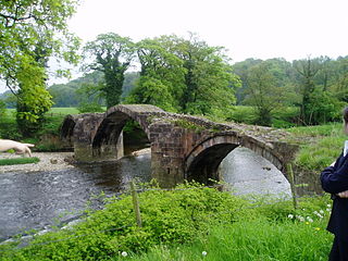
The River Hodder is in Lancashire, England. It is a County Biological Heritage Site.

Glenfaba is one of the six sheadings of the Isle of Man.

The Ottawa National Forest is a national forest that covers 993,010 acres (401,860 ha) in the Upper Peninsula of the U.S. state of Michigan. It includes much of Gogebic and Ontonagon counties, as well as slices of Iron, Houghton, Baraga, and Marquette counties. The forest is under the jurisdiction of the U.S. Forest Service.

The River Skerne is a tributary of the River Tees. It flows through County Durham in England.
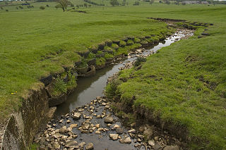
The River Loud is a river of Lancashire, England.
Longridge Fell is the most southerly fell in England, near the town of Longridge, Lancashire. It lies at the southern end of the Forest of Bowland Area of Outstanding Natural Beauty. As its name suggests, it takes the form of a long ridge which rises in a north-easterly direction from within the town of Longridge to its summit 4.5 miles distant. As the ridge curves towards the east, it comes to a sudden end and drops into the Hodder Valley. The fell is an example of a cuesta; the ridge has a sharp drop or escarpment on its northern side, and a gentler, more varying slope on its southern side. These features make it a popular takeoff for hang-gliders and paragliders on the relatively infrequent occurrences of a northerly wind.

Thailand has 22 river basins with 254 sub-basins. Rainwater is one of the most important sources of water. Thailand's water resource per capita is less than that of other countries in the region.
Knockaloe railway station served Knockaloe Internment Camp in the Isle of Man between 1915 and 1920.

The Blaber River is a minor river in the Isle of Man.

The Silver Burn or Silverburn River is a small river, about five miles (8 km) long, on the Isle of Man which rises near the South Barrule and flows south. It passes St Mark's and in its lower reaches it flows under the Monks' Bridge at Ballasalla, and reaches the sea at Castletown harbour. Just above Ballasalla, the burn runs through wooded Silverdale Glen, a site which the Manx National Trust acquired in 1966.
The Foxdale River is a river of the Isle of Man which rises east of the South Barrule and flows 5 km north through Foxdale to join the River Neb at St John's.
Laurel Bank is situated between the 10th Milestone and 11th Milestone road-side markers on the primary A3 Castletown to Ramsey Road between Ballacraine and Glen Helen in the parish of Kirk German in the Isle of Man.
Glen Helen or Lambfell Glen) is one of a series of eighteen Manx National Glens owned and maintained by the Forestry Amenity and Lands Directorate of the Isle of Man Department of Environment, Food and Agriculture.

Fivehead River flows through south Somerset, England.
The geology of the Isle of Man consists primarily of a thick pile of sedimentary rocks dating from the Ordovician period, together with smaller areas of later sedimentary and extrusive igneous strata. The older strata was folded and faulted during the Caledonian and Acadian orogenies The bedrock is overlain by a range of glacial and post-glacial deposits. Igneous intrusions in the form of dykes and plutons are common, some associated with mineralisation which spawned a minor metal mining industry.
