
Broward County is a county in the southeastern part of Florida, located in the Miami metropolitan area. It is Florida's second-most populous county after Miami-Dade County and the 17th-most populous in the United States, with 1,944,375 residents as of the 2020 census. Its county seat and largest city is Fort Lauderdale, which had a population of 182,760 as of 2020.

Lauderdale County is a county located on the western edge of the U.S. state of Tennessee, with its border the Mississippi River. As of the 2020 census, the population was 25,143. Its county seat is Ripley. Since the antebellum years, it has been developed for cotton as a major commodity crop.

Dania Beach is a city in Broward County, Florida, United States. It is part of the South Florida metropolitan area. As of the 2020 census, the city's population was 31,723. Dania Beach is the location of one of the largest jai alai frontons in the United States, The Casino at Dania Beach. It was formerly the location for two amusement centers; one named Boomers!, which housed the Dania Beach Hurricane roller coaster, and the other being Pirates World amusement park, which was featured in Barry Mahon's Thumbelina. It is also home to the International Game Fish Association Hall of Fame and Museum.

Fort Lauderdale is a coastal city located in the U.S. state of Florida, 30 miles (48 km) north of Miami along the Atlantic Ocean. It is the county seat of and largest city in Broward County with a population of 182,760 at the 2020 census, making it the tenth largest city in Florida. After Miami and Hialeah, Fort Lauderdale is the third largest city in the Miami metropolitan area, which had a population of 6,166,488 in 2019.

Oakland Park, officially the City of Oakland Park, is a city in Broward County, Florida, United States. It is part of the South Florida metropolitan area, which was home to 6,166,488 people at the 2020 census. As of the 2020 United States Census, the city's population was 44,229.

Sea Ranch Lakes is a village in Broward County, Florida, United States. The village is part of Miami metropolitan area of South Florida. It is located on North Ocean Drive and is surrounded by Lauderdale-by-the-Sea. The majority of the village is a gated community, with the remainder being a public shopping plaza and a private beach club for village residents, with a pool and access to Sea Ranch Lakes Beach. The population was 540 at the 2020 census.

Wilton Manors is a city in Broward County, Florida, United States. Wilton Manors is part of the Miami metropolitan area, which was home to 6,166,488 people at the 2020 census. As of the 2020 census, the city had a population of 11,426.

Cayce is a city in the U.S. state of South Carolina, along the Congaree River. The population was 12,528 at the 2010 census and rose to 13,789 in the 2020 United States Census, and it is the third-most populated municipality in Lexington County. The city is primarily in Lexington County, with additional, predominantly rural land to the east in Richland County. Cayce is part of the Columbia Metropolitan Statistical Area and is within South Carolina's Midlands region.
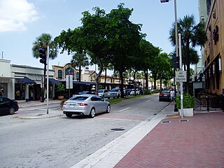
Las Olas Boulevard is a major east-west thoroughfare in Fort Lauderdale, Florida, United States that runs from SW 1st Avenue in the Central Business District to Florida State Road A1A in Fort Lauderdale Beach. The name "Las Olas" means "The Waves" in Spanish. The road once carried the designations of State Road A1A Alt. and State Road 842.

The Houses of Refuge in Florida were a series of stations operated by the United States Life Saving Service along the coast of Florida to rescue and shelter ship-wrecked sailors. Five houses were constructed on the east coast in 1876, with five more added in 1885 and 1886. There were also two life-saving stations built, one just south of the Jupiter Inlet, the other on the Gulf coast on Santa Rosa Island near Pensacola, Florida. A house of refuge was planned for the Marquesas Keys, but was never put into commission. The houses were staffed by civilian contractors who lived in the houses with their families. Most of these houses remained in service as life-saving stations until 1915 or later. Some of the locations became United States Coast Guard stations after the Life-Saving Service was merged with the United States Revenue Cutter Service to form the Coast Guard in 1915.
The Broward Center for the Performing Arts is a large multi-venue performing arts center located in downtown Fort Lauderdale, Florida, United States.

Florida's 23rd congressional district is an electoral district for the U.S. Congress, located in the Greater Miami area and covering parts of Broward County and southern Palm Beach County. In the 2020 redistricting cycle, it was drawn as a successor to the previous 22nd district and includes Boca Raton, Coral Springs, most of Deerfield Beach and Fort Lauderdale, and parts of Pompano Beach. The previous iteration of the 23rd district, which included Davie and Pembroke Pines, was instead renamed the 25th district. The district, along with two other districts in Greater Miami, has one of the highest concentrations of Jewish Americans, consisting of about 16% of the electorate.

Florida's 20th congressional district is a U.S. congressional district in Southeast Florida. It is currently held by Democrat Sheila Cherfilus-McCormick, who was elected in a January 2022 special election, following the death of Alcee Hastings on April 6, 2021. With a Cook Partisan Voting Index (CPVI) rating of D+25, it is one of the most Democratic districts in Florida.

James T. Naugle is an American real estate broker who served as mayor of Fort Lauderdale, Florida. Although a lifelong Democrat, Naugle frequently voted for and supported Republican candidates. Elected for the first time in 1991, Naugle was the longest-serving mayor in the history of Fort Lauderdale, serving for six consecutive terms.

The Detroit International Riverfront is a tourist attraction and landmark of Detroit, Michigan, extending from the Ambassador Bridge in the west to Belle Isle in the east, for a total of 5.5 miles. The International Riverfront encompasses a cruise ship passenger terminal and dock, a marina, a multitude of parks, restaurants, retail shops, skyscrapers, and high rise residential areas along with Huntington Place. The Marriott at the Renaissance Center and the Robert's Riverwalk Hotel are also situated along the International Riverfront. Private companies and foundations together with the city, state, and federal government have contributed several hundred million dollars toward the riverfront development. Key public spaces in the International Riverfront, such as the RiverWalk, Dequindre Cut Greenway and Trail, William G. Milliken State Park and Harbor, and a cruise ship passenger terminal and dock at Hart Plaza complement the architecture of the area. The area provides a venue for a variety of annual events and festivals including the Detroit Electronic Music Festival, Detroit Free Press International Marathon, the Detroit International Jazz Festival, Motor City Pride, the North American International Auto Show, River Days and Detroit China Festival. In February 2021, the Detroit International Riverfront was voted best riverwalk in the United States by USA Today readers. It was selected a second time as the best riverwalk in the U.S. in 2022.
The history of Fort Lauderdale, Florida began more than 4,000 years ago with the arrival of the first aboriginal natives, and later with the Tequesta Indians, who inhabited the area for more than a thousand years. Though control of the area changed among Spain, England, the United States, and the Confederate States of America, it remained largely undeveloped until the 20th century. The first settlement in the area was the site of a massacre at the beginning of the Second Seminole War, an event which precipitated the abandonment of the settlement and set back development in the area by over 50 years. The first United States stockade named Fort Lauderdale was built in 1838, and subsequently was a site of fighting during the Second Seminole War. The fort was abandoned in 1842, after the end of the war, and the area remained virtually unpopulated until the 1890s.

The Chattahoochee RiverWalk is a 22-mile walking and biking area along the Chattahoochee River in Columbus, Georgia, United States. The trail is paved with asphalt, concrete, or brick. Due to the RiverWalk bike path, Columbus has been listed by the League of American Bicyclists as one of the forty most Bicycle Friendly Communities in the United States.

Fort Kamehameha was a United States Army military base that was the site of several coastal artillery batteries to defend Pearl Harbor starting in 1907 in Honolulu, Hawaii.

110 Tower, formerly known as AutoNation Tower, is a 410.1 feet (125.0 m) modernist office building in downtown Fort Lauderdale, Florida. The building was one of the first modern high-rise office buildings constructed in the city, and became part of the city's sprawling skyline. The building has a baltic-brown granite clad and glass exterior, it currently stands as the fourth-tallest building in Fort Lauderdale's skyline, and also the tallest office building.
