Roby Mill

Last updated
Roby Mill
Village
Roby Mill from the Parbold Viewpoint - geograph.org.uk - 161176.jpg
Roby Mill as seen from Parbold
Location map United Kingdom Borough of West Lancashire.svg
Red pog.svg
Roby Mill
Shown within West Lancashire
Lancashire UK location map.svg
Red pog.svg
Roby Mill
Location within Lancashire
Population405 
OS grid reference SD5107
  London 174 mi (280 km) SE
Civil parish
District
Shire county
Region
Country England
Sovereign state United Kingdom
Post town Skelmersdale
Postcode district WN8
Dialling code 01695
Police Lancashire
Fire Lancashire
Ambulance North West
UK Parliament
List of places
UK
England
Lancashire
53°33′32″N2°43′45″W / 53.558861°N 2.7292419°W / 53.558861; -2.7292419

Roby Mill is a village in the West Lancashire district of Lancashire, England. The estimated population is 405. [1]

Contents

Geography and Politics

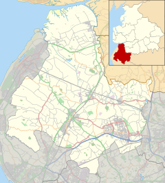
Roby Mill is located in the West Lancashire district of Lancashire, and the civil parish of Up Holland, formerly part of the unparished area of Skelmersdale. It is located approximately 6.5 miles (10.5 km) east of Ormskirk town centre, the administrative centre for West Lancashire, 2 miles (3.2 km) east of Skelmersdale town centre, 13.7 miles (22.0 km) south of Preston city centre, the administrative centre of Lancashire and 182.2 miles (293.2 km) north-west of London.

It falls under West Lancashire Borough Council and Lancashire County Council, both of which are responsible for the administration of various services in the area. [2] It is located in the Wrightington ward of West Lancashire Borough Council, where it is represented by two Conservative Party councillors [3] and in the Skelmersdale North ward of Lancashire County Council, where it is represented by one Labour Party councillor. [4]

It is in the West Lancashire parliamentary constituency, which has been represented by Labour Party MPs since the 1992 general election, namely Colin Pickthall, Rosie Cooper, and since 2023 Ashley Dalton.

Transport

The B5375 road runs through the village, connecting the town to Appley Bridge approximately 2 kilometres (1.2 mi) to the north, and to Up Holland approximately 2.5 kilometres (1.6 mi) to the south.

Preston Bus operates the 312 service which runs through the village, connecting the Concourse Shopping Centre in Skelmersdale to Wrightington Hospital. [5]

Education

The village is served by one Church of England primary school.

Related Research Articles

<span class="mw-page-title-main">Metropolitan Borough of Knowsley</span> Metropolitan borough in England

The Metropolitan Borough of Knowsley is a metropolitan borough in Merseyside, North West England. It covers several towns and villages, including Kirkby, Prescot, Huyton, Whiston, Halewood, Cronton and Stockbridge Village; Kirkby, Huyton, and Prescot being the major commercial centres. It takes its name from the village of Knowsley, though its headquarters are in Huyton. It forms part of the wider Liverpool City Region.

<span class="mw-page-title-main">Parbold</span> Human settlement in England

Parbold is a village and civil parish in West Lancashire, England.

<span class="mw-page-title-main">West Lancashire</span> District of Lancashire, England

West Lancashire is a local government district with borough status in Lancashire, England. The council is based in Ormskirk, and the largest town is Skelmersdale. The district borders Fylde to the north, over the Ribble Estuary; South Ribble, Chorley, and Wigan to the east; St Helens, and Knowsley to the south; and Sefton to the south and west.

<span class="mw-page-title-main">South Ribble</span> Borough and non-metropolitan district in England

South Ribble is a local government district with borough status in Lancashire, England. Its council is based in Leyland. The borough also includes the towns and villages of Penwortham, Leyland, Farington, Hutton, Longton, Walmer Bridge, Salmesbury, Lostock Hall, Walton le Dale and Bamber Bridge. Many of the built-up areas in the borough form part of the wider Preston built-up area.

<span class="mw-page-title-main">Poulton-le-Fylde</span> Human settlement in England

Poulton-le-Fylde, commonly shortened to Poulton, is a market town in Lancashire, England, situated on the coastal plain called the Fylde. In the 2021 United Kingdom census, it had a population of 18,115.

<span class="mw-page-title-main">Metropolitan Borough of Wigan</span> Borough of Greater Manchester, England

The Metropolitan Borough of Wigan is a metropolitan borough of Greater Manchester, England. It is named after its largest town, Wigan but covers a far larger area which includes the towns of Atherton, Ashton-in-Makerfield, Golborne, Hindley, Ince-in-Makerfield, Leigh and Tyldesley. The borough also covers the villages and suburbs of Abram, Aspull, Astley, Bryn, Hindley Green, Lowton, Mosley Common, Orrell, Pemberton, Shevington, Standish, Winstanley and Worsley Mesnes. The borough is also the second-most populous district in Greater Manchester.

<span class="mw-page-title-main">Borough of Burnley</span> Borough in Lancashire, England

The Borough of Burnley is a local government district with the borough status in Lancashire, England. It has an area of 42.7 square miles (110.7 km2) and a population of 94,721 (2021), and is named after its largest town, Burnley. The borough also contains the town of Padiham along with several villages and surrounding rural areas.

<span class="mw-page-title-main">Metropolitan Borough of St Helens</span> Metropolitan borough in England

The Metropolitan Borough of St Helens is a local government district with borough status in Merseyside, North West England. The borough is named after its largest settlement, St Helens, but also includes neighbouring towns and villages such as Earlestown, Rainhill, Eccleston, Clock Face, Haydock, Billinge, Garswood, Rainford and Newton-le-Willows.

<span class="mw-page-title-main">Thingwall</span> Village in England

Thingwall is a village on the Wirral Peninsula, in Merseyside, England. The village is situated approximately 8 km (5.0 mi) to the south west of Birkenhead and 3 km (1.9 mi) north east of Heswall. Historically part of Cheshire, the area is within the Pensby and Thingwall Ward of the Metropolitan Borough of Wirral and the parliamentary constituency of Wirral West.

<span class="mw-page-title-main">Burscough</span> Town in West Lancashire, England

Burscough is a town and civil parish in the district of West Lancashire, Lancashire, England. The town is located approximately 13.5 miles (21.7 km) north-northeast of Liverpool and 13 miles (21 km) southwest of Preston. Its northern part is called Burscough Bridge, and was originally a separate settlement.

<span class="mw-page-title-main">West Lancashire (UK Parliament constituency)</span> Parliamentary constituency in the United Kingdom, 1983 onwards

West Lancashire is a county constituency represented in the House of Commons of the UK Parliament. Following the resignation of Labour MP Rosie Cooper on 30 November 2022, the seat was won by the party's candidate Ashley Dalton in the by-election held on 9 February 2023.

<span class="mw-page-title-main">Ribble Valley (UK Parliament constituency)</span> Parliamentary constituency in the United Kingdom, 1983 onwards

Ribble Valley is a constituency in Lancashire represented in the House of Commons of the UK Parliament since 1992 by Nigel Evans, a Conservative. Evans has served as a Deputy Speaker of the House of Commons and Second Deputy Chairman of Ways and Means since January 2020; he previously served as First Deputy Chairman of Ways and Means from 2010 to 2013.

<span class="mw-page-title-main">Shevington</span> Village and civil parish in Greater Manchester, England

Shevington is a village and civil parish within the Metropolitan Borough of Wigan, Greater Manchester, England. The population of the Wigan ward called Shevington and Lower Ground had increased to 11,482 at the 2011 Census.

<span class="mw-page-title-main">2006 Preston City Council election</span> 2006 UK local government election

The City Council elections for the City of Preston, Lancashire were held on 4 May 2006 on the same day as other 2006 United Kingdom local elections. Nineteen electoral wards were fought. The only change was that Labour gained one seat from the Liberal Democrats, continuing to be the largest party, but the Council remained under no overall control

<span class="mw-page-title-main">Great Eccleston</span> Human settlement in England

Great Eccleston is a village and civil parish in Lancashire, England situated on a coastal plain called the Fylde. The village lies to the south of the River Wyre and the A586 road, approximately 10 miles (16 km) upstream from Fleetwood. At the 2001 census, the parish had a population of 1,473, rising slightly to 1,486 at the 2011 census.

<span class="mw-page-title-main">Skelmersdale</span> Town in England

Skelmersdale is a town in the West Lancashire district, in Lancashire, England, on the River Tawd, 6 miles (10 km) west of Wigan, 13 miles (21 km) northeast of Liverpool and 15 miles (24 km) southwest of Preston. In 2006, it had a population of 38,813. The town is known locally as Skem.

<span class="mw-page-title-main">City of Preston, Lancashire</span> City and non-metropolitan district in Lancashire, England

The City of Preston, or simply Preston, is a local government district with city status in Lancashire, England. It lies on the north bank of the River Ribble and has a population of 147,617 (2021). The neighbouring districts are Ribble Valley, South Ribble, Fylde and Wyre.

Elections to Preston City Council took place on 3 May 2012, the same day as other 2012 United Kingdom local elections.

<span class="mw-page-title-main">Hilldale, Lancashire</span> Human settlement in England

Hilldale is a civil parish in the West Lancashire district of Lancashire, England, containing the village of Hill Dale and the neighbouring hamlet of Andertons Mill. Formerly part of Wrightington, Hilldale became a separate civil parish in 1999. As of 2011, Hilldale has a population of 581.

<span class="mw-page-title-main">Our West Lancashire</span> Localist group of independent politicians in West Lancashire

Our West Lancashire (OWL) is a localist political party in West Lancashire, United Kingdom. As of May 2021 it held 7 seats on West Lancashire Borough Council. The party also unsuccessfully contested seats in West Lancashire on Lancashire County Council, as well. The group claims to have drawn members from all of the major parties in West Lancashire, and claims to "put residents before the party whip". It is one of two localist parties in West Lancashire, alongside Skelmersdale Independent Party.

References

  1. "Area information for Roby Mill, Skelmersdale". Archived from the original on 18 October 2020. Retrieved 17 October 2020.
  2. "Home". Lancashire County Council. Archived from the original on 13 October 2020. Retrieved 17 October 2020.
  3. "Your Councillors". West Lancashire Borough Council. Archived from the original on 17 October 2020. Retrieved 17 October 2020.
  4. "Your Councillors". Lancashire County Council. Archived from the original on 18 October 2020. Retrieved 17 October 2020.
  5. "Roby Mill". bustimes.org. Archived from the original on 18 October 2020. Retrieved 17 October 2020.