Rockhill, Pennsylvania

Last updated
Rockhill, Pennsylvania
Borough
Johnstowntraction311.jpg
Huntingdon County Pennsylvania Incorporated and Unincorporated areas Rockhill Highlighted.svg
Location of Rockhill in Huntingdon County, Pennsylvania.
USA Pennsylvania location map.svg
Red pog.svg
Rockhill
Usa edcp location map.svg
Red pog.svg
Rockhill
Coordinates: 40°14′35″N77°54′02″W / 40.24306°N 77.90056°W / 40.24306; -77.90056
Country United States
State Pennsylvania
County Huntingdon
Government
  TypeBorough Council
  MayorKarl Barry (R)
Area
[1]
  Total0.29 sq mi (0.75 km2)
  Land0.29 sq mi (0.75 km2)
  Water0.00 sq mi (0.00 km2)
Population
 (2020) [2]
  Total379
  Density1,302.41/sq mi (502.91/km2)
Time zone UTC-5 (Eastern (EST))
  Summer (DST) UTC-4 (EDT)
ZIP code
17249
Area code 814
FIPS code 42-65496
Local phone exchanges: 447, 448

Rockhill or Rockhill Furnace is a borough in Huntingdon County, Pennsylvania, United States. [3] The population was 371 at the 2010 census, [4] down from 414 at the 2000 census. It is the site of the East Broad Top Railroad and the Rockhill Trolley Museum.

Contents

Although the community was long known as "Rockhill Furnace", its name has always officially been "Rockhill". [5]

Geography

Rockhill is located in southern Huntingdon County at 40°14′35″N77°54′2″W / 40.24306°N 77.90056°W / 40.24306; -77.90056 (40.242927, -77.900433). [6] It sits on the southwestern side of Blacklog Creek, across from its neighbor, the borough of Orbisonia. It is bordered to the west by 920-foot-high (280 m) Saddle Back Ridge. Pennsylvania Route 994 passes through Rockhill, ending to the north in Orbisonia at U.S. Route 522 and leading southwest 6 miles (10 km) to Three Springs.

According to the United States Census Bureau, Rockhill borough has a total area of 0.29 square miles (0.75 km2), all land. [4]

Demographics

Historical population
CensusPop.Note
1890 657
1900 495−24.7%
1910 5041.8%
1920 500−0.8%
1930 5020.4%
1940 5489.2%
1950 5673.5%
1960 566−0.2%
1970 480−15.2%
1980 472−1.7%
1990 421−10.8%
2000 414−1.7%
2010 371−10.4%
2020 3792.2%
U.S. Decennial Census [7]

As of the census [8] of 2000, there were 414 people, 173 households, and 119 families residing in the borough. The population density was 1,323.8 inhabitants per square mile (511.1/km2). There were 186 housing units at an average density of 594.7 per square mile (229.6/km2). The racial makeup of the borough was 99.28% White, 0.72% from other races. Hispanic or Latino of any race were 2.42% of the population.

There were 173 households, out of which 27.7% had children under the age of 18 living with them, 55.5% were married couples living together, 10.4% had a female householder with no husband present, and 31.2% were non-families. 27.2% of all households were made up of individuals, and 13.3% had someone living alone who was 65 years of age or older. The average household size was 2.39 and the average family size was 2.90.

In the borough the population was spread out, with 23.7% under the age of 18, 6.0% from 18 to 24, 28.7% from 25 to 44, 23.7% from 45 to 64, and 17.9% who were 65 years of age or older. The median age was 41 years. For every 100 females there were 84.8 males. For every 100 females age 18 and over, there were 82.7 males.

The median income for a household in the borough was $27,639, and the median income for a family was $36,250. Males had a median income of $31,125 versus $20,375 for females. The per capita income for the borough was $15,376. About 9.4% of families and 13.8% of the population were below the poverty line, including 14.0% of those under age 18 and 21.3% of those age 65 or over.

History

The narrow-gauge East Broad Top Railroad was constructed through the community in 1873. Rockhill was selected as the location of the railroad's maintenance facility. The parent company Rockhill Iron and Coal located their dual-stack coke-fired iron furnace here. Rockhill as it exists today was created by the coal company and the railroad as a support community for their infrastructure.

The iron furnace shut down for the last time in 1907, and the railroad became the primary employer. The EBT shut down in 1956, but a portion from Rockhill north to Shirleysburg was reactivated in 1960 as a tourist operation. In the late 2000s the track to the south was rehabilitated to PA 475 sufficiently for speeders to operate and give rides to the public. In 2022, trackage was restored to the wye at Colgate Grove, with reproduction passenger cars powered by a small diesel locomotive. On February 18, 2023, their steam locomotive, #16, rode the rails again for the first time since 1956, carrying passengers to Colgate Grove.

Friends of the East Broad Top, Inc. have been working to provide rehabilitation to the facilities in Rockhill. Tours inside the East Broad Top shop complex are offered during the summer months. [9]

Points of interest

Related Research Articles

<span class="mw-page-title-main">Huntingdon County, Pennsylvania</span> County in Pennsylvania, United States

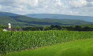
Huntingdon County is a county in the Commonwealth of Pennsylvania. As of the 2020 census, the population was 44,092. Its county seat is Huntingdon. The county was created on September 20, 1787, mainly from the northern part of Bedford County, plus an addition of territory on the east from Cumberland County.

<span class="mw-page-title-main">Hopewell, Bedford County, Pennsylvania</span> Borough in Pennsylvania, United States

Hopewell is a borough in Bedford County, Pennsylvania, United States. The population was 189 at the 2020 census.

<span class="mw-page-title-main">Saxton, Pennsylvania</span> Borough in Pennsylvania, United States

Saxton is a borough in Bedford County, Pennsylvania, United States. The population was 726 at the 2020 census.

<span class="mw-page-title-main">Metal Township, Pennsylvania</span> Township in Pennsylvania, United States

Metal Township is a township that is located in Franklin County, Pennsylvania, United States. The population was 1,768 at the time of the 2020 census.

<span class="mw-page-title-main">Broad Top City, Pennsylvania</span> Borough in Pennsylvania, United States

Broad Top City is a borough in Huntingdon County, Pennsylvania, United States. The population was 371 at the 2020 census, a decline from the figure of 452 tabulated in 2010.

<span class="mw-page-title-main">Dudley, Pennsylvania</span> Borough in Pennsylvania, United States

Dudley is a borough in Huntingdon County, Pennsylvania, United States. The population was 185 at the 2020 census.

<span class="mw-page-title-main">Huntingdon, Pennsylvania</span> Borough in Pennsylvania, United States

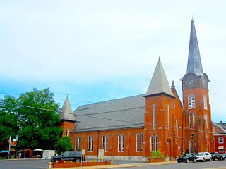
Huntingdon is a borough in Huntingdon County, Pennsylvania, United States. It is located along the Juniata River, approximately 32 miles (51 km) east of Altoona and 92 miles (148 km) west of Harrisburg. With a population of 6,827 at the 2020 census, it is the largest population center near Raystown Lake, a winding, 28-mile-long (45 km) flood-control reservoir managed by the U.S. Army Corps of Engineers.

<span class="mw-page-title-main">Mapleton, Pennsylvania</span> Borough in Pennsylvania, United States

Mapleton is a borough in Huntingdon County, Pennsylvania, United States. The population was 441 at the 2010 census. It is located on the Juniata River, which is a tributary of the Susquehanna River.

<span class="mw-page-title-main">Mill Creek, Pennsylvania</span> Borough in Pennsylvania, United States

Mill Creek is a borough in Huntingdon County, Pennsylvania, United States. The population was 328 at the 2010 census.

<span class="mw-page-title-main">Mount Union, Pennsylvania</span> Borough in Pennsylvania, United States

Mount Union is a borough in Huntingdon County, Pennsylvania, United States, approximately 44 miles (71 km) southeast of Altoona and 12 miles (19 km) southeast of Huntingdon, on the Juniata River. In the vicinity are found bituminous coal, ganister rock, fire clay, and some timber. A major Easter grass factory is located in the northern quadrant of the borough limits; until May 2007, the facility was owned by Bleyer Industries. The population was 2,447 at the 2010 census.

<span class="mw-page-title-main">Orbisonia, Pennsylvania</span> Borough in Pennsylvania, United States

Orbisonia is a borough in Huntingdon County, Pennsylvania, United States. The population was 428 at the 2010 census.

<span class="mw-page-title-main">Penn Township, Huntingdon County, Pennsylvania</span> Township in Pennsylvania, United States

Penn Township is a township in Huntingdon County, Pennsylvania, United States. The population was 1,086 at the 2020 census. The township includes the village of Hesston and the Seven Points Marina of Raystown Lake.

<span class="mw-page-title-main">Petersburg, Pennsylvania</span> Borough in Pennsylvania, United States

Petersburg is a borough in Huntingdon County, Pennsylvania, United States. It was a stop on the former Pennsylvania Railroad Main Line between Tyrone and Huntingdon and the junction point for the Petersburg Branch. The population was 480 at the 2010 census.

<span class="mw-page-title-main">Saltillo, Pennsylvania</span> Borough in Pennsylvania, United States

Saltillo is a borough in Huntingdon County, Pennsylvania, United States. The population was 346 at the 2010 census.

<span class="mw-page-title-main">Shade Gap, Pennsylvania</span> Borough in Pennsylvania, United States

Shade Gap is a borough in Huntingdon County, Pennsylvania, United States. The population was 105 at the 2010 census.

<span class="mw-page-title-main">Shirleysburg, Pennsylvania</span> Borough in Pennsylvania, United States

Shirleysburg is a borough in Huntingdon County, Pennsylvania, United States. The population was 150 at the 2010 census.

<span class="mw-page-title-main">Three Springs, Pennsylvania</span> Borough in Pennsylvania, United States

Three Springs is a borough in Huntingdon County, Pennsylvania, United States. The population was 444 at the 2010 census.

<span class="mw-page-title-main">Sewickley Township, Pennsylvania</span> Township in Pennsylvania, United States

Sewickley Township is a township in Westmoreland County, Pennsylvania, United States. The population was 5,590 at the 2020 census.

<span class="mw-page-title-main">East Broad Top Railroad and Coal Company</span> Historic district in Pennsylvania, United States

The East Broad Top Railroad (EBT) is a 3 ft narrow gauge historic and heritage railroad headquartered in Rockhill Furnace, Pennsylvania.

Blacklog Creek is a 28.5-mile-long (45.9 km) tributary of Aughwick Creek in Huntingdon County, Pennsylvania, in the United States.

References

  1. "ArcGIS REST Services Directory". United States Census Bureau. Retrieved August 8, 2023.
  2. "Census Population API". United States Census Bureau. Retrieved Oct 12, 2022.
  3. U.S. Geological Survey Geographic Names Information System: Rockhill, Pennsylvania
  4. 1 2 "Geographic Identifiers: 2010 Census Summary File 1 (G001): Rockhill borough, Pennsylvania". American Factfinder. U.S. Census Bureau. Archived from the original on February 13, 2020. Retrieved January 22, 2018.
  5. Population Estimates Boundary Changes Archived 2006-02-06 at the Wayback Machine , United States Census Bureau, 2009-03-18. Accessed 2009-07-23.
  6. "US Gazetteer files: 2010, 2000, and 1990". United States Census Bureau. 2011-02-12. Retrieved 2011-04-23.
  7. "Census of Population and Housing". Census.gov. Retrieved June 4, 2016.
  8. "U.S. Census website". United States Census Bureau . Retrieved 2008-01-31.
  9. "Friends of the East Broad Top – Preserving the oldest narrow gauge railroad anywhere in America".