Northwich is a market and port town and civil parish in the unitary authority of Cheshire West and Chester in the ceremonial county of Cheshire, England. It lies in the heart of the Cheshire Plain, at the confluence of the rivers Weaver and Dane. The town is about 18 miles (29 km) east of Chester, 15 miles (24 km) south of Warrington, and 19 miles (31 km) south of Manchester.

The Cornovīī were a Celtic people of the Iron Age and Roman Britain, who lived principally in the modern English counties of Cheshire, Shropshire, north Staffordshire, north Herefordshire and eastern parts of the Welsh counties of Flintshire, Powys and Wrexham. Their capital in pre-Roman times was probably a hillfort on the Wrekin. Ptolemy's 2nd-century Geography names two of their towns: Deva Victrix (Chester) and Viroconium Cornoviorum (Wroxeter), which became their capital under Roman rule.

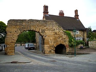
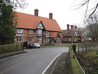
Middlewich is a town in the unitary authority of Cheshire East and the ceremonial county of Cheshire, England, 19.2 miles (30.9 km) east of Chester, 2.9 miles (4.7 km) east of Winsford, 5.3 miles (8.5 km) southeast of Northwich and 4.7 miles (7.6 km) northwest of Sandbach. The population at the 2011 Census was 13,595. Middlewich, with Northwich and Winsford, forms part of the Central Cheshire conurbation, with an estimated 2023 population of 130,000.

Headcorn is a village and civil parish in the borough of Maidstone in Kent, England. The parish is on the floodplain of the River Beult south east of Maidstone.

Badbury Rings is an Iron Age hill fort and Scheduled Monument in east Dorset, England. It was in the territory of the Durotriges. In the Roman era a temple was located immediately west of the fort, and there was a Romano-British town known as Vindocladia a short distance to the south-west.

The history of Cheshire can be traced back to the Hoxnian Interglacial, between 400,000 and 380,000 years BP. Primitive tools that date to that period have been found. Stone Age remains have been found showing more permanent habitation during the Neolithic period, and by the Iron Age the area is known to have been occupied by the Celtic Cornovii tribe and possibly the Deceangli.
Lincolnshire, England derived from the merging of the territory of the ancient Kingdom of Lindsey with that controlled by the Danelaw borough Stamford. For some time the entire county was called 'Lindsey', and it is recorded as such in the Domesday Book. Later, Lindsey was applied to only the northern core, around Lincoln; it was defined as one of the three 'Parts of Lincolnshire', along with Holland in the south-east and Kesteven in the south west.

Salt, also referred to as table salt or by its chemical formula NaCl, is an ionic compound made of sodium and chloride ions. All life depends on its chemical properties to survive. It has been used by humans for thousands of years, from food preservation to seasoning. Salt's ability to preserve food was a founding contributor to the development of civilization. It helped eliminate dependence on seasonal availability of food, and made it possible to transport food over large distances. However, salt was often difficult to obtain, so it was a highly valued trade item, and was considered a form of currency by certain people. Many salt roads, such as the Via Salaria in Italy, had been established by the Bronze Age.
Winsford is a town and civil parish in the unitary authority of Cheshire West and Chester and the ceremonial county of Cheshire, England, on the River Weaver south of Northwich and west of Middlewich. It grew around the salt mining industry after the river was canalised in the 18th century, allowing freight to be conveyed northwards to the Port of Runcorn on the River Mersey. The town of Winsford has an estimated population of 35,000 in 2023.
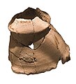
Middlewich, a town in northwest England, lies on the confluence of three rivers – the Dane, the Croco and the Wheelock. Most importantly for the history of salt making, it also lies on the site of a prehistoric brine spring.
Lindum Colonia was the Roman settlement which is now the City of Lincoln in Lincolnshire. It was founded as a Roman Legionary Fortress during the reign of the Emperor Nero or possibly later. Evidence from Roman tombstones suggests that Lincoln was first garrisoned by the Ninth Legion Hispana, which probably moved from Lincoln to found the fortress at York around c. 71 AD. Lindum was then garrisoned by the Second Legion Adiutrix, which then went on to Chester in 77–78 AD.
Middlewich is one of the Wich towns in Cheshire, England.

Cheshire is a county in North West England. Rock salt was laid down in this region some 220 million years ago, during the Triassic period. Seawater moved inland from an open sea, creating a chain of shallow salt marshes across what is today the Cheshire Basin. As the marshes evaporated, deep deposits of rock salt were formed.

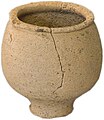
Open-pan salt making is a method of salt production wherein salt is extracted from brine using open pans.

Bradwall is a small village and civil parish in the unitary authority of Cheshire East, about 2 mi (3.2 km) northwest of Sandbach in the ceremonial county of Cheshire, England, and about 20 mi (32 km) south of Manchester. According to the 2011 census, the population of the entire parish was 182. The area is predominantly agricultural, with no manufacturing or retail outlets.
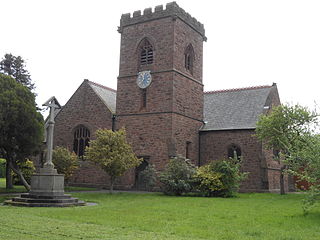
Warmingham is a village and civil parish in the unitary authority of Cheshire East and ceremonial county of Cheshire, England, on the River Wheelock, 3.25 miles (5.23 km) north of Crewe, 3.25 miles (5.23 km) south of Middlewich and 3.25 miles (5.23 km) miles west of Sandbach. The parish also includes the small settlement of Lane Ends, with a total population of just under 250. Nearby villages include Minshull Vernon, Moston and Wimboldsley.
In Congleton Borough, there were many different provisions for children and young people ranging from pre-schooling to Colleges of Further education. The nearest Area Education Office County Offices were in the neighbouring Borough of Macclesfield. As of 1 April 2009, responsibility for education in the former borough of Congleton passed to the new unitary authority of Cheshire East.
The history of Northwich can be traced back to the Roman period. The area around Northwich has been exploited for its salt pans since this time. The town has been severely affected by salt mining with subsidence historically being a large issue. A programme of mine stabilisation has recently been undertaken.
Mellor hill fort is a prehistoric site in North West England, that dates from the British Iron Age—about 800 BC to 100 AD. Situated on a hill in Mellor, Greater Manchester, on the western edge of the Peak District, the hill fort overlooks the Cheshire Plain. Although the settlement was founded during the Iron Age, evidence exists of activity on the site as far back as 8,000 BC; during the Bronze Age the hill may have been an area where funerary practices were performed. Artefacts such as a Bronze Age amber necklace indicate the site was high status and that its residents took part in long-distance trade. The settlement was occupied into the Roman period. After the site was abandoned, probably in the 4th century, it was forgotten until its rediscovery in the 1990s.
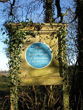
Sulloniacis or Sulloniacae was a mansio on the Roman road known as Watling Street in Roman Britain. Its existence is known from only one entry in the Antonine Itinerary, a listing of routes and facilities for the cursus publicus, the official courier service of the Roman Empire. Sulloniacis, which is recorded in Iter II for the route that ran between Portus Ritupis and Deva Victrix, was nine Roman miles from Verulamium and 12 from Londinium (London). Roman remains found at Brockley Hill near Edgware in the London Borough of Barnet have been identified as those of Sulloniacis.