Rose-Belle

Last updated

Rose-Belle
Town
Mauritius location map.svg
Red pog.svg
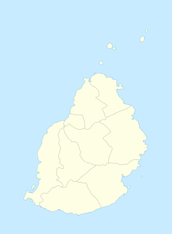
Rose-Belle
Municipal Council location
Coordinates: 20°24′9″S57°36′22″E / 20.40250°S 57.60611°E / -20.40250; 57.60611
Country Flag of Mauritius.svg Mauritius
Districts Grand Port
Government
[1]
  Type Municipality
Elevation
270 m (890 ft)
Population
 (2021) [2]
  Total12,799 [3]
Time zone UTC+4 (MUT)
ISO 3166 code MU-CU
Climate Af
Website Municipal Council

Rose-Belle is a small town in southeastern Mauritius.

Location

It is located in the Grand Port district, ten kilometers west of the district's well known town of Mahébourg. The population of the town in 2021 was 12,799. Of the 20 cities in Mauritius, Rose Belle ranks 15th in terms of population.

Related Research Articles

Moka is a village in Mauritius located mainly in the Moka District. The western part of the village lies in the Plaines Wilhems District. Since 1967 it forms part of Constituency No. 8 Quartier Militaire and Moka. The village is administered by the Moka Village Council under the aegis of the Moka District Council. According to the census made by Statistics Mauritius in 2011, the population was at 8,846. The elevation is 203 meters and can be up to 425 meters in some places. Moka is directly on the other side of the Moka Range from Port Louis. The village is close to the mountain Le Pouce and the town Beau-Bassin Rose-Hill. Réduit is a suburb of the village where the State House and University of Mauritius is situated. The village is also home to the Mauritius Broadcasting Corporation and the Mahatma Gandhi Institute.

<span class="mw-page-title-main">Grand Port District</span> District in Mauritius

Grand Port is a district of Mauritius, situated in the east of the island. The name means "large port" in French. The district has an area of 260.3 km2 and the estimated population was 112,997, as of 31 December 2015.

<span class="mw-page-title-main">Curepipe</span> Town in Plaines Wilhems, Mauritius

Curepipe also known as La Ville-Lumière, is a town in Mauritius, located mainly in the Plaines Wilhems District. Its eastern part lies in the Moka District. The town is administered by the Municipal Council of Curepipe. Curepipe lies at a higher elevation, often referred to as the "Central Plateau". According to the census made by Statistics Mauritius in 2018, the population of the town was at 78,618.

<span class="mw-page-title-main">Flacq District</span> District in Mauritius

Flacq is a district of Mauritius, situated in the east of the island. It is the largest district, having an area of 297.9 km², the population estimate was 138,460 as of 31 December 2015.

<span class="mw-page-title-main">Savanne District</span> District in Mauritius

Savanne or Savannah is a district of Mauritius, situated in the south of the island. The district has an area of 244.8 km2 and, as of 31 December 2015, the estimated population was 68,585. The southern part of the island is one of the most scenic and unspoilt.

The Districts of the Republic of Mauritius are the second-level administrative divisions after the Outer Islands of Mauritius.

<span class="mw-page-title-main">Pamplemousses District</span> District in Mauritius

Pamplemousses is a district of Mauritius, located in the northwest of the island, and is one of the most densely populated parts of the island. The name of the district comes from the French word for grapefruits. The district has an area of 178.7 km2 and an estimated population of 139,966, as of 31 December 2015.

<span class="mw-page-title-main">Quatre Bornes</span> Town in Plaines Wilhems, Mauritius

Quatre Bornes, also known as La Ville des Fleurs, is a town in Mauritius, located mainly in the Plaines Wilhems District. Its western part lies in the Rivière Noire District. The town is administered by the Municipal Council of Quatre Bornes. Situated between the towns of Beau-Bassin Rose-Hill and Vacoas-Phoenix, Quatre Bornes is linked by roads to the north, east, south and west of Mauritius. According to the census made by Statistics Mauritius in 2015, the population of the town was at 77,308.

<span class="mw-page-title-main">Plaines Wilhems District</span> District in Mauritius

Plaines Wilhems is a district of Mauritius. It is the most populous district, with an estimated population of 366,506 at the end of 2018. The district is mainly urban; it consists of four towns, the village of Midlands and part of two other villages. The Plaines Wilhems district does not have a District Council; it has four Municipal Town Councils. The towns are Beau-Bassin Rose-Hill, Curepipe, Quatre Bornes and Vacoas-Phoenix. The villages are Midlands, Cascavelle and Moka. The district was named after Wilhem Leicknig. Of Prussian origin, he settled on the island of Mauritius, then known as Isle de France, in 1721.

<span class="mw-page-title-main">Rivière du Rempart District</span> District in Mauritius

Rivière du Rempart is a district of Mauritius, located in the north-east of the island. It has an area of 147.6 km² and an estimated population of 108,005, as of 31 December 2015.

<span class="mw-page-title-main">Vacoas-Phoenix</span> Town in Plaines Wilhems, Mauritius

Vacoas-Phoenix also known as French: Villes Jumelles, is a town in Mauritius, located in the Plaines Wilhems District, the eastern part also lies in the Moka District. The town is administered by the Municipal Council of Vacoas-Phoenix. The town lies between Quatre Bornes and Curepipe.

<span class="mw-page-title-main">Beau Bassin-Rose Hill</span> Town in Plaines Wilhems, Mauritius

Beau Bassin-Rose Hill is a town in Mauritius, located in the Plaines Wilhems District. It is administered by the Municipal Council of Beau Bassin-Rose Hill and has a population of 147,066 inhabitants, making it the third largest city on the island.

Centre de Flacq or Central Flacq is the metropolitan area of Flacq District, located in the center of the district. The village is one of the most developed and popular villages in Mauritius. Home to several commercials and public institutions, the village topped the list of the most developed village in Flacq District. The village is administered by the Centre de Flacq Village Council under the aegis of the Flacq District Council. According to the census made by Statistics Mauritius in 2011, the population was at 15,791. The main source of transportation are taxi and bus service and English was registered as its official language and is highly exercised for notifications and advertisements.

<span class="mw-page-title-main">Bambous, Mauritius</span> Village in Rivière Noire District, Mauritius

Bambous is a small town in Mauritius located in the Rivière Noire District. The village is administered by the Bambous Village Council under the aegis of the Rivière Noire District Council. According to the census by Statistics Mauritius in 2011, the population was 15,345.

<span class="mw-page-title-main">Rivière Noire District</span> District in Mauritius

Rivière Noire or Black River is a district on the western side of the island of Mauritius. Rivière Noire translates to Black River. This region receives less rainfall than the others. The district has an area of 259 square kilometres (100 sq mi) and the population was estimated to be 80,939 as of 31 December 2015. It is the third largest district of Mauritius in area, but the smallest in terms of population. The district is mostly rural, but it also include the western part of the city of Port Louis and western part of Quatre Bornes.

<span class="mw-page-title-main">Grand Baie</span> Village in Rivière du Rempart District, Mauritius

Grand Baie is a coastal village in Mauritius located mainly in the Rivière du Rempart District. The western part of the village lies inside the Pamplemousses District. The village is administered by the Grand Baie Village Council under the aegis of the Rivière du Rempart District Council. According to the census by Statistics Mauritius in 2011, the population was at 11,910.

Goodlands is a medium-sized town in northern Mauritius located in Rivière du Rempart District. The village is administered by the Goodlands Village Council under the aegis of the Rivière du Rempart District Council. It is one of the most populated villages in Mauritius. According to the 2011 census, the population was 20,712.

<span class="mw-page-title-main">Municipal Council of Beau Bassin-Rose Hill</span>

The Municipal Council of Beau-Bassin Rose-Hill is the local authority responsible for the administration of the town of Beau-Bassin Rose-Hill, Plaines Wilhems District, Mauritius. Since 31 May 2023, the mayor is Rajeneedavee Mootoo Caroopen and the deputy mayor is Jai Krishna Vishwanauth Choolun.

Rivière Du Poste is a village in the southern part of Mauritius located in both Savanne and Grand Port districts. The locality is about 19 miles south of Port Louis, the nation's capital. The village is administered by the Rivière du Poste Village Council under the aegis of the Savanne District Council. According to the census made by Statistics Mauritius in 2011, the population was 2,170. The neighboring villages are La Flora, Mare Tabac and Rose Belle and Camp Diable and Riviere Dragon in the south of the village.

References

  1. http://localgovernment.gov.mu/English/Local%20Authorities/Pages/Municipal-and-District-Councils-in-Mauritius.aspx
  2. Ministry of Finance & Economic Development (2012). "ANNUAL DIGEST OF STATISTICS 2012" (PDF). 31 December. Government of Mauritius: 22. Retrieved 20 October 2013.{{cite journal}}: Cite journal requires |journal= (help)
  3. "Population of Rose Belle 2021 | Rose Belle population - statistics". Population HUB. Retrieved 14 March 2021.