Rosebush, Michigan

Last updated

Rosebush, Michigan
Village of Rosebush
Rosebush, Michigan (2023).jpg
Looking east along E. Rosebush Road
Rosebush (village), MI location.png
Location within Isabella County
USA Michigan location map.svg
Red pog.svg
Rosebush
Location within the state of Michigan
Usa edcp location map.svg
Red pog.svg
Rosebush
Location within the United States
Coordinates: 43°41′57″N84°46′4″W / 43.69917°N 84.76778°W / 43.69917; -84.76778
CountryUnited States
State Michigan
County Isabella
Township Isabella
Settled1844
Platted 1868
Government
  Type Village council
  PresidentMargaret Anderson
Area
[1]
  Total0.89 sq mi (2.31 km2)
  Land0.89 sq mi (2.31 km2)
  Water0.00 sq mi (0.00 km2)
Elevation
781 ft (238 m)
Population
 (2020)
  Total353
  Density396.63/sq mi (153.14/km2)
Time zone UTC-5 (Eastern (EST))
  Summer (DST) UTC-4 (EDT)
ZIP code(s)
48878
Area code 989
FIPS code 26-69640 [2]
GNIS feature ID0636218 [3]

Rosebush is a village in Isabella County in the U.S. state of Michigan. The population was 353 at the 2020 census. The village is within Isabella Township, and is also entirely within the Isabella Indian Reservation, home to the federally-recognized Saginaw Chippewa Tribal Nation.

Contents

History

Rosebush began in 1844 when Cornelius Bogan started a general store. He called the town Halfway because it was approximately halfway between Clare and Mount Pleasant. In 1868, the Ann Arbor Railroad came through the area and resident James Bush, while officially platting the land, bartered with the railroad some of his property for the right to have the station named after his wife, Rose. An addition to the community was later platted in 1873 by Elias B. Calkins and named Calkinsville – this was the name of the original post office on July 9, 1873. The post office name was changed to Rosebush in 1889, back to Calkinsville in 1890 and once again Rosebush on February 19, 1903. The name has remained unchanged since. [4]

Geography

According to the U.S. Census Bureau, the village has a total area of 0.89 square miles (2.31 km2), all land. [5]

Major highways

Demographics

Historical population
CensusPop.Note
1970 439
1980 336−23.5%
1990 333−0.9%
2000 37913.8%
2010 368−2.9%
2020 353−4.1%
U.S. Decennial Census [6]

2010 census

As of the census [7] of 2010, there were 368 people, 170 households, and 89 families residing in the village. The population density was 413.5 inhabitants per square mile (159.7/km2). There were 186 housing units at an average density of 209.0 per square mile (80.7/km2). The racial makeup of the village was 88.6% White, 1.1% African American, 3.8% Native American, 1.4% from other races, and 5.2% from two or more races. Hispanic or Latino of any race were 6.3% of the population.

There were 170 households, of which 21.2% had children under the age of 18 living with them, 34.7% were married couples living together, 11.8% had a female householder with no husband present, 5.9% had a male householder with no wife present, and 47.6% were non-families. 42.9% of all households were made up of individuals, and 17.1% had someone living alone who was 65 years of age or older. The average household size was 2.13 and the average family size was 2.91.

The median age in the village was 39 years. 19.8% of residents were under the age of 18; 14% were between the ages of 18 and 24; 22.9% were from 25 to 44; 26.3% were from 45 to 64; and 17.1% were 65 years of age or older. The gender makeup of the village was 44.6% male and 55.4% female.

2000 census

As of the census [2] of 2000, there were 379 people, 145 households, and 95 families residing in the village. The population density was 437.6 inhabitants per square mile (169.0/km2). There were 156 housing units at an average density of 180.1 per square mile (69.5/km2). The racial makeup of the village was 96.31% White, 2.11% African American, 0.53% Native American, 0.53% from other races, and 0.53% from two or more races. Hispanic or Latino of any race were 2.90% of the population.

There were 145 households, out of which 37.2% had children under the age of 18 living with them, 45.5% were married couples living together, 17.2% had a female householder with no husband present, and 33.8% were non-families. 23.4% of all households were made up of individuals, and 6.9% had someone living alone who was 65 years of age or older. The average household size was 2.58 and the average family size was 3.02.

In the village, the population was spread out, with 30.1% under the age of 18, 10.6% from 18 to 24, 31.4% from 25 to 44, 16.9% from 45 to 64, and 11.1% who were 65 years of age or older. The median age was 32 years. For every 100 females, there were 89.5 males. For every 100 females age 18 and over, there were 84.0 males.

The median income for a household in the village was $31,111, and the median income for a family was $35,250. Males had a median income of $31,083 versus $25,000 for females. The per capita income for the village was $14,041. About 12.1% of families and 20.4% of the population were below the poverty line, including 29.8% of those under age 18 and 13.5% of those age 65 or over.

Images

Related Research Articles

<span class="mw-page-title-main">Isabella County, Michigan</span> County in Michigan, United States

Isabella County is a county located in the U.S. state of Michigan. As of the 2020 Census, the population was 64,394. Its county seat is Mount Pleasant. The area was known as Ojibiway Besse, meaning "the place of the Ojibwa". Isabella County contains the Isabella Indian Reservation, on which members of the Saginaw Chippewa Tribal Nation live.

<span class="mw-page-title-main">Athens, Michigan</span> Village in Michigan, United States

Athens is a village in Calhoun County in the U.S. state of Michigan. The population was 936 at the 2020 census. The village is located in southern Athens Township, and is part of the Battle Creek, Michigan Metropolitan Statistical Area. It was settled in 1831.

<span class="mw-page-title-main">Tekonsha, Michigan</span> Village in Michigan, United States

Tekonsha is a village in Tekonsha Township, Calhoun County in the U.S. state of Michigan. It is part of the Battle Creek, Michigan Metropolitan Statistical Area. The population was 653 at the 2020 census.

<span class="mw-page-title-main">Ashley, Michigan</span> Village in Michigan, United States

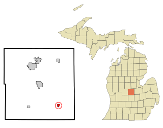
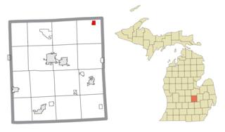
Ashley is a village in Gratiot County in the U.S. state of Michigan. The population was 508 at the 2020 census. The village is located in the northwest corner of Elba Township. No major state trunkline runs through the village, although M-57 passes within one mile to the south. Ashley was platted in 1884.

<span class="mw-page-title-main">Elkton, Michigan</span> Village in Michigan, United States

Elkton is a village in Huron County in the U.S. state of Michigan. The population was 796 at the 2020 census. The village is within Oliver Township, along the Pinnebog River. It was incorporated in 1897.

<span class="mw-page-title-main">Port Austin, Michigan</span> Village in Michigan, United States

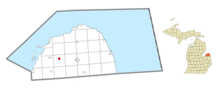
Port Austin is a village in Huron County in the U.S. state of Michigan. The population was 664 at the 2010 census. The village is within Port Austin Township.

<span class="mw-page-title-main">Muir, Michigan</span> Village in Michigan, United States

Muir is a village in Lyons Township, Ionia County in the U.S. state of Michigan. The population was 604 at the 2010 census.

<span class="mw-page-title-main">Broomfield Township, Michigan</span> Civil township in Michigan, United States

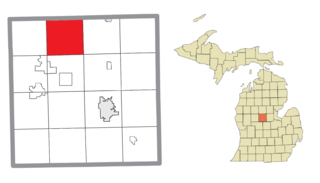
Broomfield Township is a civil township of Isabella County in the U.S. state of Michigan. As of the 2020 census, the township population was 1,857.

<span class="mw-page-title-main">Coldwater Township, Isabella County, Michigan</span> Civil township in Michigan, United States

Coldwater Township is a civil township of Isabella County in the U.S. state of Michigan. The population was 801 at the 2020 census, making it the least-populated township in the county.

<span class="mw-page-title-main">Gilmore Township, Isabella County, Michigan</span> Civil township in Michigan, United States

Gilmore Township is a civil township of Isabella County in the U.S. state of Michigan. The population was 1,314 at the 2020 census.

<span class="mw-page-title-main">Isabella Township, Michigan</span> Civil township in Michigan, United States

Isabella Township is a civil township of Isabella County in the U.S. state of Michigan. The population was 2,096 at the 2020 census.

<span class="mw-page-title-main">Shepherd, Michigan</span> Village in Michigan, United States

Shepherd is a village in Isabella County in the U.S. state of Michigan. The population was 1,469 at the 2020 census. The village is located within Coe Township.

<span class="mw-page-title-main">Sherman Township, Isabella County, Michigan</span> Civil township in Michigan, United States

Sherman Township is a civil township of Isabella County in the U.S. state of Michigan. The population was 3,127 at the 2020 census.

<span class="mw-page-title-main">Lake Isabella, Michigan</span> Village in Michigan, United States

Lake Isabella is a village split between Sherman Township and Broomfield Township within Isabella County in the U.S. state of Michigan. The population grew to 1,681 people as of the 2010 Census, making the community one of the state's ten fastest growing communities in terms of percentage, with an increase of 35% from the 2000 Census, and an increase of 160% from 1990. The village shares the 48893 ZIP Code with several neighboring municipalities.

<span class="mw-page-title-main">Clinton, Lenawee County, Michigan</span> Village in Michigan, United States

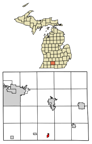
Clinton is a village in Lenawee County in the Irish Hills area of the U.S. state of Michigan. The population was 2,336 at the 2010 census. The village is located within Clinton Township.

<span class="mw-page-title-main">Edmore, Michigan</span> Village in Michigan, United States

Edmore is a village in Montcalm County of the U.S. state of Michigan. The population was 1,210 at the 2020 census.

<span class="mw-page-title-main">New Lothrop, Michigan</span> Village in Michigan, United States

New Lothrop is a village in Shiawassee County in the U.S. state of Michigan. The population was 565 at the 2020 census. The village is located within Hazelton Township.

<span class="mw-page-title-main">Breedsville, Michigan</span> Village in Michigan, United States

Breedsville is a village in Van Buren County of the U.S. state of Michigan. The population was 199 at the 2010 census. The village is within Columbia Township.

<span class="mw-page-title-main">Lawton, Michigan</span> Village in Michigan, United States

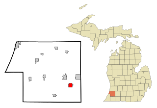
Lawton is a village in southeastern Van Buren County, Michigan, United States. The population was 1,900 at the 2010 census.

Lennon is a village in the U.S. state of Michigan. The population was 511 at the 2010 census. The village is located along M-13 within Venice Township in Shiawassee County to the west and Clayton Township in Genesee County to the east.

References

  1. "2020 U.S. Gazetteer Files". United States Census Bureau. Retrieved May 21, 2022.
  2. 1 2 "U.S. Census website". United States Census Bureau . Retrieved January 31, 2008.
  3. U.S. Geological Survey Geographic Names Information System: Rosebush, Michigan
  4. Romig, Walter (October 1, 1986) [1973]. Michigan Place Names: The History of the Founding and the Naming of More Than Five Thousand Past and Present Michigan Communities (Paperback). Detroit, Michigan: Wayne State University Press. p. 484. ISBN   978-0-8143-1838-6.
  5. "US Gazetteer files 2010". United States Census Bureau. Archived from the original on July 2, 2012. Retrieved November 25, 2012.
  6. "Census of Population and Housing". Census.gov. Retrieved June 4, 2015.
  7. "U.S. Census website". United States Census Bureau . Retrieved November 25, 2012.