Related Research Articles

Bal Harbour is a village in Miami-Dade County, Florida. The population was 3,093 at the 2020 US Census.

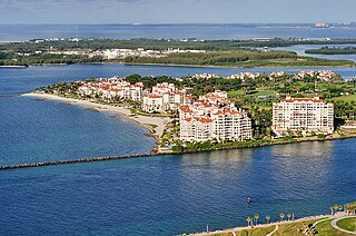
Fisher Island is a census-designated place in Miami-Dade County, Florida, United States, located on a barrier island of the same name. Since 2015, Fisher Island has the highest per capita income of any place in the United States. It had only 218 households and a total population of 467.

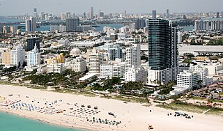
Miami Beach is a coastal resort city in Miami-Dade County, Florida. It was incorporated on March 26, 1915. The municipality is located on natural and man-made barrier islands between the Atlantic Ocean and Biscayne Bay, the latter of which separates the Beach from the mainland city of Miami. The neighborhood of South Beach, comprising the southernmost 2.5 sq mi (6.5 km2) of Miami Beach, along with Downtown Miami and the PortMiami, collectively form the commercial center of South Florida. Miami Beach's population is 82,890 according to the 2020 census. Miami Beach is the 26th largest city in Florida based on official 2019 estimates from the U.S. Census Bureau. It has been one of America's pre-eminent beach resorts since the early 20th century.

Sunny Isles Beach is a city located on a barrier island in northeast Miami-Dade County, Florida, United States. The city is bounded by the Atlantic Ocean on the east and the Intracoastal Waterway on the west.

Biscayne National Park is an American national park located south of Miami, Florida in Miami-Dade County. The park preserves Biscayne Bay and its offshore barrier reefs. Ninety-five percent of the park is water, and the shore of the bay is the location of an extensive mangrove forest. The park covers 172,971 acres and includes Elliott Key, the park's largest island and northernmost of the true Florida Keys, formed from fossilized coral reef. The islands farther north in the park are transitional islands of coral and sand. The offshore portion of the park includes the northernmost region of the Florida Reef, one of the largest coral reefs in the world.

Biscayne Bay is a lagoon with characteristics of an estuary located on the Atlantic coast of South Florida. The northern end of the lagoon is surrounded by the densely developed heart of the Miami metropolitan area while the southern end is largely undeveloped with a large portion of the lagoon included in Biscayne National Park.

Key Biscayne is an island located in Miami-Dade County, Florida, located between the Atlantic Ocean and Biscayne Bay. It is the southernmost of the barrier islands along the Atlantic coast of Florida, and lies south of Miami Beach and southeast of Miami. The key is connected to Miami via the Rickenbacker Causeway, originally built in 1947.

South Beach, also nicknamed colloquially as SoBe, is a neighborhood in Miami Beach, Florida. It is located east of Miami between Biscayne Bay and the Atlantic Ocean. The area encompasses Miami Beach south of Dade Boulevard.

Miami Modernist architecture, or MiMo, is a regional style of architecture that developed in South Florida during the post-war period. The style was internationally recognized as a regionalist response to the International Style. It can be seen in most of the larger Miami and Miami Beach resorts built after the Great Depression. Because MiMo styling was not just a response to international architectural movements but also to client demands, themes of glamour, fun, and material excess were added to otherwise stark, minimalist, and efficient styles of the era. The style can be most observed today in Middle and Upper Miami Beach along Collins Avenue, as well as along the Biscayne Boulevard corridor starting from around Midtown, through the Design District and into the Upper Eastside.

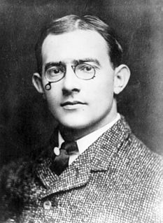
Carl Graham Fisher was an American entrepreneur. He was an important figure in the automotive industry, in highway construction, and in real estate development.

The Collins Bridge was a bridge that crossed Biscayne Bay between Miami and Miami Beach, Florida. At the time it was completed, it was the longest wooden bridge in the world. It was built by farmer and developer John S. Collins (1837–1928) with financial assistance from automotive parts and racing pioneer Carl G. Fisher. Fisher, an auto parts magnate, loaned Collins $50,000 in 1911 to complete the bridge when Collins' money ran out. Collins, then 75 years old, traded Fisher 200 acres (81 ha) of land on Miami Beach for the loan.

John Stiles Collins was an American Quaker farmer from Moorestown Township, New Jersey who moved to South Florida at the turn of the 20th century. He attempted to grow vegetables and coconuts on the swampy, bug-infested stretch of land between Miami and the ocean, a barrier island which became Miami Beach.

The Venetian Causeway crosses Biscayne Bay between Miami on the mainland and Miami Beach on a barrier island in the Miami metropolitan area. The man-made Venetian Islands and non-bridge portions of the causeway were created by materials which came from the dredging of the bay. The Venetian Causeway follows the original route of the Collins Bridge, a wooden 2.5 mi (4 km) long structure built in 1913 by John S. Collins and Carl G. Fisher which opened up the barrier island for unprecedented growth and development.

Lincoln Road Mall is a pedestrian road running east–west parallel between 16th Street and 17th Street in Miami Beach, Florida, United States. Once completely open to vehicular traffic, it now hosts a pedestrian mall replete with shops, restaurants, galleries, and other businesses between Washington Avenue with a traffic accessible street extending east to the Atlantic Ocean and west to Alton Road with a traffic accessible street extending to Biscayne Bay.

The Venetian Islands are a chain of artificial islands in Biscayne Bay in the cities of Miami and Miami Beach, Florida. The islands are, from west to east: Biscayne Island (Miami), San Marco Island (Miami), San Marino Island, Di Lido Island, Rivo Alto Island, and Belle Isle. Flagler Monument Island remains an uninhabited picnic island, originally built in 1920 as a memorial to railroad pioneer Henry Flagler. The islands are connected by bridges from the Miami mainland to Miami Beach.

Belle Isle is a neighborhood in the city of Miami Beach on an island in Biscayne Bay, Florida, United States. It is the easternmost of the Venetian Islands, a chain of artificial islands in Biscayne Bay in the cities of Miami and Miami Beach. It is home to apartment buildings, a portion of the Venetian Causeway, a city of Miami Beach park, and a hotel. It is between Rivo Alto Island and the main barrier island of Miami Beach.
The Florida land boom of the 1920s was Florida's first real estate bubble. This pioneering era of Florida land speculation lasted from 1924 to 1926 and attracted investors from all over the nation. The land boom left behind entirely new, planned developments incorporated into towns and cities. Major investors and speculators such as Carl G. Fisher also left behind a new history of racially deed restricted properties that segregated cities for decades. Among those cities at the center of this bubble were Miami Beach, Coral Gables, Hialeah, Miami Springs, Opa-locka, Miami Shores, and Hollywood. It also left behind the remains of failed development projects such as Aladdin City in south Miami-Dade County, Fulford-by-the-Sea in what is now North Miami Beach, Miami's Isola di Lolando in north Biscayne Bay, Boca Raton, as it had originally been planned, Okeelanta in western Palm Beach County, and Palm Beach Ocean just north of the Town of Palm Beach. The land boom shaped Florida's future for decades and created entire new cities out of the Everglades land that remain today. The story includes many parallels to the real estate boom of the 2000s, including the forces of outside speculators, easy credit access for buyers, and rapidly appreciating property values, ending in a financial collapse that ruined thousands of investors and property owners, and crippled the local economy for years thereafter.

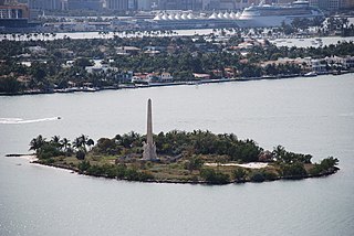
Flagler Memorial Island is an uninhabited artificial island of South Beach in the city of Miami Beach in Biscayne Bay, Florida. A 110-foot (34 m) high obelisk with allegorical sculptures at its base stands as a monument to Miami pioneer Henry M. Flagler, and was built in the center of the freshly constructed island in memory of Flagler, who died in 1913.

The Flamingo Hotel overlooked Biscayne Bay on the west side of the newly formed city of Miami Beach, Florida, until the 1950s, when it was torn down to make room for the new Morton Towers development, which is now known as the Flamingo South Beach.
Star Island is a neighborhood in the city of Miami Beach on a man-made island in Biscayne Bay, Florida, United States. The island is south of the Venetian Islands and just east of Palm and Hibiscus islands.
References
- ↑ Mr. Miami Beach - Carl G. Fisher
- ↑ John S. Collins Biography
- ↑ Braham D. Lavender, Miami Beach in 1920 pg. 13, 2002
- ↑ Review of book on Miami hotel history
- 1 2 Mr Miami Beach, documentary film transcript
- ↑ American Heritage.com
- ↑ "The Man Who Invented". Archived from the original on 2007-09-29. Retrieved 2006-06-07.
- ↑ Ruby Leach Carson 40 Years of Miami Beach pg. 19, 1955
- ↑ Biscayne National Park, p. 30