
Branford is a shoreline town located on Long Island Sound in New Haven County, Connecticut, about 6 miles (10 km) east of downtown New Haven. The population was 28,026 at the 2010 census.
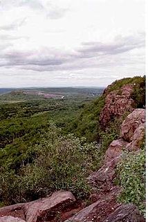
Guilford is a town in New Haven County, Connecticut, United States, that borders Madison, Branford, North Branford and Durham, and is situated on I-95 and the Connecticut seacoast. The population was 22,375 at the 2010 census. In 2015 the population stands at approximately 22,413 people.

Branford Center is a neighborhood and census-designated place (CDP) in the town of Branford, Connecticut, United States. The CDP encompasses the traditional town center area and the area known as Branford Point. The population of the CDP was 5,819 at the 2010 census.

Route 146 is a state road that serves as a scenic alternative to US 1 between Branford and Guilford in the U.S. state of Connecticut. Route 146 is 13.00 miles (20.92 km) long, with 8.36 miles (13.45 km) in Branford and 4.64 miles (7.47 km) in Guilford.

Guilford is a regional rail station on the Northeast Corridor, located slightly south of the town center of Guilford, Connecticut. Owned by the Connecticut Department of Transportation, it is served by the CTrail Shore Line East service.
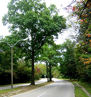
The Neponset Valley Parkway is a historic parkway in southern Boston and Milton, Massachusetts, United States. It is a connecting parkway in the Greater Boston area's network, providing a connection between the Blue Hills Reservation, Neponset River Reservation, and the Stony Brook Reservation. The parkway was constructed between 1898 and 1929 with design assistance from Charles Eliot and the Olmsted Brothers. It was listed on the National Register of Historic Places in 2005.

The Branford Point Historic District is a historic district in Branford, Connecticut. It was listed on the National Register of Historic Places in 1988. It includes a significant portion of the Branford Point neighborhood, generally considered to be the area along the west side of the Branford Harbor to the Amtrak railroad tracks. It is bounded on the west by the Short Beach neighborhood, on the north by Branford Center, and on the east by the Branford River. Harbor Street, Maple Avenue, and Stannard Avenue are the main thoroughfares of the neighborhood. In the 2000 Census, Branford Point was included by the U.S. Census Bureau in the Branford Center census-designated place.
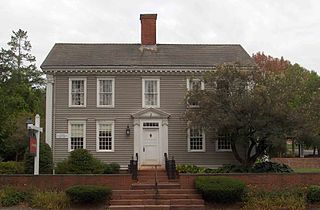
The Simsbury Center Historic District is a 75-acre (30 ha) historic district located in the town center area of Simsbury, Connecticut. It encompasses seven blocks of Hopmeadow Street, as well as the cluster of commercial, civic, and residential buildings along Railroad, Station, and Wilcox Streets, and Phelps Lane. Although its oldest element is the cemetery, most of its buildings were built in the late 19th and early 20th century. It was listed on the National Register of Historic Places in 1996.

The Torringford Street Historic District is a historic district on the east side of the city of Torrington, Connecticut. The district includes properties along Torringford Street, the main thoroughfare of the Torringford section of the city, between United States Route 202 and West Hill Road. The road is one of the oldest in Torrington, and this section is notable for containing a cross-section of well-preserved architecture from the 18th to the mid-20th centuries. The district was listed on the National Register of Historic Places in 1991.

The Dudleytown Historic District, also known as Clapboard Hill is a historic district in Guilford, Connecticut. Extending along Clapboard Hill Road for 1.4 miles (2.3 km), it encompasses a landscape whose land usage encapsulates all of the major regional rural development trends from the 17th to the early 20th centuries. It is architecturally dominated by rural vernacular residences of the 18th and 19th centuries. It was listed on the National Register of Historic Places in 1991.
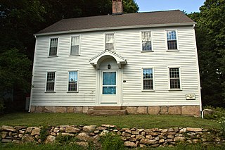
The John Rogers House is a historic house at 690 Leete's Island Road in Branford, Connecticut. It is a 2+1⁄2-story wood-frame structure, five bays wide, with a side-gable roof, a large central chimney, and a center entry sheltered by a bracketed hood. Long thought to have been built c. 1810, it has been carefully researched to date to the middle 18th century, belonging for many years to the locally prominent Rogers family. The John Rogers House was listed on the National Register of Historic Places in 1988. Portions of the content on this web page were adapted from a copy of the original Connecticut Historical Commission, Historic Resources Inventory documentation.
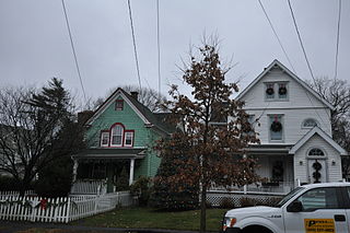
The Fourth Ward Historic District encompasses an early urban residential subdivision of Greenwich, Connecticut. Extending north from United States Route 1 along Sherwood Place, Church Street, and adjacent streets, it is one of two subdivisions created before the arrival of the railroad in Greenwich in 1848. It is characterized by dense residential construction, with architectural styles from the Greek Revival to early 20th-century styles. The district was listed on the National Register of Historic Places in 2000.

The Glastonbury Historic District encompasses a streetscape dating to the 17th century, along Main St. from Hebron Ave. to Talcott Rd. in Glastonbury, Connecticut. In addition to a significant number of 17th and 18th-century houses, it shows the architectural development of the town over time, with buildings spanning three centuries in construction dates. It was listed on the National Register of Historic Places in 1984.
The Shore Line Electric Railway was a trolley line along the southern coastline of Connecticut, running between New Haven and Old Saybrook with additional branches to Chester and Stony Creek. Unlike most trolley lines in New England, the Shore Line Electric was a true interurban, running large railway-style cars largely on a private right-of-way rather than on public streets. Though its main line was in operation for only 15 nonconsecutive years, the Shore Line Electric briefly acquired a substantial network of trolley lines stretching across eastern Connecticut, including the Norwich and Westerly Railway, the Groton and Stonington Street Railway, and several lines of the Connecticut Company. Most of the trolley line no longer is extant, however, the Shore Line Electric Railway Power House still stands along the mouth of the Connecticut River in Old Saybrook.

The Pelatiah Leete House is a historic house at 575 Leete's Island Road in Guilford, Connecticut, United States. Built in 1710 by Pelatiah Leete, it is the oldest surviving house associated with the locally prominent Leete family, who were among the founders of the New Haven Colony. The house was listed on the National Register of Historic Places in 1974.

The Edward Frisbie Homestead is a historic house at 240 Stony Creek Road in Branford, Connecticut. Built about 1790 by the grandson of one of Branford's first settlers, it is a little-altered and well-preserved example of Federal period architecture. It was listed on the National Register of Historic Places in 1985.

Guilford Historic Town Center is a large historic district encompassing the entire town center of Guilford, Connecticut, in the United States. It is centered on the town green, laid out in 1639, and extends north to Interstate 95, south to Long Island Sound, west to the West River, and east to East Creek. It includes more than 600 historic structures, most built between the late 17th and early 20th centuries, reflecting the town's growth and history during that time. It was listed on the National Register of Historic Places in 1976.

The John Hoadley House is a historic house at 213 Leete's Island Road in Branford, Connecticut. Built about 1810, it is a well-preserved example of late colonial architecture. It was listed on the National Register of Historic Places in 1988.

29 Flat Rock Road is a historic house in Branford, Connecticut. Probably built in the second half of the 18th century, it is a well-preserved example of a modest period farmhouse, a type of which relatively few now survive in the town. It was listed on the National Register of Historic Places in 1988.

The North Branford Center Historic District encompasses the historic town center of North Branford, Connecticut. Centered at the junction of North Street and Foxon Road, it has been the center of the town's civic and religious life since the early 18th century. The district includes the town hall, library, Congregational Church, and residential architecture dating to the early days. The district was listed on the National Register of Historic Places in 1999.


