Lewiston is a town in Niagara County, New York, United States. The population was 15,944 at the 2020 census. The town and its contained village are named after Morgan Lewis, a governor of New York.

Channel-Port aux Basques is a town at the extreme southwestern tip of Newfoundland fronting on the western end of the Cabot Strait. A Marine Atlantic ferry terminal is located in the town which is the primary entry point onto the island of Newfoundland and the western terminus of the Newfoundland and Labrador Route 1 in the province. The town was incorporated in 1945 and its population in the 2021 census was 3,547.

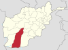
Grishk, also spelled Gereshk, is a town in Grishk District of Helmand province, geographically located along the Helmand River in Afghanistan, some 120 km (75 mi) northwest of Kandahar, at 817 metres (2,680 ft) altitude. Upstream lies the Kajaki Dam which diverts water to the Boghra Irrigation Canal, an essential infrastructure for the region's crops. Grishk Dam is also nearby. Grishk was originally built around a fort on the east bank of the river but was later rebuilt on the west. The fort was twice captured by the British: first in the First Anglo-Afghan War and again in 1879. In both cases the fort was later abandoned. Grishk has a population of about 48,546 and has a hospital and a school of engineering which was built back in 1957.

The Kajaki Dam is one of the two major hydroelectric power dams of Helmand province in southern Afghanistan. The dam is located on the Helmand River 100 miles (161 km) north-west of Kandahar and is operated by the Helmand and Arghandab Valley Authority. It has a dual function, to provide electricity and to irrigate some 650,000 acres (1800 km2) of an otherwise arid land. Water discharging from the dam traverses some 300 miles (500 km) of downstream irrigation canals feeding farmland. As of July 2022 it produces up to 151 megawatts (MW) of electricity.

Kajaki(Pashto: کجکی) is a district in the Northeast of Helmand Province, Afghanistan. Its population is by a vast majority Pashtun, and stood at 69,300 in 2012. The district centre is the village of Kajaki. Route 611 passes through the district to the district center.

State Route 100 is a primary state highway in the U.S. state of Virginia. The state highway runs 53.31 miles (85.79 km) from U.S. Route 221 in Hillsville north to SR 61 in Narrows. SR 100 is one of the major highways of the New River Valley, connecting Narrows and Pearisburg in Giles County with Dublin, Pulaski, and Interstate 81 (I-81) in Pulaski County.

Operation Herrick was the codename under which all British operations in the War in Afghanistan were conducted from 2002 to the end of combat operations in 2014. It consisted of the British contribution to the NATO-led International Security Assistance Force (ISAF), and support to the American-led Operation Enduring Freedom (OEF), within the central Asian country.
Kajaki is a village in southern Afghanistan, and is split between two townsteads, Kajaki 'Olya, and Kajaki Sofla. It is the district centre of Kajaki District in Helmand Province. North east of the village is an important hydro power station for electricity and irrigation projects, the Kajaki Dam. The village itself hugs the east side of the Helmand River, right after it makes its first turn south, one km out from the dam. Kajaki is bordered by the town Payson to its west, Tangeye, an abandoned bazaar to its north, Shabez Kheyl, and Kanzi to its north west, all across the Helmand. Kajaki serves as the northern terminus of Route 611.

Operation Achilles was a NATO operation, part of the War in Afghanistan. Its objective was to clear Helmand province of the Taliban. The operation began on March 6, 2007. The offensive is the largest NATO-based operation in Afghanistan to date. NATO officials reported that, contrary to previous operations, Taliban fighters were avoiding direct confrontation in favor of guerilla tactics.
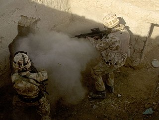
Operation Volcano was a British operation to clear a village that the Taliban were using as a command and control node, consisting of 25 compounds, near the Kajaki hydroelectric dam in February 2007. The British troops came from Troops from 42 Commando, Royal Marines and 59 Commando, Royal Engineers. During the operation, the marines received fire from Taliban forces further in the compounds and from the village of Chinah. This threat was neutralized by air assets and Royal Marine's mortars. Operation Volcano was part of the March–May 2007 Operation Achilles.

Operation Lastay Kulang or Pickaxe Handle was a British-led NATO offensive in the southern Helmand province of Afghanistan. Lastay Kulang began on May 30 and ended on June 14, 2007, with 2000 ISAF and Afghan National Army troops taking part. The mission was a direct follow-up of Operation Achilles that ended on the same day.

The Helmand province campaign was a series of military operations conducted by the International Security Assistance Force (ISAF) forces against Taliban insurgents and other local groups in the Helmand Province of Afghanistan. Their objective was to control a province that was known to be a Taliban stronghold, and a center of opium production. None of the ISAF's intended strategic and political objectives were achieved in the long term.

Operation Eagle's Summit was a military operation conducted by ISAF and Afghan National Army troops, with the objective of transporting a 220-tonne turbine to the Kajaki Dam in Helmand Province through territory controlled by Taliban insurgents. Ending in success for the coalition, it involved many British troops, and was said to have been one of the largest logistical operations carried out by the British Army since World War II. The operation took its name from the eagle pictured on the insignia of the 16th Air Assault Brigade.
Secondary Highway 618, commonly referred to as Highway 618, is a provincially maintained secondary highway in the Canadian province of Ontario. It connects Olsen Mine and Madsen with the northern terminus of Highway 105 in the town of Red Lake. The 11.7-kilometre (7.3 mi) route was established in 1956, and has remained the same since then. It passes through a remote forested area, and encounters no communities of any significance outside of Red Lake. The route was assumed by the Department of Highways, predecessor to today's Ministry of Transportation of Ontario, in 1956, along with many other secondary highways in Ontario. The route has remained unchanged since then.

The Battle for Sangin was an extended campaign during the War in Afghanistan. Sangin is considered the bloodiest battleground of Afghanistan by both US and British alike. With both nations suffering the loss of over 100 killed in action, and several hundred moderate to severe casualties. The volatile campaign in the Sangin Valley has been extensively covered in the media by Wall Street Journal, Time, USA Today, and other publications.
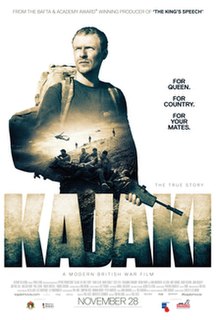
Kajaki: The True Story, released in North America as Kilo Two Bravo, is a 2014 British war docu-drama film directed by Paul Katis in his feature debut, written by Tom Williams, and produced by Katis and Andrew de Lotbiniere.

FOB Zeebrugge is a former International Security Assistance Force (ISAF) Forward Operating Base (FOB) initially operated by the British Army and the Royal Marines under Operation Herrick before being transferred to the United States Marine Corps and located in Sangin District, Helmand Province, Afghanistan.
Route 100 is a major highway in Newfoundland and Labrador. The highway begins at its northern terminus at the Trans-Canada Highway in the town of Whitbourne, runs for 108 kilometres (67 mi) until it ends at its southern terminus, the town of Branch, where it transitions into Route 92. Motorists can drive along the coast of Placentia Bay and eventually the Atlantic Ocean once traveling south of Point Verde.