Royal Commission on the Historical Monuments of England

Last updated

Royal Commission on the Historical Monuments of England
AbbreviationRCHME
Merged into English Heritage
Established1908
Dissolved1999
Type Royal commission
FocusHeritage
Region served
England (excluding Monmouthshire)

The Royal Commission on the Historical Monuments of England (RCHME) was a government advisory body responsible for documenting buildings and monuments of archaeological, architectural and historical importance in England. It was established in 1908 (shortly after the parallel commissions for Scotland and Wales); and was merged with English Heritage in 1999. The research section and the archive are now part of Historic England. [1]

Contents

History

The Royal Commission was established in 1908, twenty-six years after the passage of the Ancient Monuments Protection Act 1882, which provided the first state protection for ancient monuments in the United Kingdom, and eight years after the passage of the wider-ranging Ancient Monuments Protection Act 1900. Critics, including David Murray in his Archaeological Survey of the United Kingdom (1896) and Gerard Baldwin Brown in his Care of Ancient Monuments (1905), had argued that, for the legislation to be effective, a detailed list of significant monuments needed to be compiled, and had made unfavourable comparisons between the policies of Britain and its European neighbours. Learned societies including the British Archaeological Association, the Society of Antiquaries of London, the Royal Institute of British Architects and the Royal Society of Arts also lobbied for action to be taken. Brown had explicitly proposed that the issues should be addressed by a Royal Commission, comparable to the Royal Commission on Historical Manuscripts. His suggestion bore fruit, and led to the establishment in turn of the Royal Commission on the Ancient and Historical Monuments of Scotland on 14 February 1908; the Royal Commission on the Ancient and Historical Monuments of Wales in August 1908; and, finally, by Royal Warrant dated 27 October 1908, the Royal Commission on Historical Monuments (England). [2]

Under the terms of its warrant, the Commission's remit was "to make an inventory of the Ancient and Historical Monuments and Constructions connected with or illustrative of the contemporary culture, civilization and conditions of life of the people of England, excluding Monmouthshire, from the earliest times to the year 1700, and to specify those which seem most worthy of preservation". [3] A revised warrant of 29 November 1913 extended the terminal date to 1714 (the death of Queen Anne). [4] A new warrant of 29 March 1946 gave the Commissioners discretion to undertake recording beyond 1714, and an informal terminal date of 1850 was adopted. [5]

Further royal warrants, revising the Commission's terms of reference, were granted in 1963 and on 15 April 1992. [6] The Commission was merged with English Heritage on 1 April 1999. [7]

Publications

The Commission determined from the outset to publish its inventories of monuments, and to compile them on a county-by-county basis. [8] The first county selected for survey was Hertfordshire: the resultant volume was published in 1910. Some 40 inventory volumes were published over the next 70 years, before the project was wound down, in favour of more thematic publications, in the early 1980s. [9] In accordance with the Commission's warrant, the inventories were initially limited to identifying constructions up to 1714, but were later extended to 1850.

Several inventories were not geographically complete at the time the project was abandoned. Cities and counties covered in part are York (abandoned after 1981), Cambridgeshire (abandoned after 1972), Northamptonshire (abandoned after 1986), Gloucestershire (abandoned after 1976) and Salisbury (abandoned after 1977). In some cases research for forthcoming volumes had started after the decision not to proceed with publication was taken, and these appeared in later HMSO publications or elsewhere. Dorset is the only county which was completed in its entirety to the revised 1850 date, with Cambridge and Stamford the only urban areas to be completed to the same date.

The published inventories are now available to view in full at British History Online. [10]

Inventories

Map of RCHME Inventories, 1910-86 Map of RCHME Inventories published 1910-86.png
Map of RCHME Inventories, 1910–86

National Monuments Record

The National Buildings Record (NBR) was established on a partially voluntary basis in 1940 as a survey – primarily photographic – of buildings of national importance considered to be at risk of damage or destruction through military action. Although originally independent of the RCHME, the two bodies shared premises and frequently worked in close collaboration. The NBR continued its activities after the end of the war, and in 1963 was taken over by the RCHME. At this point it was renamed the National Monuments Record (NMR) to reflect the fact that its remit was archaeological as well as architectural. [11] In 1999, with the rest of the Commission's activities, it was absorbed into English Heritage, and in 2012 was renamed the English Heritage Archive. In 2015 the work of the NMR moved with the archive to Historic England and became the Historic England Archive.

Ordnance Survey Archaeology Division

The Ordnance Survey had always endeavoured to mark visible antiquities on its maps, and in 1920 had appointed its first archaeology officer: the role had subsequently developed into a department of specialists maintaining a national record of archaeological sites. In 1983 the responsibilities of the Archaeology Division were transferred to the three Royal Commissions for England, Wales and Scotland. [12]

Survey of London

The Survey of London, a project to undertake an architectural survey of the former County of London, was founded as a private initiative in 1894, but was later taken over by the Greater London Council (GLC). On the abolition of the GLC in 1986, responsibility for the Survey was transferred to the RCHME.

Notable people

The first Commissioners were: [13]

Notable staff members:

Related Research Articles

<span class="mw-page-title-main">Sandsfoot Castle</span> Castle in Weymouth, Dorset, UK

Sandsfoot Castle, also known historically as Weymouth Castle, is an artillery fort constructed by Henry VIII near Weymouth, Dorset. It formed part of the King's Device programme to protect against invasion from France and the Holy Roman Empire, and defended the Weymouth Bay anchorage. The stone castle had an octagonal gun platform, linked to a residential blockhouse, and was completed by 1542 at a cost of £3,887. Earthwork defences were built around the landward side of the castle, probably in 1623. Sandsfoot saw service during the English Civil War, when it was held by Parliament and Royalists in turn during the conflict. It survived the interregnum but, following Charles II's restoration to the throne, the fortress was withdrawn from military use in 1665.

<span class="mw-page-title-main">Lydlinch</span> Human settlement in England

Lydlinch is a village and civil parish in the Blackmore Vale in north Dorset, England, about three miles west of Sturminster Newton. The village is sited on Oxford clay close to the small River Lydden. The parish – which includes the village of King's Stag to the south and the hamlet of Stock Gaylard to the west – is bounded by the Lydden to the east and its tributary, the Caundle Brook, to the north.

<span class="mw-page-title-main">Woodsford</span> Human settlement in England

Woodsford is a village and civil parish beside the River Frome, Dorset, England, about 4 miles (6.4 km) east of the county town Dorchester. Dorset County Council's 2013 mid-year estimate of the parish population is 80.

<span class="mw-page-title-main">Barby, Northamptonshire</span> Village in Northamptonshire, England

Barby is a village and civil parish about 5 miles (8 km) north of Daventry in Northamptonshire, England. The 2011 Census recorded the parish population as 2,336. Barby is located right off the M45 motorway a short spur from the M1 motorway to the A45 Trunk Road.

<span class="mw-page-title-main">Upper Catesby</span> Human settlement in England

Upper Catesby is a hamlet in the civil parish of Catesby, Northamptonshire, about 3.5 miles (5.6 km) southwest of Daventry. The hamlet is about 550 feet (170 m) above sea level, at the top of a northwest-facing escarpment. The population is included in the civil parish of Hellidon.

<span class="mw-page-title-main">Croughton, Northamptonshire</span> Village and civil parish in England

Croughton is a village and civil parish in West Northamptonshire, England, about 3 miles (5 km) southwest of Brackley. The 2011 Census recorded the parish's population as 992.

<span class="mw-page-title-main">Hellidon</span> Village in Northamptonshire, England

Hellidon is a village and civil parish about 5 miles (8 km) south-west of Daventry in Northamptonshire, England. The parish area is about 1,600 acres (650 ha). It lies 520 feet (160 m) – 590 feet (180 m) above sea level on the north face of an ironstone ridge, its highest point, 670 feet (200 m) at Windmill Hill, being 0.5 miles (800 m) south-east of the village. The Leam and tributaries rise in the parish. The 2011 Census gave a population of 256, estimated at 286 in 2019. The long-distance Jurassic Way footpath linking Banbury, Oxfordshire, and Stamford, Lincolnshire, passes through. The origin of the name is unclear. "Holy Valley", "Haegla's Valley" and "Unstable valley" have been suggested, with the Old English "dun", meaning hill.

<span class="mw-page-title-main">Sulgrave</span> Human settlement in England

Sulgrave is a village and civil parish in West Northamptonshire, England, about 5 miles (8 km) north of Brackley. The village is just south of a stream that rises in the parish and flows east to join the River Tove, a tributary of the Great Ouse.

<span class="mw-page-title-main">Weedon Lois</span> Human settlement in England

Weedon Lois is a village and former civil parish, now in the parish of Weston and Weedon, in the West Northamptonshire district, in the ceremonial county of Northamptonshire, England. It is about 5.5 miles (9 km) west of Towcester. In 1931 the parish had a population of 296.

<span class="mw-page-title-main">West Farndon</span> Human settlement in England

West Farndon is a hamlet and deserted medieval village about 34 mile (1.2 km) southwest of Hinton, Northamptonshire, in the civil parish of Woodford cum Membris.

<span class="mw-page-title-main">Eydon</span> Human settlement in England

Eydon is a village and civil parish in West Northamptonshire, about 8 miles (13 km) north-east of Banbury. The village is between 510 and 540 feet (160 m) above sea level on the east side of a hill, which rises to 580 feet (180 m) and is the highest point in the parish. The parish is bounded to the west by the River Cherwell, to the south by a stream that is one of its tributaries, and to the east and north by field boundaries.

<span class="mw-page-title-main">Warkworth, Northamptonshire</span> Human settlement in England

Warkworth is a village and civil parish in West Northamptonshire, about 2 miles (3 km) east of Banbury in Oxfordshire and 1 mile (1.6 km) southeast of junction 11 of the M40 motorway.

<span class="mw-page-title-main">Royal Commission on the Ancient and Historical Monuments of Scotland</span> 1908–2015 Scottish government agency

The Royal Commission on the Ancient and Historical Monuments of Scotland (RCAHMS) was an executive non-departmental public body of the Scottish Government that was "sponsored" [financed and with oversight] through Historic Scotland, an executive agency of the Scottish Government.

Overthorpe is a village and civil parish in West Northamptonshire, about 2 miles (3 km) east of Banbury in Oxfordshire and 1 mile (1.6 km) southeast of junction 11 of the M40 motorway. Overthorpe is in the east of nshire, and its western boundary forms part of the county boundary with Oxfordshire. It is part of the informal district of Banburyshire.

<span class="mw-page-title-main">Historic England Archive</span> Public archive in Swindon, England

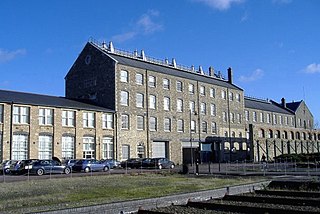
The Historic England Archive is the public archive of Historic England, located in The Engine House on Fire Fly Avenue in Swindon, formerly part of the Swindon Works of the Great Western Railway.

Hinton is a village about 6.5 miles (10.5 km) south of Daventry in Northamptonshire. The village is the largest settlement in the civil parish of Woodford cum Membris, the others being the village of Woodford Halse and hamlet of West Farndon.

<span class="mw-page-title-main">Lutton, Northamptonshire</span> Human settlement in England

Lutton is a village and civil parish in North Northamptonshire, England. The 2011 Census recorded its parish population as 186.

<span class="mw-page-title-main">Orton, Northamptonshire</span> Human settlement in England

Orton is a village and civil parish about 3 miles (5 km) west of Kettering, in North Northamptonshire, England.

<span class="mw-page-title-main">Radstone</span> Human settlement in England

Radstone is a hamlet and civil parish in West Northamptonshire, about 2 miles (3 km) north of Brackley. The 2001 Census recorded a parish population of 54. At the 2011 Census the population of the hamlet remained less than 100 and was included in the civil parish of Whitfield.

<span class="mw-page-title-main">Catesby Tunnel</span> Former railway tunnel in England

Catesby Tunnel is a disused railway tunnel in Northamptonshire on the route of the former Great Central Main Line. Its northern portal is about 1,100 yards (1,000 m) south of Catesby Viaduct and 250 yards (230 m) west of Upper Catesby, with the tunnel ending at Charwelton to the south. In terms of both length and gauge, Catesby Tunnel is unusually large, at 27 feet (8.2 m) wide, 25 feet 6 inches (7.8 m) high, and 2,997 yards (2.7 km) long.

References

  1. "Historic England – Championing England's heritage".
  2. Sargent 2001, pp. 57–9.
  3. Sargent 2001, p. 59.
  4. Sargent 2001, p. 60.
  5. Sargent 2001, p. 67.
  6. Sargent 2001, pp. 74, 76.
  7. "Conservation Bulletin, Issue 35". Historic England. April 1999. Retrieved 1 March 2021.
  8. Sargent 2001, p. 60.
  9. Sargent 2001, p. 71.
  10. Inventories available online
  11. Sargent 2001, pp. 72–4.
  12. Sargent 2001, pp. 74–6.
  13. Sargent 2001, p. 59.

Bibliography